McIDAS Learning Guide
Version 2008
[Search Manual]
[Table of Contents]
[Go
to Previous]
[Go
to Next]
Graphics and the Cursor - Generating Graphics
In the following two exercises, you will generate maps and create freehand drawings.
Generating Maps
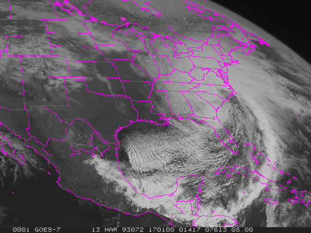
- Display the first GOES-7 4km Visible image on frame 1 centered
at Baton Rouge, Louisiana, and decrease the resolution by a factor of 2.
- Type: IMGDISP GV4.1 1 STATION=KBTR
MAG=-2 SF=Y
- Generate a high resolution map on the image.
- Type: MAP VH

- Highlight the states of North Carolina and Wyoming, by plotting
the map of these states in a different color (color level 3).
- Type: MAP X 3 STATE=NC WY
- Display the second GV4 image on frame 2 centered at Baton
Rouge, and generate a coastal outline map in graphics color level 5, red.
- Type: IMGDISP GV4.2 2 STATION=BTR
MAG=-2 SF=Y;MAP L 5
The L parameter specifies a low resolution map conforming to the satellite
image.
- Turn the satellite image off and on so the map is easier
to see.
- Press: Alt K
- Press: Alt K
- Turn the graphics off and back on, to see the image without
the map.
- Press: Alt W
- Press: Alt W
- Erase the image in frame 3. Show frame 3 and generate a
Mercator map of the USA that includes all counties in the USA.
- Type: ERASE I 3
- Type: SF 3;MAP USA 3 COUNTY=ALL
- Display GI4.2 on frame 4 and generate a map with political
boundaries, coastal boundaries, and latitude and longitude lines.
- Type: IMGDISP GI4.2 4 STA=BTR MAG=-2
SF=Y
- Type: MAP X 5 LALO FILE=OUTLHPOL
- Type: MAP L 3
Notice that the political boundaries are in graphics color level 5 (red)
and the coastal boundaries are in graphics color level 3 (yellow).
Adding Text and Freehand Drawings
In this exercise, you will write text to a frame with the ZA command
and create freehand drawings with the ZLM command.
- Show frame 1 and erase its graphics.
- Type: SF 1;ERASE G 1
- Position the cursor at TV line 30 and element 100. Add the
following annotation to the frame describing the image.
- Type: PC T 30 100;ZA 5 10 "GOES VISIBLE
FOR 13 MARCH 1993 AT 17:01 UTC
The phrase GOES VISIBLE FOR 13 MARCH 1993 AT 17:01 UTC is written on frame
1. The first parameter of the ZA command (5) indicates the graphics color
level; the second parameter (10) indicates the height of the letters in pixels.
- Show frame 2 and erase both the image and the graphics.
- Type: SF 2;ERASE
- Activate the freehand drawing command ZLM.
- Type: ZLM DRAW
- Press and hold the middle mouse button and draw something
on the screen by moving the mouse.
- End the draw option by pressing the right and middle mouse
buttons simultaneously, or:
- Press: Alt Q
[Search Manual]
[Table of Contents]
[Go
to Previous]
[Go
to Next]