|
Satellite sensors such as SeaWiFS can provide us with
up-to-the minute quantified chlorophyll abundance data on both the
local and global scales and also give us a means to assess spatial
and temporal variations as never before. The images below represent
mean global chlorophyll distributions during the boreal spring, as
revealed by SeaWiFS data. It would be impossible to gain such a
snapshot of the world's chlorophyll without satellites!
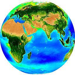 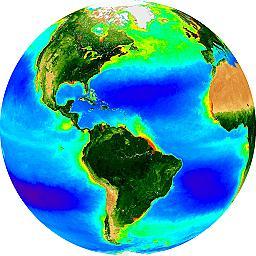 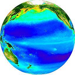
A SeaWiFS view of the world, prepared using NASA's SeaWiFS
Globe Design Tool
Clearly, though, the chlorophyll present in the ocean cannot all
represent upwelling. So, while the presence of high levels of
chlorophyll could indicate a phytoplankton bloom in response to
upwelling, other clues are necessary to identify true upwelling
events.
|
