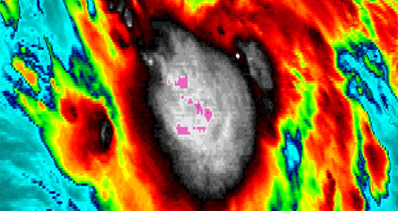
Tropical Storm Isaac Viewed via GOES-14 SRSOR
Tropical cyclone researchers at the Cooperative Institute for Meteorological Satellite Studies (CIMSS) are monitoring the progress of Tropical Storm Isaac. Imagery from GOES-14 Super Rapid Scan Operations (SRSOR) is processed with McIDAS revealing the fluctuation of cold cloud top IR brightness temperatures (light to dark purple color enhancement). The white tropical cyclone symbol denotes the position of the center of Tropical Storm Isaac at 12:00 UTC.
Read more in the CIMSS Satellite Blog.
The Day-Night Band on VIIRS, flying on the Suomi/NPP satellite gave an excellent view of Isaac at strong tropical storm strength in the northern Gulf of Mexico shortly after midnight on 28 August 2012.

