Monthly News Summary – July 2011
- Real-time Tracking of Cordon Caulle Volcanic Ash Cloud
- GOES Sounder Near-casting Demonstrated at the Hazardous Weather Testbed
- CIMSS at CMA and CMA at CIMSS
- ASPB Participation in GOES-R AWG Annual Review
- Brad Pierce on GEO-CAPE SWG and ARSET Panel
- Science on a Sphere Collaborations with Aldo Leopold Nature Center
- 19th Annual CIMSS High School Workshop
- CIMSS Students Make a Big Splash in the Desert
Real-time Tracking of Cordon Caulle Volcanic Ash Cloud
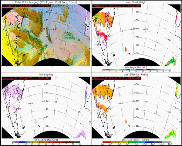
The Cordon Caulle volcano in Chile began erupting violently on 04 June 2011, disrupting air traffic over South America and beyond. The Center for Satellite Applications and Research (STAR) and the Cooperative Institute for Meteorological Satellite Studies (CIMSS) provided near real-time satellite retrievals of ash cloud height, mass loading, and particle size to the volcanic ash operational and research community.
Volcanic ash products developed for the next generation of GOES satellite.
STAR and CIMSS scientists Michael Pavolonis and Justin Sieglaff developed the volcanic ash products in preparation for the next generation Geostationary Environmental Operational Satellite (GOES-R). The Spinning Enhanced Visible/Infrared Imager (SEVIRI) was used as a proxy for GOES-R data.
GOES Sounder Near-casting Demonstrated at the Hazardous Weather Testbed
Robert Aune and Ralph Petersen of CIMSS participated in the Hazardous Weather Testbed (HWT) at the National Weather Service’s Storm Prediction Center (SPC) in Norman, Oklahoma. They assisted participants with interpreting products generated by the Geostationary Operational Environmental Satellite (GOES) Sounder near-casting model running at CIMSS.
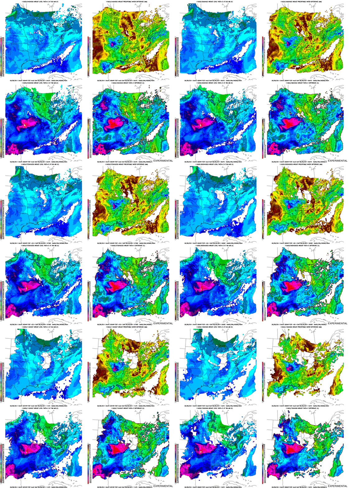
Nearcasting model products.
Information from the GOES-13 sounder water vapor channels help to define the regions most susceptible to convection on that day. This technique initializes a trajectory model with Rapid Update Cycle (RUC) winds and precipitable water at different levels as retrieved from the GOES-13 sounder.
The near-casting model was used to estimate locations in the U.S. where severe convective storms were most likely to form and were not likely to form, up to nine hours in advance. Forecasters at the severe convective storms desk, the heavy precipitation desk, and the convective initiation desk found the products to be very useful throughout the exercise, citing numerous cases where the near-casting products added value to the forecast process.
In June 2011 SSEC and CIMSS continued their close collaboration with the China Meteorological Administration (CMA) when three SSEC scientists traveled to Beijing to conduct a McIDAS-V workshop at the CMA Training Centre, the Beijing Component of the WMO Regional Training Centre in China, and when four delegates from CMA traveled to Madison to view presentations by scientists at the University of Wisconsin-Madison.
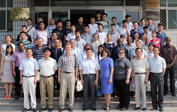
On 07-11 June 2011, Becky Schaffer, Jay Heinzelman, and Joleen Feltz conducted a 5-day “International Training Course on McIDAS-V,” instructing participants on the use of this visualization and analysis tool for both research and operational users of observational, model, and satellite data.
Attendees included 13 international participants from Cayman Islands, Egypt, Hong Kong, Mexico, Niger, Oman, Papua New Guinea, Poland, Rwanda, Thailand, Trinidad, Venezuela, and Yemen, as well as 40 participants from CMA.
“International Training Course on McIDAS-V, Software Application in Satellite Meteorology” participants — China Meteorological Administration Training Centre (CMATC)
WMO Regional Training Centre, Beijing
On 16-17 June 2011, four delegates from the China Meteorological Administration (CMA) visited the Cooperative Institute for Meteorological Satellite Studies (CIMSS). The delegates were Yan Guanghua, Liu Lihong, Zhang Yong, and Xiao Ziniu (Deputy Director General of CMA Training Center).
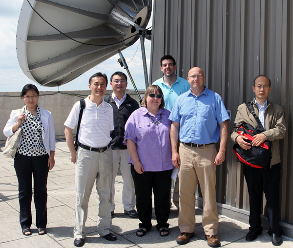
Maria Vasys, Patrick Rowley, and Jerry Robaidek (center, left to right) show visiting CMA scientists the satellite dish array and the magnificent views from the roof.
Topics focused on training and applications in satellite meteorology, with presentations by several CIMSS/SSEC and Advanced Satellite Products Branch (ASPB) staff. Also, several tours and demonstrations were included, including demonstrations of the Advanced Weather Interactive Processing System (AWIPS) and a web mapping service (WMS) application.
submitted by Becky Schaffer
ASPB Participation in GOES-R AWG Annual Review
Several scientists from CIMSS participated in the GOES-R Annual Meeting held in Fort Collins, CO, 14-16 June 2011. Presentations were made by Tom Greenwald, Tony Wimmers, Yinghui Liu, Xuanji Wang, Zhenglong Li, Chris Schmidt, Tom Rink and Mat Gunshor.
Several STAR Advanced Satellite Products Branch (ASPB) scientists also participated in the 2011 Geostationary Operational Environmental Satellite (GOES)-R Algorithm Working Group (AWG) Review.
The goal of the GOES-R AWG Review was to present the accomplishments of the AWG over the past year, hold individual product application team meetings with the Algorithm Integration Team (AIT), and inform the GOES-R Program Office and AWG Technical Advisory Committee (TAC) on the status of the AWG.
ASPB and CIMSS scientists presented status updates on Option 2 Aviation and Cryosphere algorithm development, Baseline Imagery, Cloud, Aviation, Soundings and Cryosphere algorithm validation, as well as Proxy, Man-computer Interactive Data Access System (McIDAS)-V, and GOES-R Analysis Facility Instrument for Impacts on Requirements (GRAFIIR) efforts.
AWG algorithm development and evolving algorithm validation work are progressing with great success.
Brad Pierce on GEO-CAPE SWG and ARSET Panel
Brad Pierce has been asked to Co-Chair the Air Quality Standards and Processes Science Working Group (SWG) for the NASA Geostationary Coastal and Air Pollution Events (GEO-CAPE) satellite. GEO-CAPE is a National Research Council recommended mission identified in “Earth Science and Applications from Space: National Imperatives for the Next Decade and Beyond” that will provide information for air-quality assessment, forecasting and model validation to support air-program management and public health.
The SWGs are responsible for preparation for the GEO-CAPE Mission Concept Review (MCR) tentatively scheduled for Fall 2013. The Air Quality Standards and Processes SWG activities will focus on design and execution of chemical Observation System Simulation Experiments (OSSE) designed to demonstrate the impact of GEO-CAPE trace gas measurements on Air Quality forecasts.
In addition, Brad Pierce was asked to serve as a member of the advisory panel for NASA’s Applied Remote Sensing and Training Program (ARSET). The mission of the ARSET program is to provide education and training to facilitate the use of remote sensing data for air quality applications. The advisory group is composed of university, industry, and federal scientists with expertise in remote sensing capabilities and the needs of the end user community. The purpose of the advisory group is to keep ARSET up to date on research topics and remote sensing capabilities relevant to air quality applications and encourage interactions among remote sensing experts and end-users.
Science on a Sphere Collaborations with Aldo Leopold Nature Center
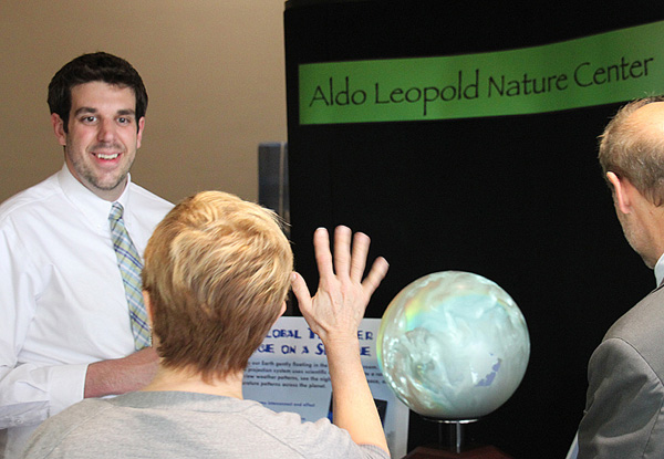
Patrick Rowley, Margaret Mooney, and Steve Ackerman from CIMSS attended the opening of the Aldo Leopold Nature Center (ALNC) Climate Change Classroom in Monona on 02 June 2011. Mooney and Rowley have been collaborating with the ALNC staff since January helping to develop educator programs and make plans for the installation of a Science on a Sphere (SOS) exhibit.
Patrick Rowley demonstrating Science on a Sphere at the Aldo Leopold Nature Center.
ALNC Chair Terry Kelly, acknowledged CIMSS in his opening remarks before cutting the ribbon and ushering supporters into the new 11,000 square foot addition. Throughout the evening, Patrick Rowley demonstrated a small 3D spherical display system while answering questions about the 6-foot sphere soon to inhabit a large silo built specifically for an awe-inspiring SOS exhibit.
19th Annual CIMSS High School Workshop
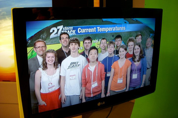
Ten high school students from as far away as Connecticut participated in the 2011 CIMSS High School Workshop on Atmospheric and Earth Sciences on 26-30 June 2011. The workshop included field trips to WKOW-TV 27, Weather Central, the National Weather Service forecast office in Sullivan, the UW Geology Museum, Washburn Observatory (day and night… we saw Saturn!), the UW Planetarium, the airport to see the “Satellites See Wisconsin” exhibit, Devil’s Lake and the surrounding area for a tour of geologic features, and a limnology dredging expedition on Lake Mendota.
Numerous presentations at SSEC were given, including: Earth System Science, 3D Globe, weather briefings, basic meteorology, tropical weather and forecasting (a crowd favorite), GIS and remote sensing, Antarctica, climate change, and aviation weather. Another favorite was the McIDAS workshop led by Gary Wade.
Students, chaperones, and WKOW’s Brian Olson pose in front
of the green screen at WKOW-TV 27.
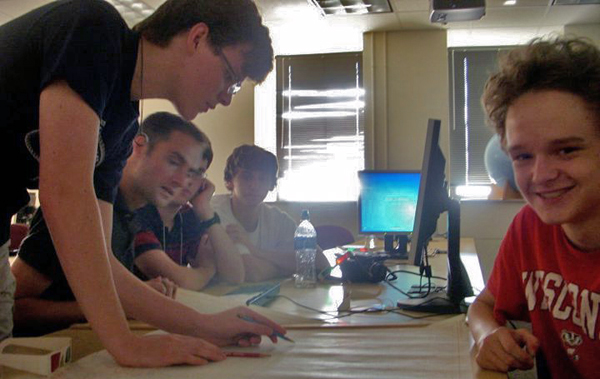
Students work with Chris Rozoff on hurricane forecasting.
submitted by Patrick Rowley
Busy Tour Schedule Keeps AOSS Tour Guides Hopping
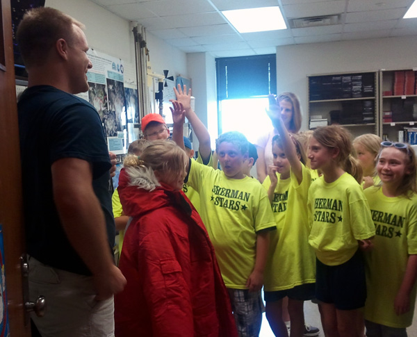
In an extremely busy summer tour schedule Patrick Rowley, Margaret Mooney, Mark Hobson, and Rick Kohrs guided approximately 900 students of a wide range of ages and from many schools statewide through the AOSS Building, with stops at the Science on a Sphere, the Antarctic Meteorological Research Center, and, of course, the spectacular views from the roof.
LeeWellhouse fields questions about Antarctic studies.
CIMSS Students Make a Big Splash in the Desert
Jacola Roman and Elise Garms found themselves launching radiosondes at midnight in support of the JAXA/JPL team that is doing vicarious validation at Railroad Valley, Nevada, for the GOSAT satellite.
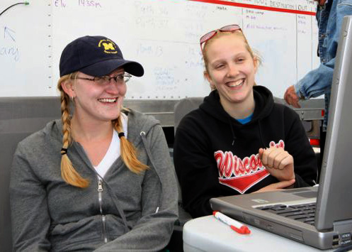
Elise Garms (left) and Jacola Roman. (photo credit: Carol Bruegge, JPL)
From 18-26 June 2011 twenty-eight investigators from eleven institutions and three countries participated in the 2011 GOSAT calibration campaign. The team worked at Railroad Valley, Nevada — a desert playa 100 miles east of Tonopah, Nevada, and 60 miles west of Ely — with nothing but desert in between. They had to cart in all their own food, water, and electricity.
The team did have time to take some pictures. More can be found via links on the GOSAT Calibration Campaign page.
Jacola is a first year graduate student and Elise is a senior undergrad in the AOS department. Not only are they contributing significantly to this field campaign (including assisting Robert Knuteson with the AERIbago), but they are also learning about observational science in a very hands on way.

