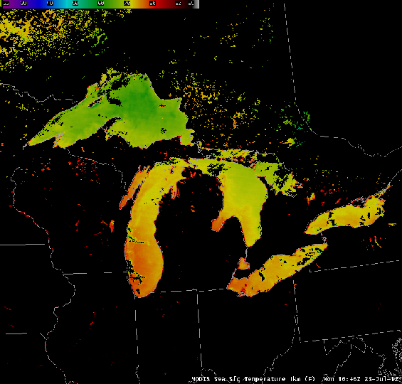
Satellites Take Great Lakes’ Temperature
SSEC/CIMSS, using data gathered by the Moderate Resolution Imaging Spectroradiometer (MODIS) instruments on the Terra and Aqua polar-orbiting satellites, has compiled an 8-day average of surface temperatures of the Great Lakes.
Persistent heat over the upper Midwest and Eastern United States for the first half of 2012 have helped warm Great Lakes surface water temperatures. A surface temperature image from AVHRR (the image doesn’t include all of Lake Superior) also shows warm temperatures.
MODIS estimates of Lake Surface temperature, above, show only a small region of temperatures cooler than 60 F in the entire Lake system in a very small region near Isle Royale in Lake Superior. All other temperatures exceed 60 F.
The Sea Grant Coast Watch supplies maps of Great Lakes temperatures: Superior, Huron, Michigan, Erie and Ontario.

