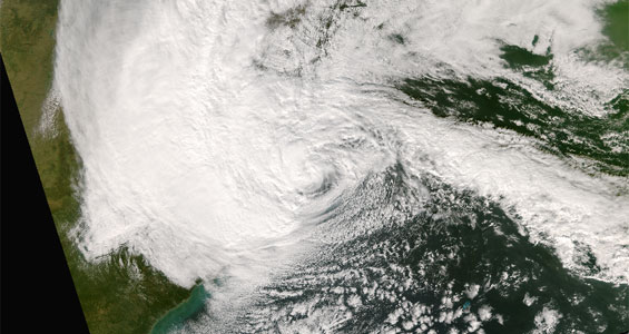
Satellite Tracking of Hurricane Sandy Provided Early Warnings
Scientists with the Tropical Cyclone Group at CIMSS monitored the life-span of Hurricane Sandy. Hurricane imagery was analyzed at 1-minute intervals with the Super Rapid Scan Operations (SRSOR) imager on the GOES-14 satellite. GOES-13 was in Rapid Scan Operations (RSO) mode as well. Hurricane Sandy loomed large in the Atlantic and swept up the eastern seaboard of the United States. The uniquely violent weather event went on to severely batter the East Coast. Estimates of damage have climbed to over a billion dollars.
More Information:
- CIMSS Satellite Blog – coverage of the storm
- CIMSS Tropical Cyclones website
- GOES-14 Real-Time SRSOR animations
- Satellite imagery Youtube videos of Hurricane Sandy
- CIMSS GOES-14 Imager SRSOR page: Movies and GOES-14 SRSOR information
- True Color, Real-time, MODIS Satellite Imagery
- GOES East Satellite Real-time Animations
- Suomi NPP Satellite Captures Mid-Atlantic Blackouts

