Suomi’s Vision Continues to Illuminate
In the late 1950’s, UW-Madison Professor Verner Suomi had a vision. He saw a future where orbiting satellites could look down from the heights and study our home planet from a perspective never before available. Known as the Father of Satellite Meteorology Suomi, along with Professor of Engineering Robert Parent, created such innovations as the spin-scan camera which supplied the first full-color images of Earth from space (and pioneered continuous viewing of weather from space). And for decades, spectacular images of the “blue marble,” Earth bathed in the light of the sun, have been the quintessential satellite view of Earth.
These images are the legacy of Suomi, who conceived, designed, and built in collaboration with Parent the first instrument to study Earth’s climate from space. Launched on the Explorer 7 satellite in 1959, Suomi and Parent’s radiometer, which measured heat coming into and radiated from Earth, revolutionized how we see our planet. In January of 2012, NASA and NOAA re-named their newest Earth-observing satellite in his honor: the Suomi National Polar-Orbiting Partnership. The Suomi NPP has been supplying valuable science, and incredible images, since it was launched.
Today, NASA and NOAA released unprecedented new images – cloud-free images of planet Earth, at night, and yet alive with light.


These views of Earth’s city lights are composites assembled from data acquired by the Suomi National Polar-orbiting Partnership (Suomi NPP) satellite. The data was acquired over nine days in April 2012 and thirteen days in October 2012. It took the satellite 312 orbits and 2.5 terabytes of data to get a clear shot of every parcel of Earth’s land surface and islands. This new data was then mapped over existing Blue Marble imagery of Earth to provide a realistic view of the planet. Image and caption credit for both images: NASA Earth Observatory/NOAA NGDC.
One of five advanced instruments aboard the Suomi NPP is the Visible Infrared Imaging Radiometer Suite (VIIRS), which gathers photons in 22 different wavelengths. One of the channels of the VIIRS is the Day-Night Band (DNB). The DNB, which detects light in a range of wavelengths from green to near-infrared, is sensitive enough to capture the light of a single ship at sea, the aurora, or even clouds lit by very faint, nocturnal atmospheric light called airglow.
Under the light of the moon, the DNB can discern details previously only available to visible channels during the day. Such details were seen as Hurricane Sandy smashed into New Jersey on the evening of October 29. Wildfires can be distinguished from oil field gas flares; city lights can be studied to track urban and suburban growth or how quickly power is restored after a natural disaster. Dense marine fogs, which often form at night, can be seen and tracked, giving confidence to forecasters as they issue advisories to the public.

Using the “day-night band” (DNB) of the Visible Infrared Imaging Radiometer Suite (VIIRS), the Suomi National Polar-orbiting Partnership (Suomi NPP) satellite acquired this view of the aurora borealis early on the morning of 08 October 2012. The northern lights stretch across Canada’s Quebec and Ontario provinces in the image, and are part of the auroral oval that expanded to middle latitudes because of a geomagnetic storm. Image and caption credit: NASA Earth Observatory/NOAA NGDC.
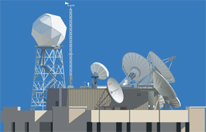
SSEC has been providing the National Weather Service (NWS) with data from VIIRS, including the Day Night Band, using data from the direct broadcast antenna at the University of Wisconsin, which is processed using the Community Satellite Processing Package (CSPP), also developed at SSEC. As an example, VIIRS data from SSEC has been used by the NWS in Monterrey to provide higher confidence in issuing marine dense fog advisories.

This image of the continental United States at night is a composite assembled from data acquired by the Suomi NPP satellite in April and October 2012. The image was made possible by the satellite’s “day-night band” of the Visible Infrared Imaging Radiometer Suite (VIIRS), which detects light in a range of wavelengths from green to near-infrared and uses filtering techniques to observe dim signals such as city lights, gas flares, auroras, wildfires and reflected moonlight. Image and caption credit: NASA Earth Observatory/NOAA NGDC.
As a polar-orbiting satellite, Suomi NPP passes over every square inch of the Earth twice each day; once at 1:30 am local time and once at 1:30 pm local time, collecting a 3,000 kilometer wide swath of information as it passes over.
Professor Suomi’s original satellite radiometer in 1959 was simple, but his vision of examining the Earth with greater detail and better understanding from space will continue into the future.
NASA press release.
NASA Earth Observatory page.
More views of the Earth at night.
UW press release.
The CIMSS Satellite Blog images.
SSEC Google Maps image.
Back to Front Page

