|
|
McIDAS-X
User Responses: Top 5 Functions
Top 5 Requested Functions From Each User |
- We currently use McIDAS almost exclusively from a
mcenv environment within unix/linux shell scripts.
- We pass lots of variables into command
line McIDAS jobs.
- We use FRMSAVE to capture visual output from the
mcenv sessions.
- We make use of most of the img* and
grd* commands as well as PTDISP.
Dave Stettner - SSEC |
- Hassle-free auto zoom in and zoom out
on whatever is displayed on a frame. E.g., a satellite
image overlaid with NWP and observations fields. This is
NOT the Alt Z function I am talking about although it is
still a desirable feature. I was talking about the recalculated
permanent display (as you would do with the MAG= keyword)
of an enlarged or shrunk image centered over the position
of the mouse.
Yuelong Miao - Australia |
- More easily overlay gridded data (say
EC 850 temps) and/or surface obs (quickscat or synoptic obs)
and/or cloud drift obs onto a sat pic at the correct
or nearest time step.
- More easily calculate the speed and direction of
movement of cloud features.
- More easily move sat pics (translate, rotate,
zoom in and out) so as to compare sat pics with model
data in Kenny or other viewer.
- More easily create composite images (several satellites)
within a prescribed area and time frame.
- More easily reposition an improperly mapped overlay
(such as a coastline) into the correct spot.
Scott Carpentier - Australia |
- Most important: - maintain and extend background
processing via shell scripting (constructing
tailored displays of data and pumping to web pages)
- Ability to handle (display loop etc)
netCDF files
- Ability to overlay semi-transparent
images in common projections with each layer having independent
color tables
- Easily determine the next microwave/scatterometer
pass for a particular location from any platform (i.e.
not for each platform)
- Easily constructed storm centered loops (tropical
cyclones)
Andrew Burton - Australia |
The following feedback focuses on User Interface
issues. They do not necessarily pick up on any new features that "McIDAS-V" might
be good at providing, however quick and easy access to data is
always at the top of our user's requirements, so I'm emphasizing
that here.
I've also focused on NWP data as my "use case", and assume that
the system is already capable of animation, retrieving and displaying
multiple datasets and the like.
- Load favorite data sets
* a convenient way of loading your favorite data sets is required
* no more than 2 or 3 mouse clicks
* could be grouped under NWP, Sat data etc
- Convenient way of specifying parameters
of interest, and levels of interest
* one system here copies data to "cut down data sets", and then
assumes that all parameters/levels in this dataset are of interest, and presents
these in the GUI (see Example 1 below)
* another approach is to specify what is preferred via configuration
files
* the important thing is to reduce the number of key presses required
to get to the parameters/levels
- Convenient way of changing levels and
parameters
* Example 1 shows an up/down button pair to change levels
* Example 2 shows a less crowded interface, but lacks the convenient
up/down button pair
- Be able to overlay contour fields and
shaded (rgb) fields
- Be able to overlay data/images onto
a common projection
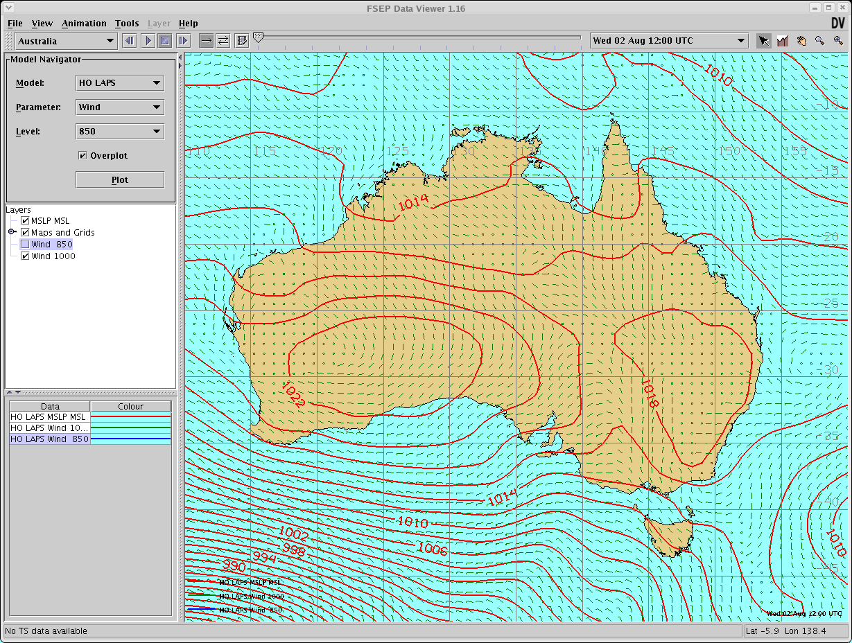
Example 1 = attachment "kenny.png"
Example 2 = attachment "dv.png"
James Kelly - Australia |
Five most important McIDAS-X functions to be ported across
to McIDAS-V
- IMGDISP
- IMGREMAP
- IMGPROBE
- FRMSAVE
- AXFORM
I'm assuming such basic features as EB, C, D will
be ported, and the ability to run all McIDAS commands from background
scripts (no GUI) - this is a very important part of
running our HRPT station in Antarctica.
On the wish list is an enhancement to the IMGPROBE command
to allow more spectral analysis and filtering work
to be done. In particular the ability to use conditional
testing of different bands to modify the output AREA.
For example :- IF BAND1-BAND2 > x .AND. BAND4-BAND5 < y
THEN set pixel=a ELSE set pixel=b
Neil Adams - Australia |
- The ability to generate products, non interactively: Our
prime example is our Antarctic Composites. Although I'm sure
this function would get done anyway in McIDAS-V, I will emphasize
it here as implies multiple things: 1. The system has
the ability to work with many satellites, there calibration,
and navigation (which may be missing from IDV/McIDAS-V at
this time). 2. Also, it implies we'll be able to robustly
work with the data (IMGREMAP, IMGOPER FORM=CMIN, IMGFILT
FILT=CLEAN), and most important, write out the product into
a file (McIDAS AREA, and others - like netCDF, etc.) 3. This
job can run in the background without having to manually
start it (not that I don't value the interactivity in McIDAS!! I
do. Really. Its not called mCidas for a reason...). Anyway,
this implies a fair bit of foundation...some exists (this
new python/jython stuff that I've not learned yet), some
may not in McIDAS-V/IDV.
- Data fusion/overlay: At
the risk of sounding like JT Young, I will: the ability
for us to take our composite or other satellite data and
put data on top of it: data "fusion". Being able
to have model output contours, AND model plots (can I ask
on that side that we get a FULLY capability station model
plot here? One that use the proper cloud symbols like in
SFCMG. Be nice to do REAL synoptic station model
plots too (with the clouds and everything!) This fusion
is one thing key for us, and more so for the next few years
for us. Most of this may already exist in McIDAS-V/IDV.
- Data injection/ingestion/importing: The
ability for us to "ingest" our Automatic Weather Station
(AWS) observations into McIDAS is a BIG thing for us. I
think this is one of the reasons that McIDAS was used at
places like CCFF was the fact that McIDAS can suck in just
about anything into flexible data format like MD files. In
any case, I'm not sure how this fits into McIDAS-V - its
not an data ingestor/decoder like XCD is or SDI is, but if
is continues to have abilities to import data like you can
txt2md, txt2grid, etc....that is very, very handy. It
is my experience that lowest common denominator for
data is often ASCII Text - shared between science groups. It
is one reason why after 25 year of our AWS project we still
offer the data in ASCII text files. I don't know if any of
this is really there - lots of data "reader" work here for
McIDAS-V/IDV.
- Data Display for QC and export: One of
the big routines uses we have for McIDAS now is both QC displays
that are interactively running all of the time and *have
the ability to update automatically* (this is the SKEDular,
not cron), and the ability in the background (non-interactively)
save displays created for use on the web, ftp, inserting
into LDM, etc. In fact, I have wondered if McIDAS-V will
be the first time we will have a true marriage of McIDAS
and the Web - ala McWeb (I have a simple HTML or o.k. Rick
- XML - interface that will allow a web page built to have
a user build a product/display on the fly - nothing complex,
but still...) I unfortunately haven't run enough of
McIDAS-V/IDV yet to see how much of this is possible.
- Science processing: As I have worked more
and more on my PhD thesis the ability to science - o.k.,
I'll be more specific, the ability to do mathematics (IMGOPER,
IMGFILT, GRD* MATH=, etc.) and even use others homegrown
code (for example Don Hilger's PCI code, or even other McIDAS "subsystems" like
autoWindco, etc.) This suggestion is unfortunately not specific
enough to probably act on, and the tons of code out there
that McIDAS ready (like autowindco, Don't PCI code, etc.)
is really hard to just convert. There is probably other "algorithms" that
would be huge to have in McIDAS-V. Things like that will
hopefully make the system attractive. That said, will the
new system allow for folks to work with data pretty easily
to develop new "commands" ...er... make that new procedures,
applications, etc. that will do "science" on the data. This
is sort of like asking for something that the old, first
VisAD system (not the one we have now...), and what we get
with all of the functions and subroutines in McIDAS now,
etc. McIDAS-V/IDV may have limited ability here, and
this is a thing to have once the foundation of McIDAS-V/IDV
is laid out. It may get some of this from the interest
of the other funding PIs (all of the hyperspectral stuff,
for example).
Matthew Lazzara - AMRC |
- Automatically updating satellite images
- Automatic display of NOAA images would
be good
- Not sure what else
Melanie Webb - Australia |
- automatically update a loop of imagery based on a
time increment or event (e.g., new image arrives)
- interactively probe/interrogate any calibration of
a displayed image or image file on disk
- this is similar to #2, but more of a wish list item: display
an image and interactively probe other datasets for colocated
data values (e.g., have surface temperatures from
Metar obs or forecast grids pop up while roaming the image)
- add or remove selected map components
like country, state and county borders, cities, etc.
- list NOAAPORT observational and forecast text data (I
do this frequently with Mc-X but would like to see something
more user-friendly [doesn't require knowledge of WMO and AWIPS
headers] in Mc-V)
Barry Roth - SSEC |
- Co-location of multiple satellites to conduct calibration
testing of new satellites. This is done using
NAVDISP, IMGDISP, IMGOPER and IMGPROBE.
- Combining multiple source of data (GRID, MD and
AREAS) for a single product. The math functions
of GRDCOPY and IMGOPER along with IMGRGB are required to
create these types of products.
- McBASI functionality. I primarily
take advantage of McBASI's file and text manipulation along
with it's ability batch up commands.
- Launching "background" mcenv jobs from cron to create
gif/jpg products.
- Using McIDAS API functions to create user developed
programs. Frequently McIDAS may not have exactly
what I need to develop a product for a client. In these
cases, I may need to alter and existing command or create
a new command.
- Several of our sites (including SSEC) have several people
remotely login to workstations to run McIDAS. If
sites continue to run in this configuration, they
will have to have a TON of memory! Just something to consider.
Rick Kohrs - SSEC |
- You must be able to run several processing jobs at
the same time without interfering with one another. In
the data center, it is not uncommon to be generating 10 or
more completely different products on the same machine as
the same user at the same time. To lose that
ability would be very bad.
- unattended automated processing from cron or a daemon,
. This means the ability to process real time data and
create products without requiring a graphics card, someone
logged in, etc. This extremely important the Data Center The
ability to run commands easily from a unix command line is
also related to this. And do all of this without consuming
huge amounts of resources .... McIDAS is great at this. If
a graphics card is needed, this would eliminate several data
center computers from being usable.
- ability to "serve" to remote clients multiple data
formats. And to then be able to restrict the servers
easily by IP, username, project number and IP what datasets
are available to whom. This should be able
to restrict by dataset, since sometimes some data on a machine
can only legally be provided to some users and not others. E.g.
Lightning data, or MSG data. And log all requests.
- ability for servers to interact with sql databases
for speed and efficiency especially for grib.
- ability to read and write data in multiple formats ....
read .... many of the current "raw" satellite data formats,
without having, or reading common grib,(grib2) netcdf or level1b,
hdf formats. Write ... gif, png, jpeg, tiff, netcdf,
area, ascii files, geotiff etc
- ability to automatically remap and
merge image data ... probably goes without saying.
Jerry Robaidek - SSEC |
- Flexibility of displaying and manipulating satellite
data at any location around the world at chosen location
and resolution in both McIDAS area and AWIPS netCDF formats.
Loops should auto update (similar to event scheduler). Either
have fast loop loads or keep the loops preloaded in separate
frames.
- Keep availability of ‘scratch’ frames
that keep their image until manually erased.
- Easy manipulation/listing/access of station database
- Data sharing capabilities with other
sites such as NESDIS or INM (Spanish)
- Text database search and list. Search on
WMO or AWIPS headers or parts of headers, site id’s,
issue times, etc. Also keep the MATCH keyword functionality.
- Level II radar data display
- At least 2-3 multiple display windows.
- We also second the example of creation of GIF images
in the background
Brian Hoeth - JSC |
- Bulletin Board for ingestor/decoder status and associated ‘stat’ command.
- ‘Serial’ data ingestor API.
- Connection to TCL/Tk.
- Connection to Expect.
- Multi-headed display – e.g. text/command
window on one and image window on another (we modify SSEC code, ‘mcidas’ to
our local ‘mcidas2d,’ to do this)
- Ability to create ‘limited function’ displays,
i.e. withdrawn command window and all functions selected from
predefined GUI. Useful in areas such as public displays. (we
modify SSEC code ‘mcidas’ again to our ‘mcidasfcr’ for
an external customer that needs specific weather data displayed,
but does not need the full, unrestricted McIDAS session access)
Brice Biggerstaff - JSC |
- Ability to overlay images such
as satellite images and radar images on the one viewing screen.
- Ability to overlay observations and/or
model data over satellite images and radar images.
- Ability to change parameters and/or
images viewed using toggle buttons
- Ability to loop the above overlaid
images for a selected time period.
- Ability to more easily remap images when there are
obvious differences between the coast-line map and the coast-line
on the satellite image. (Clicking on the graphics
and being able to drag them to the correct location would
be fantastic for this.)
Monica Long - Australia |
- Easy conversion (one click or one command) of an
image into a GeoTIFF format (with navigation files or nav
included in the TIFF) for integration into GIS/ArcIMS
systems
- Display of GIS type data: GeoTIFF, Shape Files, polygons
- Ability to display more data types (HDF, HDF5, netCDF,
GEMPAK, GriB)
- Easy conversion of netCDF data to McIDAS MD data
and vice versa
- Compatibility with AWIPS: ability to create or display
AWIPS files
- Ability to save a predefined loop into an AVI, Animated
GIF, or output that could be viewed by the AniS software
Brian Hughes - ESPC (NOAA/NESDIS Satellite analysis
Branch) |
- Generate gif images of geostationary and polar orbiting
satellite data in the background, including RGB
images and cloud products with color bars.
- Use locally-developed calibration modules to work
with 2-byte satellite image cloud product area files.
- Run TLE/TEXT files to generate satellite orbital
predict data and track maps.
- Use numerical weather prediction model data in mcidas
grid files and extract/interpolate the data for a specified
satellite image time.
- Use aircraft, ground site, or other specified lat/lon locations
and extract the appropriate satellite area file data
and put into an ascii file.
- Continue to develop and provide support for the API
(libmcidas.a) allowing users to develop C, Fortran
programs that can call mcidas routines, and are executed
directly on the shell command line.
Doug Spangenberg & Rabi Palikonda - NASA-Langley |
- the ability to quickly and easily overlay
model data is highly desirable.
- easy ways to overlay radar/obs data
(toggle off/on).
- Ability to zoom in/out from broad scale SHem to
over SE AUST without having to load new images of higher
resolution (i.e. would zoom to higher resolution images).
Victorian Office - Australia |
- provide similar 'convert' and 'composite' functions
of ImageMagick.
- in a map format that allowed display of points for
whick soundings (RAOB, ATOVS, NWP profile ...) available.
- easy to rotate the earth (satellite image) at desired
LATLONG.
- combine E,D,S keys to a single key.
- easy to display derived satellite product with UNIT,
SCALE, BAR, IMGPROBE, SU, PRDUTIL
Lee Hong - Australia |
Some work done at the NWS depicts well what McIDAS is lacking
for the operational meteorologist.
- A graphical editor interface for forecast preparation
Something in the line of the Interactive Forecast Preparation
System (IFPS) fed by a National Digital Forecast DataBase
(NDFD) and a Graphical Forecast Editor (GFE).
- A production machine to generate meteorological
products in a 'quasi' automagical way. Based on
the previous tools.
Our forecasters have started to look around for new tools for
these tasks, as they are increasingly pressed for higher production
work which McIDAS can not cope with at present. Ninjo http://ams.confex.com/ams/pdfpapers/71789.pdf is
one of the systems we are investing our budget on.
Pepo Juega - Spain |
- The ability to execute McIDAS commands in the background.
This is extremely important in shell scripting which we rely
upon heavily. We use this for such things as creating ASCII
files of our local data for archival, generating virtual frames
for quick display, notification for copying satellite images
to our data servers, creating canned data files for download
to dial up customers.
- For non gui applications, the ability to send the
image window display to a second monitor. (I.E.
dual-head display)
- Automatically update 10 loops of the 10 most recent
GOES images on multiple workstations simultaneously,
typically 4 to 8 workstations.
Paul Wahner - CCFF |
- Server testing
- visually compare navigation/data points of two different
datasets (image, md, grid) - e.g. from two
different satellites or the same satellite data on two different
servers
- quantitatively compare values of data points of
two different datasets (image ,md, grid), either looking
at the output values or running mathematical differences on
the two datasets
- color filled contours of point data, with a color
bar at the bottom (currently go through a
lot of hoops - PTCON OUT=SAVE, GRDIMG, IMGREMAP, IMGOPER,
IMGFILT, IMGDISP)
- display current watches/warnings by county and as
watch boxes
- automatically update a NEXRAD loop with
standard BREF enhancement and the associated color bar, map
with counties, states and some cities plotted
- once an hour, list the current temperatures for
a list of surface stations with heat index and wind chill
calculated, if applicable
Becky Schaffer - SSEC |
- intuitive, easy to use GUI
- no McBASI - instead, just provide a set
of commands that can be called by any scripting language you
want
Bill Bellon - SSEC |
- Generate GIF images of real-time GOES and other
satellite data via a mcenv script (I guess this
counts as a background). This includes MODIS, POES, MSG,
FY2C, etc.
- If possible, be able to display image
of Brightness temp and reflectance for 3.9 micron channel.
- In addition, being able to read in products/units,
apply enhancement and stretch tables via a mcenv script (background),
change units (prdutil). Save to images.
- Probe the image for data at specific locations (imgprobe)
and for specific units and output to TXT.
- Output TXT files and display MD
files. If possible, a converter between
MD and BUFR format (for winds).
- Output RAOB, surface obs, radiosonde data to TXT
from ADDE sources via mcenv script.
- The ability to remap data from 2 bytes per pixel
to 2 or 1 bytes per pixel (REMAP2 and IMGREMAP)
- IMGCOPY, to output AREA files
- Have DSSERVE and DATALOC the same way as they are
now.
- The ability to get ADDE data the same
as McIDAS-X
- Have PTLIST the same as it is now.
- The ability to run McIDAS from a script (mcenv)
- Have the ability to plug in McIDAS-X developers
tools (such as REMAP2) into McIDAS-V easily.
- Easy ability to apply a base map.
- The ability to easily pick out how to do navigation
and correct calibration of raw counts to Reflectance's and
BT's.
- The ability to combine various channel (i.e. to
make an RGB or "false-color" image)
William Straka - SSEC |
- Access to Direct Broadcast of polar
orbiting data and real-time GOES data
- Generate GIF images of real-time GOES data in the
background
- Re-mapping polar orbiting data
- Enhancement Utilities for the imagery
- Access to text products, such as severe weather
reports, severe weather watches and warnings
Jason Brunner - SSEC |
- Generation of GIF (or JPG or PNG) images of real-time
GOES data in the background
- easier, GUI-based color enhancement
tool (similar to what AWIPS has)
- can't think of anything else... McIDAS Rules!
Scott Bachmeier - SSEC |
- Ability to remap imagery from one resolution or
projection to another from script
- Ability to create a NetCDF file that meets Unidata
formatting standards for any parameter within an AREA/GRID
from script
- Ability to ingest NetCDF, MODIS HDF, and AVHRR Level
1B data
- Imglist capability that dumps out image dimensions,
time, and resolution
- Improved color bar plotting that uses physical units
instead of 0 to 255 brightness values, coupled with
functionality for differing fonts/sizes/label interval, etc... Using
Virtual Graphics to add a color bar doesn't often meet publication
quality graphic requirements
Kris Bedka - SSEC |
- Keep to ability to call McIDAS commands from UNIX
scripts (our winds displays would all have to be
re-written if this feature was removed).
- Color contour and color bar application:
Something that does filled contours of images, grids, and even
MD files, and allows for the automatic generation of a color
bar would be nice.
- When using PTDISP to display wind barbs, for example, you
can't color code based on wind speed (or any other
computed parameter) with a single command (e.g. color
code wind barbs with an error code or with the wind's pressure).
The first one is crucial, the second two are sort of "nice
to have" features.
Howard Berger - SSEC |
- Keep GRDIMG capability... we use this extensively.
- Not sure if this has been addressed or not...
but there are certain derived AREA files that extend from dateline
to dateline (thru Prime Meridian). When I display
an image near the dateline, it only displays one side or the
other of the AREA file. Would be nice if McIDAS
could display both parts of the image easily.
Tim Olander - SSEC (adding to Howard's list above) |
- Running mcenv in the background via unix (linux,
whatever) script. Full functionality is critical, including
saving GIFs (or another format, such as .png if GIF is expensive
- the point is that GIF isn't critical but saving to a commonly
used image format is) in the background.
- IMGPROBE and related statistics. The
D-Key is very important for assessing data quality... being
able to point at a pixel and know all the info about the corresponding
satellite field of view... the raw counts, radiance, brightness
temperature (or albedo or whatever for visible), the lat/lon,
and the scan-line time.
- Related to 2, We need to be able to display satellite
imagery without any spatial smoothing at times. I
don't think this is compatible with the idea of remapping
everything to a common grid for display purposes. When
satellite navigation and/or calibration is in question (as
it always is when satellites are new and sometimes for much
longer, like with MTSAT) it is very important to be able
to look at individual pixels and know they haven't been averaged
with their neighbors. This is going to be important
for all sorts of applications, including checking on products
like retrievals and fire algorithms on top of just checking
raw calibration and navigation. In effect it
would be nice to be able to turn off spatial interpolation
for certain applications (and would be nice if this was easy
to do).
- NAVCALC info... it's very important for
me to be able to tell where a satellite is and when. Even
for GEOs because they sometimes move.
- Exporting navigated/calibrated data to another format
(like we can do with netCDF now) is very important
when McIdas AREA data needs to be used in a different software
package or shared with a coworker that doesn't use McIdas. Mostly
I say "screw 'em" if they don't use McIdas but because I'm
a better programmer in Matlab and not a very good fortran
programmer I often export to netCDF so I can program up analysis
in Matlab faster.
Mat Gunshor - SSEC |
- Generate GIF images of real-time GOES data in the
background.
- All custom code should compile.
- Ability to query GRIB1, GRIB2, netcdf, HDF files.
- Ability to collocate data files and compute statistics
on them.
- 3-d plotting.
Steve Wanzong - SSEC |
- Make sure MDDPI tool (written by Chris Schmidt)
would work under the new McIDAS-V - this is VERY
important for my sounder winds, or else I have no way of
extracting constant pressure analyzes.
- It would be convenient if one could save images
in other then GIF formats (i.e. JPG and TIFF)
- Just yesterday wanted to list all bands form a MODIS
aerosol product HDF file - not all available parameters are
listed - why is that? I had to read the data with
MatLab instead.
- Easier (non-interactive) way of deriving stats for
an AREA image file.
- Be able to add a gray-scale bar corresponding to
a selected BAND or variable (and not just BRIT)
Iliana Genkova - SSEC |
- Retain the Command line for foreground issues.
- For programming purposes, retain Fortran 77 (for
old dinosaurs like myself).
- Although not supporting it as a form of programming language,
it would be useful to still use macro03 language or
capabilities (same reason as above)
- The utilities IMGOPER and IMGREMAP.
- Everything else.
Tony Schreiner - SSEC |
- Make sure full mcenv McIDAS-X interface within
UNIX shell scripts is still functional.
- Make sure the IMGDISP paneling capability is
still functional.
- Generate GIF images of any raw or remapped
area files (e.g., real-time GOES data) in the background.
- A wish -- support for NetCDF-format MD (i.e., point)
files (so we're not limited to 400 words/record).
- Fortran-90 compatible code
Jim Nelson - SSEC |
- Display and calibrate and earth locate
GOES data, MODIS data, MAS data, etc. (i.e. IMGDISP)
- IMGPROBE function
- Earth location (i.e. E key, MAP command)
- TFILE command
- FRMSAVE command
Chris Moeller - SSEC |
- Generation of images from MTSAT-1R for the Bureau of Meteorology
external web pages in real-time
- Displaying satellite images with the
ability to overlay point or
gridded data
- Displaying profiles from radiosondes, models and satellites -
preferably together
- The ability to overlay multiple AREA
files would be very useful
- The ability to save data in netCDF format
Anthony Rea - Australia |
|
|
|
Responses by Site:
Australia (10)
CCFF (1)
ESPC (1)
JSC (2)
NASA-Langley (2)
Spain (1)
SSEC (20)
|
