McIDAS Basemaps
The images below can be used as basemaps for the McIDAS IMGRGB command or as standalone basemaps for other graphical applications. Due to the large size of these 1km global rectilinear images (21600 x 43200), we recommend that you create an ADDE dataset for the basemaps. The individual files can be downloaded, uncompressed, and then served as McIDAS AREA files. All of the compressed AREA files can found at ftp://ftp.ssec.wisc.edu/pub/mug/basemaps.
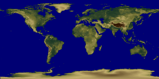
Land Elevation
 |
||
|---|---|---|
| Download the following files to create a Land Elevation image like that shown above: | ||
| topo.gz | 323 MB | 2-byte AREA file created from USGS Digital Elevation Models (DEMs) (21600 lines x 43200 elements) |
| TOPO.ST | 2 KB | Stretch table for Land Elevation image above |
| HRTOPO.ET | 4 KB | Enhancement table for Land Elevation image above |
| The RAW values are as follows: | ||
|
0-8752
|
Height above sea-level | |
|
55537
|
Ocean | |
|
>55537
|
Height below sea-level = (RAW – 65536) | |
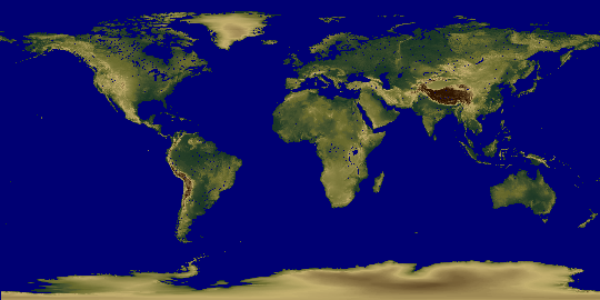
Land Elevation and Waterways
 |
||
|---|---|---|
| Download the following files to create an image of Land Elevation and Waterways like that shown above: | ||
| topolakes.gz | 321 MB | 2-byte AREA file created by combining USGS Digital Elevation Models (DEMs) and USGS Land Cover data. (21600 lines x 43200 elements) |
| TOPO.ST | 2 KB | Stretch table for Land Elevation and Waterways image above |
| HRTOPO.ET | 4 KB | Enhancement table for Land Elevation and Waterways image above |
| The RAW values are as follows: | ||
|
0-8752
|
Height above sea-level (regions at or below sea-level = 0) | |
|
55537
|
Ocean/Lakes/Rivers | |
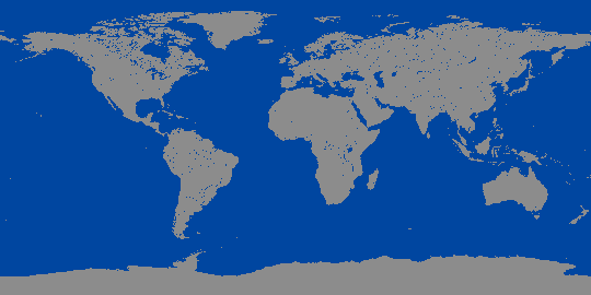
Land Sea Mask
 |
||
|---|---|---|
| Download the following files to create a Land Sea Mask image like that shown above: | ||
| land_sea_mask.gz | 4 MB | 1-byte AREA file created from USGS Land Cover data. (21600 lines x 43200 elements) |
| LSMASK.ET | 4 KB | Enhancement table for Land Sea Mask image above |
| The RAW values are as follows: | ||
|
8
|
Land values above and below sea-level | |
|
4
|
Ocean/Lakes/Rivers | |
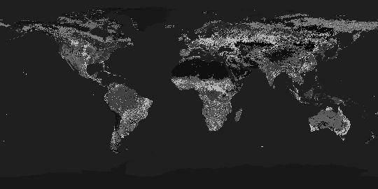
Land Use
 |
||
|---|---|---|
| Download the following files to create a Land Use image like that shown above: | ||
| landuse.gz | 33 MB | 1-byte AREA file created from USGS Land Cover data. (21600 lines x 43200 elements) |
| landuse.txt | 3 KB | Text file containing the RAW value definitions |
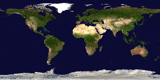
NASA's Blue Marble
 |
||
|---|---|---|
| Download the following files and use the McIDAS COMBINE command to create a NASA Blue Marble Next Generation image like that shown above: | ||
| bigbluemarblered.gz | 236 MB | AREA file containing the red channels of the Blue Marble basemap (21600 lines x 43200 elements) |
| bigbluemarblegreen.gz | 239 MB | AREA file containing the green channels of the Blue Marble basemap (21600 lines x 43200 elements) |
| bigbluemarbleblue.gz | 221 MB | AREA file containing the blue channels of the Blue Marble basemap (21600 lines x 43200 elements) |
| When using this basemap for web or other publications, please provide the following credit line – The basemap was provided by Earth Observatory Team – NASA (http://earthobservatory.nasa.gov). |
||
Uncompressing the Data Files and Creating the ADDE Datasets
Since the basemap images require a large amount of disk space, you may need to store them in a different file partition than /home. For example purposes, we’ll assume you have created a directory called /mcbasemaps to store the basemap files.
- Download the images to /mcbasemaps (either using a web browser or ftp).
- In the /mcbasemaps directory, uncompress the images.
~mcidas/bin/gunzip topo.gz
~mcidas/bin/gunzip topolakes.gz
~mcidas/bin/gunzip land_sea_mask.gz
~mcidas/bin/gunzip landuse.gz
~mcidas/bin/gunzip bigbluemarblered.gz
~mcidas/bin/gunzip bigbluemarblegreen.gz
~mcidas/bin/gunzip bigbluemarbleblue.gz - In a McIDAS session, create the ADDE datasets using the DSSERVE command.
DSSERVE ADD BASEMAP/TOPO AREA DIRFILE=’/mcbasemaps/topo’
DSSERVE ADD BASEMAP/TOPOLAKES AREA DIRFILE=’/mcbasemaps/topolakes’
DSSERVE ADD BASEMAP/LSMASK AREA DIRFILE=’/mcbasemaps/land_sea_mask’
DSSERVE ADD BASEMAP/LANDUSE AREA DIRFILE=’/mcbasemaps/landuse’
DSSERVE ADD BASEMAP/BBM-RED AREA DIRFILE=’/mcbasemaps/bigbluemarblered’
DSSERVE ADD BASEMAP/BBM-GREEN AREA DIRFILE=’/mcbasemaps/bigbluemarblegreen’
DSSERVE ADD BASEMAP/BBM-BLUE AREA DIRFILE=’/mcbasemaps/bigbluemarbleblue’
Note, if you need to make these basemaps available to other users, you may want to create remote datasets by running the DSSERVE commands under the user mcadde (See Appendix I – McIDAS-X Site Administration and Management in the McIDAS User’s Guide for setting up remote datasets).
