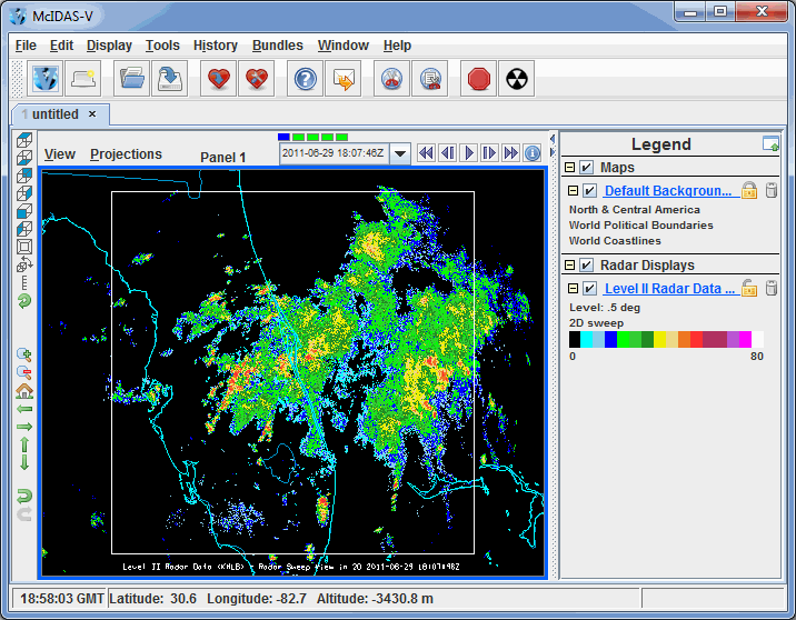
Image 1: The McIDAS-V Main Display Window
McIDAS-V is a free, open source, visualization and data analysis software package that is the next generation in SSEC's 40 year history of sophisticated McIDAS software packages. McIDAS-V displays weather satellite (including hyperspectral) and other geophysical data in 2- and 3-dimensions. McIDAS-V can also analyze and manipulate the data with its powerful mathematical functions. McIDAS-V is built on SSEC's VisAD and Unidata's IDV libraries, and contains "Bridge" software that enables McIDAS-X users to run their commands and tasks in the McIDAS-V environment, and an integrated version of SSEC's HYDRA software package.

This McIDAS-V User's Guide is currently under construction. Once completed, it will describe using the features available in the McIDAS-V application. For a brief description about getting started using McIDAS-V and making displays of common data available, refer to the Getting Started section.
This Guide was originally developed at the Unidata Program Center by the developers of the Integrated Data Viewer (IDV). The first version of the McIDAS-V User's Guide was created from the IDV User's Guide (September 2007) and has since been updated to reflect the changes that have been made to McIDAS-V, IDV, and VisAD (see the Release Notes for details on recent changes).
Development of McIDAS-V is ongoing at the Space Science and Engineering Center (SSEC) at the University of Wisconsin-Madison. The development is driven by the needs of the community of users. Suggestions, comments, and collaboration are welcomed and encouraged. See Documentation and Support for more information. The goal is to provide new and innovative ways of displaying and analyzing Earth science data, as well as provide common displays that many of its users have come to expect.
See Downloading and Running McIDAS-V for information on how to download McIDAS-V, install McIDAS-V, and run McIDAS-V. For additional information, refer to the latest McIDAS-V training materials.