« Back to "Super Typhoon Wutip - February 21-26, 2019"
Typhoon Wutip on 24 February 2019
Posted: February 24, 2019
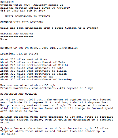
According to the National Weather Service in Guam, at 0900Z on 24 Feb (700 PM ChST), Wutip has been downgraded from a super typhoon to a typhoon, with winds decreasing to 130mph.
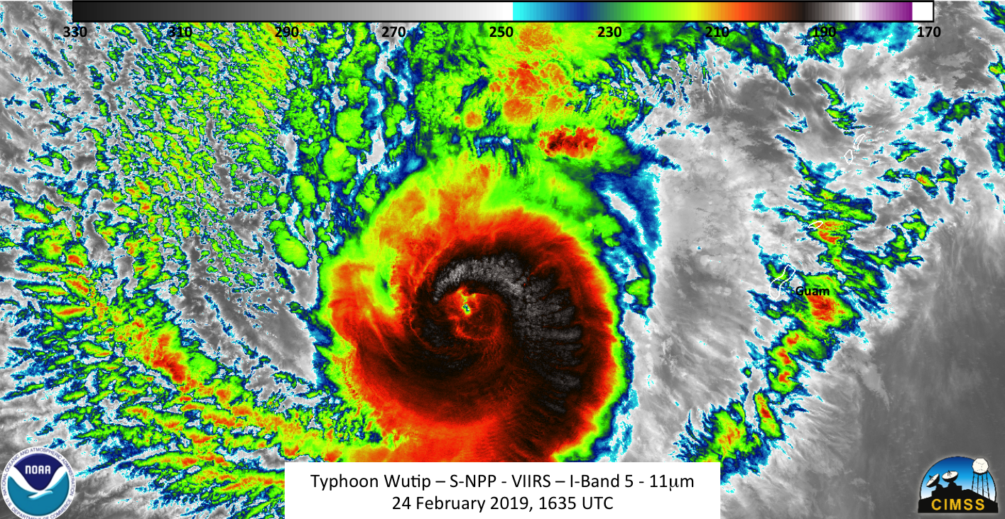
By the 1500 UTC advisory, the winds from Typhoon Wutip had decreased to 120mph, as derived from satellite

This windspeed was confirmed by information from the Joint Typhoon Weather Center (http://www.metoc.navy.mil/jtwc/products/wp0219web.txt) at 1500UTC.
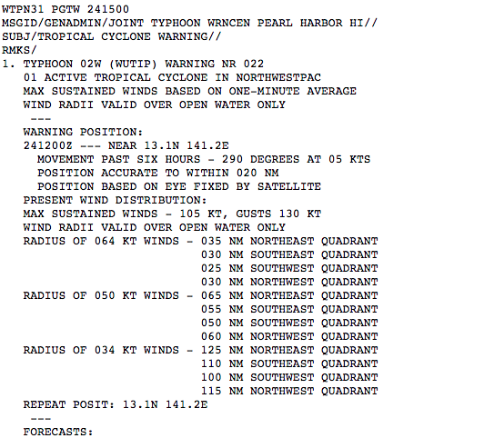
This makes it a moderate category 3 storm as of 1500UTC, with additional weakening continuing through the day.
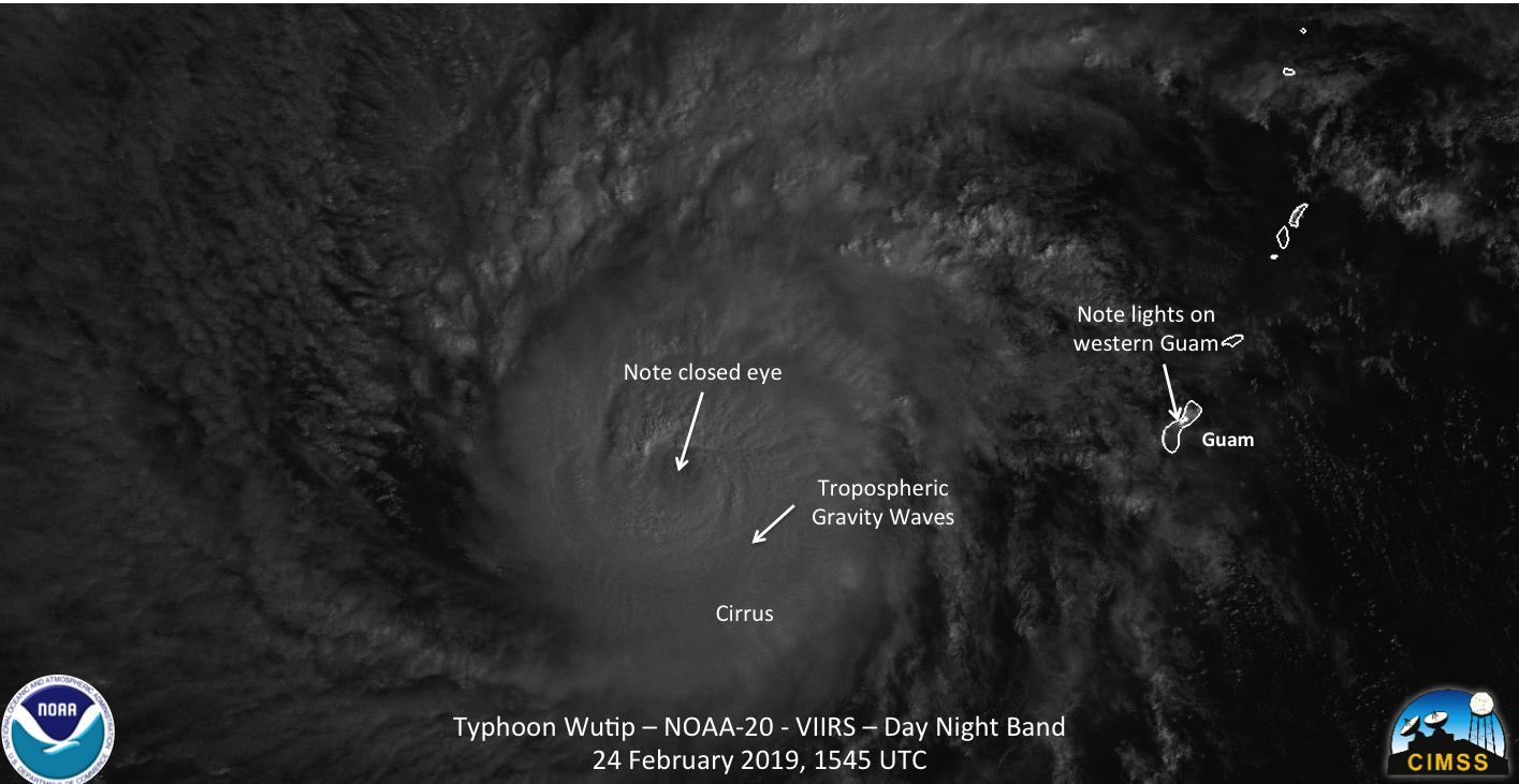
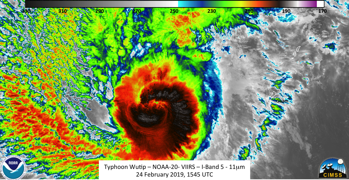
NOAA-20 continued to observe the storm slightly off nadir, while S-NPP observed the storm at the more towards the eastern edge of it’s scan.
The waning gibbous (70% illumination) continues provided enough moonlight to illuminate the storm quite nicely. Both the IR and DB observed the tropospheric gravity waves and overshooting tops from the weakening storm.


As can be seen in the imagery, the eye is cloud covered, as one would expect from a weakening storm. Also of note are the lights on the western side of Guam, near where the international airport is (Anderson AFB is on the northern tip of the island)
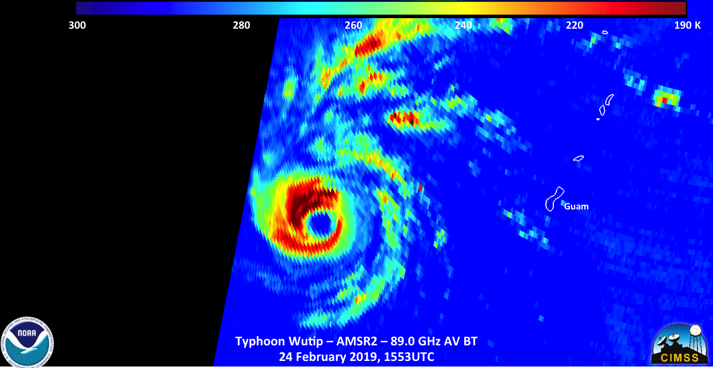
The ATMS instrument on NOAA-20 measured within the storm. It showed a cold temperatures continuing to surround the center of circulation, though not completely surrounding it like before. In addition, while we are looking at different parts of the atmosphere, it is worth noting that the coldest temperatures are not exactly aligned with the most intense convection as see from VIIRS. Of particular note is along the western portion of the eyewall.


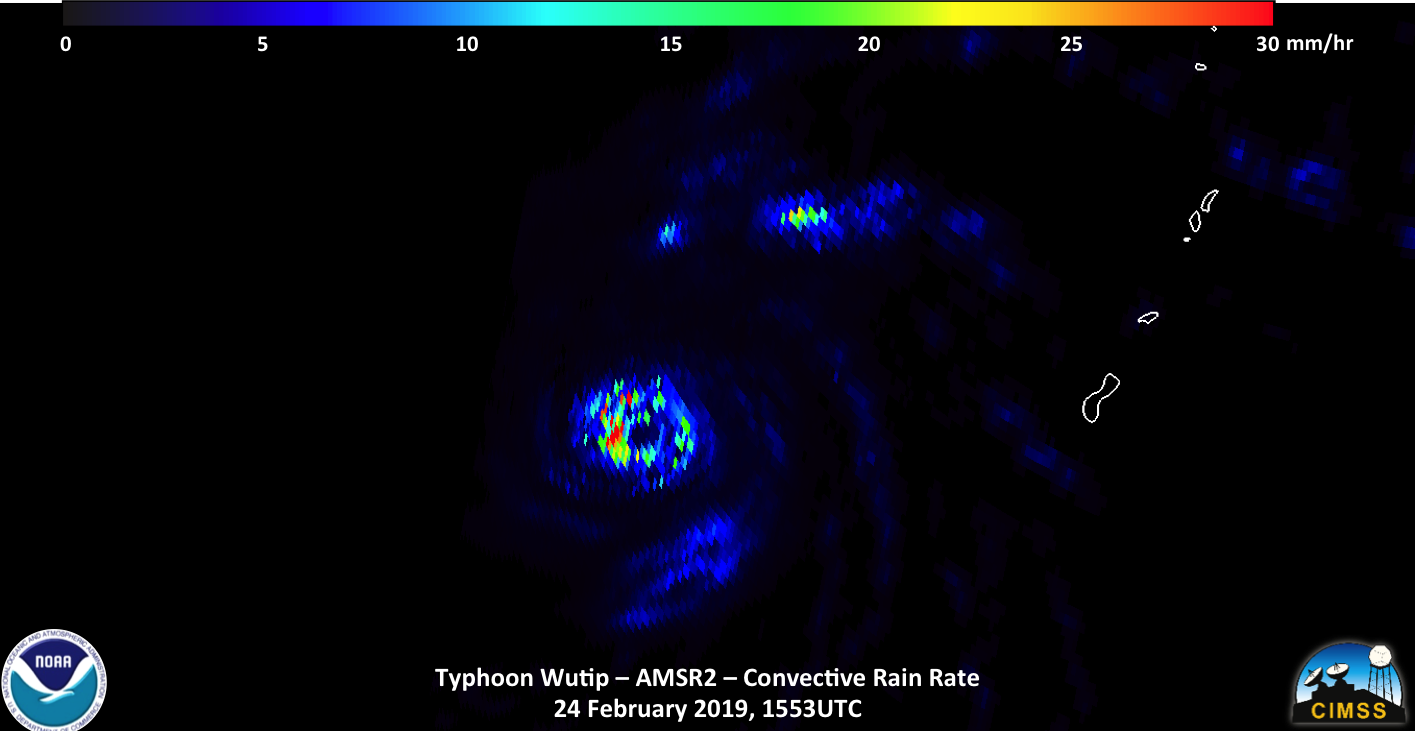
As mentioned, GCOM-W1 did observe Typhoon Wutip today on the edge of the scan, slightly after NOAA-20 flew over. The convective precipitation product seem to show convective rain continuing to surround the eye. This is correlated with the coldest regions in the 88.9 GhZ brightness temperature imagery. In addition, the higher resolution of AMSR2 shows much more structure to the storm
An interesting thing was found when looking at the S-NPP imagery which occured after the NOAA-20 pass, given the relative location of Wutip and the orbits of the two satellites
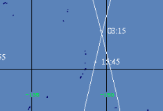
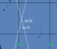
Orbit track of NOAA-20 (right) and S-NPP (left) near Guam on 24 February.
It appears that Wutip did a full rotation over the course of 50 minutes. This can be seen by looking VIIRS imagery
As well as the ATMS brightness temperatures at 88.0GHz

Note the orientation of the cold temperatures within the storm, as observed by the ATMS instrument. This information can potentially provide information as to the inner speed of the storm core.
With the continued weakening of the storm and the track taking it away from US interests, this will be the last set of observations of this storm.
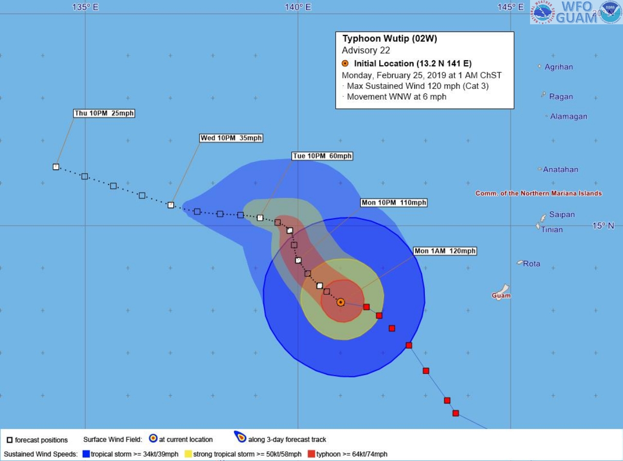
Typhoon Wutip Forecast track, courtesy of NWS Guam

