« Back to "Super Typhoon Wutip - February 21-26, 2019"
Typhoon Wutip on 22 February 2019
Posted: February 22, 2019
Typhoon Wutip is now almost due south of the US territory of Guam in the Pacific. At ~15Z, according to the Joint Typhoon Warning Center, Wutip had sustain winds at 105 knots which is equivalent to a Category 3 storm (http://www.metoc.navy.mil/jtwc/products/wp0219web.txt).

Interestingly the Regional Specialized Meteorological Center (RSMC) Tokyo Typhoon monitoring page (https://www.jma.go.jp/en/typh/index.html) had winds significantly less than the estimates from the JTWC. Again, both of these are are all satellite estimates, since there are no routine aircraft observations in the Pacific.

Typhoon Wutip was observed by the train of three satellites shortly after the 1500Z observations. I will be going slightly out of order here in the observations
The first was an edge of scan pass from S-NPP at ~1533Z. The IR from VIIRS showed convection completely surrounding the circulation, with tropospheric gravity waves and overshooting tops continuing to be seen.
The waning gibbous (88% illumination) continued to provided enough moonlight to illuminate the storm quite nicely, also showing the tropospheric gravity waves and overshooting tops. Both of these are indications of intense convection. In addition, the DNB appears to show what might be an opening eye.
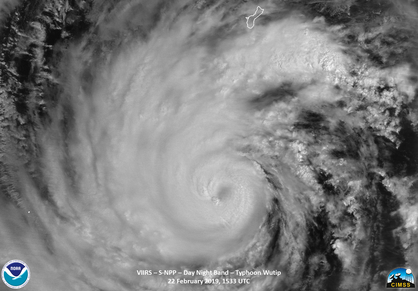
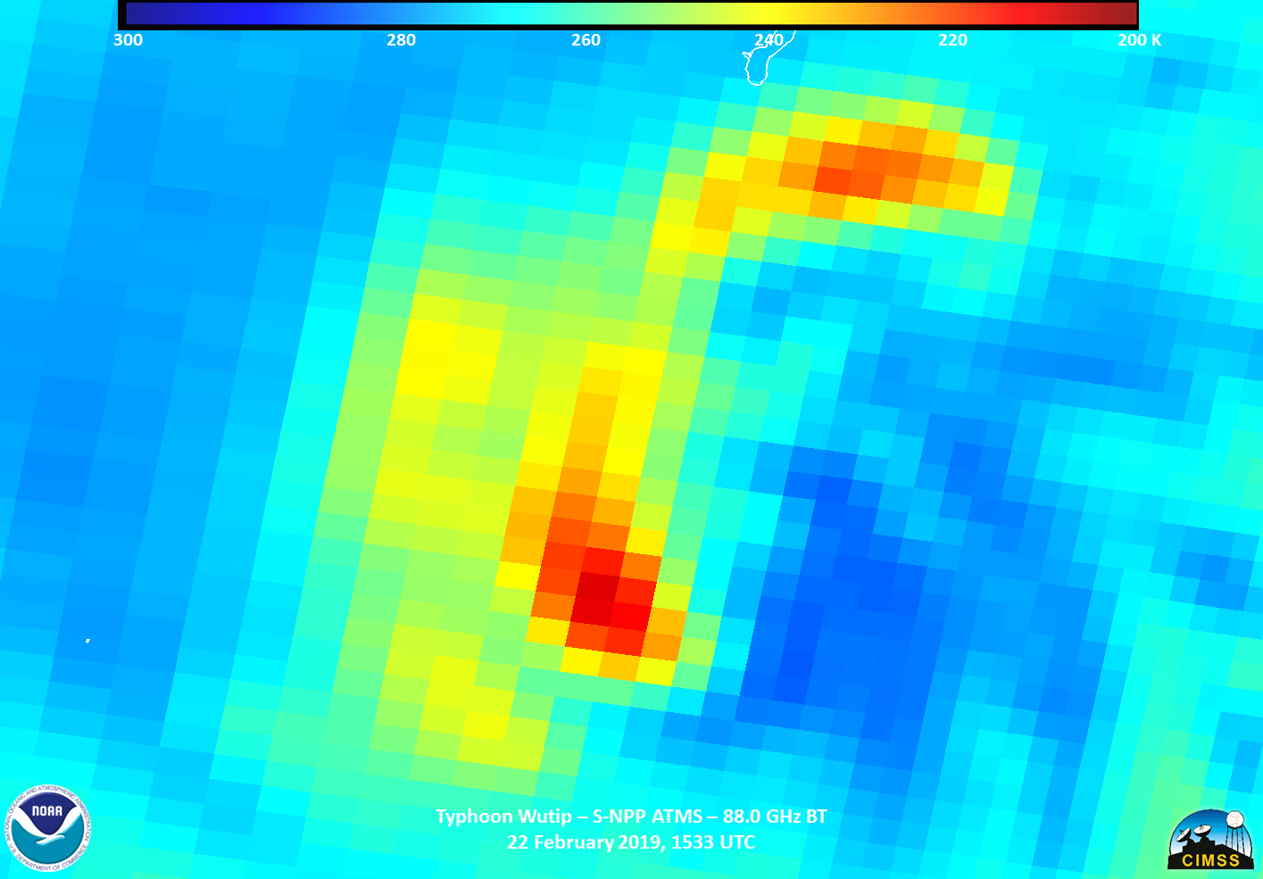
However, given that the storm was towards the edge of the scan, nothing definite could be said by simply looking at the IR and DNB imagery. Even the ATMS 88.0 GhZ BT didn’t seem to indicate an eye, though remember this is towards the edge of scan.
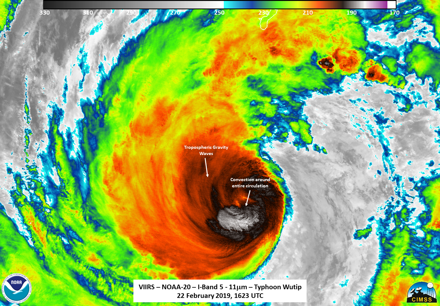
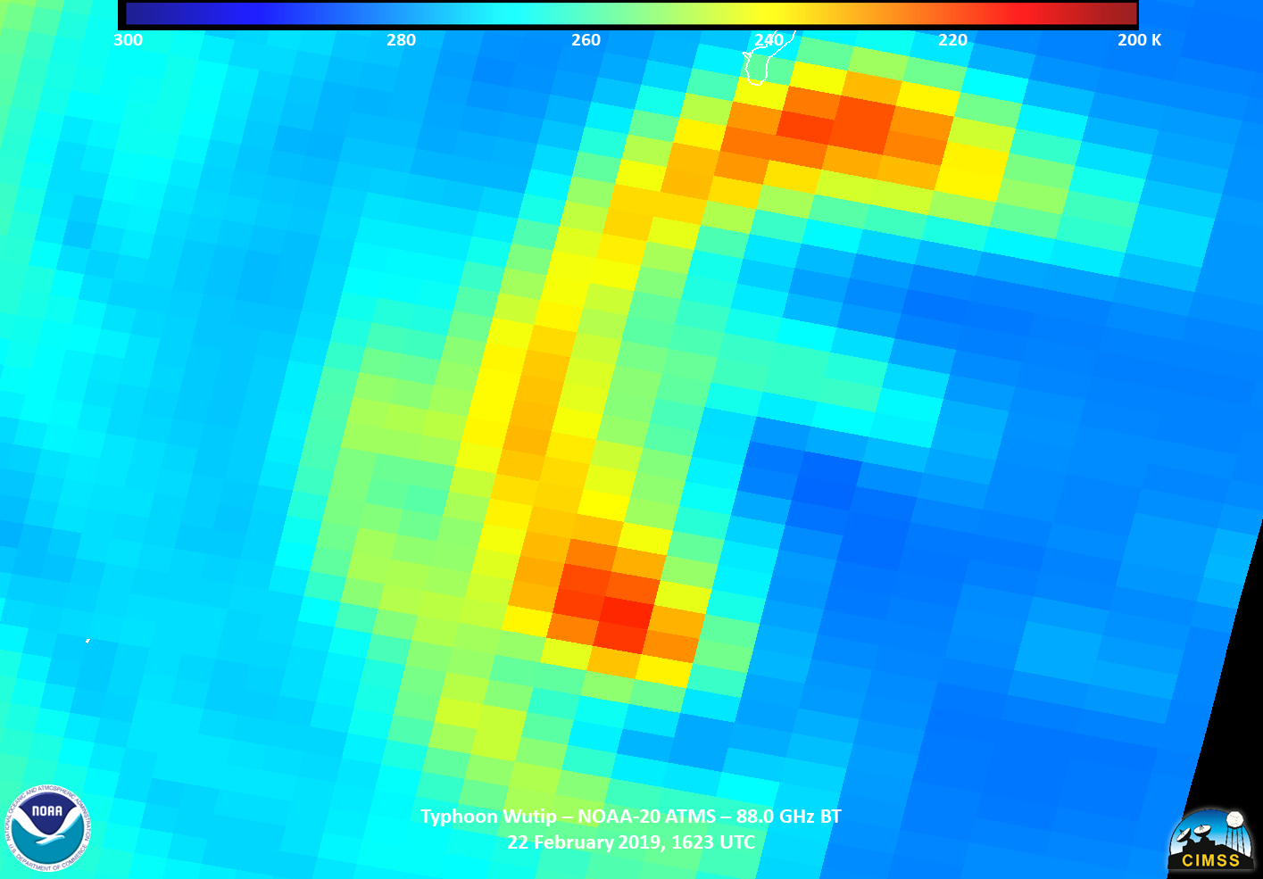
NOAA-20 flew over Wutip roughly 50 minutes later at ~1623. Both the IR and DNB imagery indicated similar observations as the S-NPP imagery, though perhaps an even more open eye in the visible at night image.

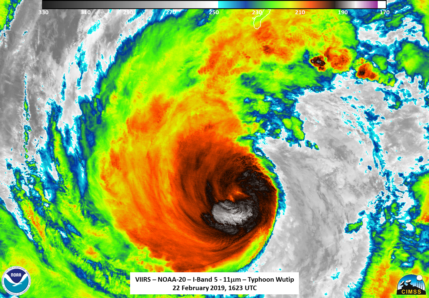
Recall that Wutip is at the edge of the scan, so it could be shadows from the clouds playing a visual trick. Especially since there doesn’t appear to be anything in the ATMS imagery, also at the edge of the scan.
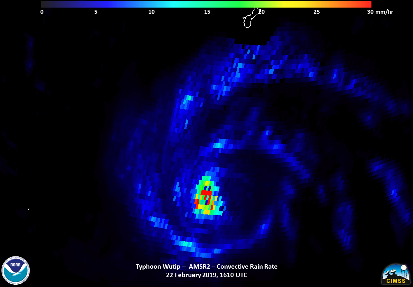
This brings us to the star, I think, of today’s story, GCOM-W1, which flew over at ~1610Z, with Wutip being at near nadir to the AMSR2 instrument. While the convective and surface precipitation products didn’t seem to show much,
the 88.9 GhZ brightness temperature revealed what appears to be a fully closed eye (as you would expect in a major cyclone) as well as maybe a hint of a secondary eye trying to form.
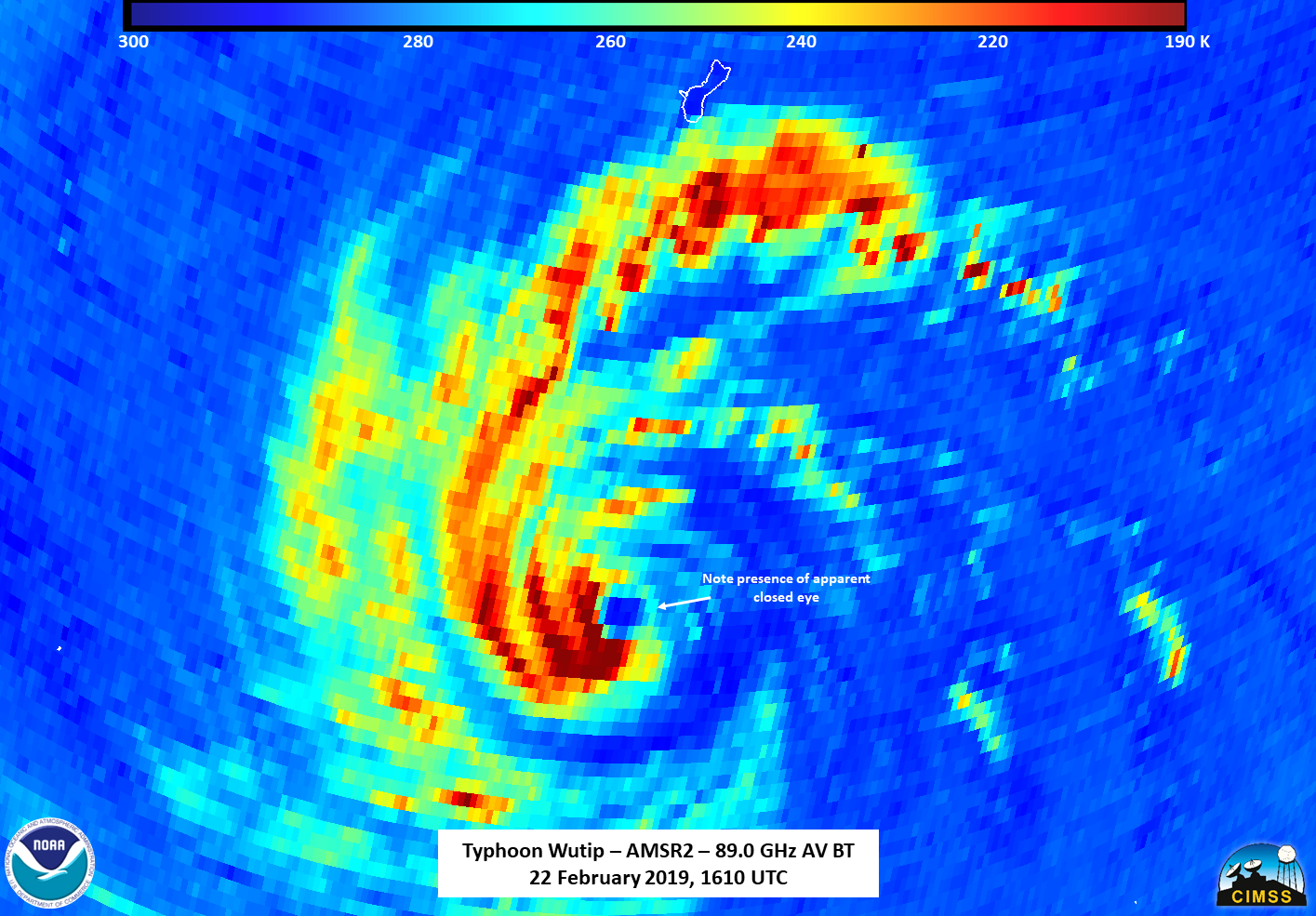
This could possibly be evidence of an eyewall replacement cycle occurring or about to occur.
As of 18Z, the storm is forecast to continue on a westward track before turning north well east of Guam and the Northern Mariana Islands. Unfortunately, GCOM-W1 will be out of position tomorrow for looking at Wutip, so one must rely on the ATMS data on NOAA-20 and S-NPP, with NOAA-20 giving the best view tomorrow.

