« Back to "Super Typhoon Wutip - February 21-26, 2019"
Super Typhoon Wutip on 23 February 2019
Posted: February 23, 2019
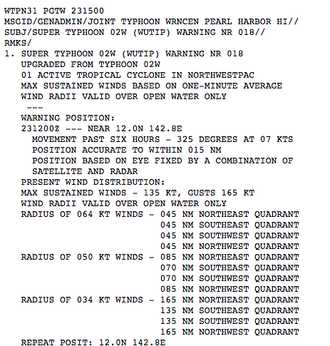
According to the National Weather Service in Guam, at 100 AM CHST on 24 Feb 2019 (1500 UTC, 23 Feb 2019), Super Typhoon Wutip had maximum sustained winds have increased to 155 mph and was located by both radar and satellite
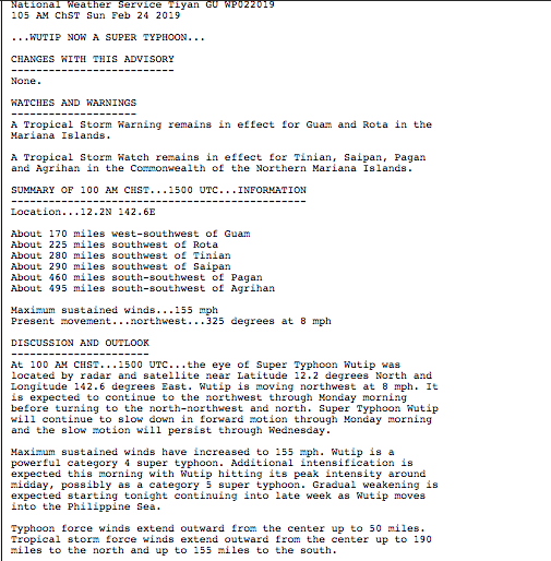
This windspeed was confirmed by information from the Joint Typhoon Weather Center (http://www.metoc.navy.mil/jtwc/products/wp0219web.txt).
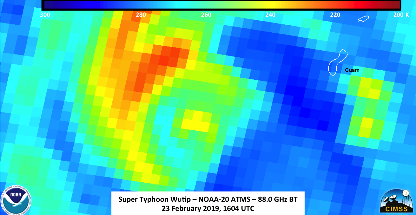
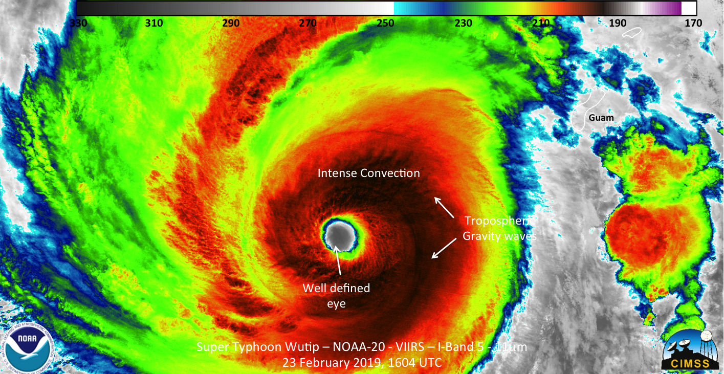
As expected for the position of Super Typhoon Wutip and the orbit GCOM-W1, the AMSR-2 instrument was not able to observe the storm on 23 February. NOAA-20, however, afforded a near nadir view of the storm at about 1604 UTC. Both the IR and Day Night Band were able to observe the well defined eye of Wutip as well as the tropospheric gravity waves emanating from the circulation, as can be seen below.


In addition, when one zooms into the eye of the storm itself, the waning gibbous (80% illumination) provided enough moonlight to reveal the intensity of the storm in another way, namely mesovorticies within the eye itself. These are small scale rotational features often found in the eyewalls of intense tropical cyclones.
In addition to the VIIRS imagery, the ATMS instrument on NOAA-20 was able to observe the internal structure of Super Typhoon Wutip. It showed a cold temperatures complete surrounding the center of circulation.
At this point, one may be asking, “What about S-NPP? Surely it observed Super Typhoon Wutip as well.” You would be correct, however it caught the storm at the edge of two separate passes. There are a few interesting things that can be seen. First is that Wutip’s eye appears to jump around significantly in the IR imagery, as you can see this in the sequence of the SNPP, NOAA-20 and SNPP passes below.

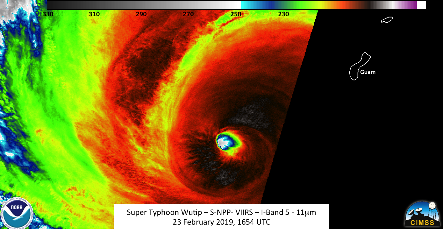
This is because the storm is at the edge of the pass for both SNPP passes while the NOAA-20 pass is at near nadir. Because the storm has high clouds, the parallax affect causes clouds to be displaced relative to their actual position at the surface for the times it is at a high viewing angle.
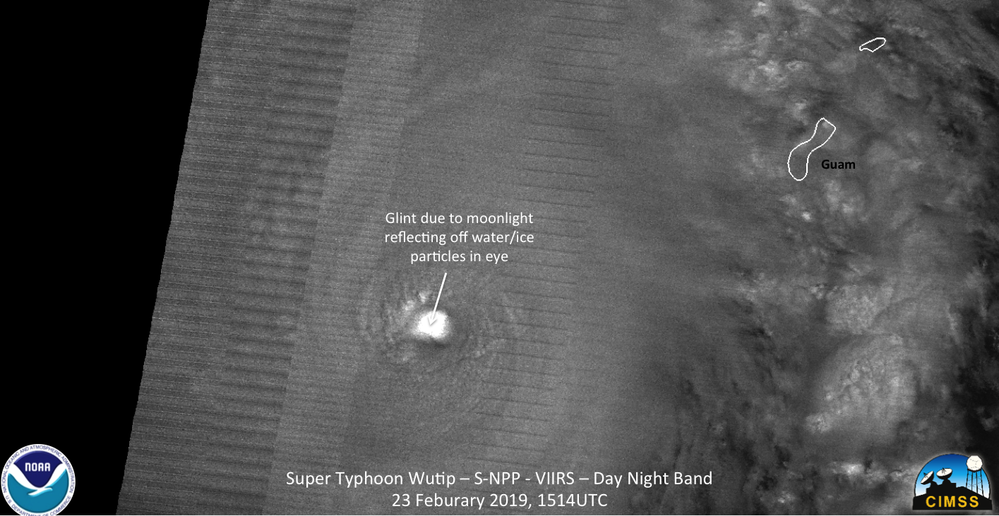
The other interesting thing can be seen in the 1514Z DNB image. Due to the relative position of the moon, storm and satellite as well as the ice crystals within the clouds in the eyewall itself, you actually get a form of glint in the eye. Also, as a note for those that may not be familiar with the Day Night Band imagery, the venetian blind affect is an edge of scan artifact on the sensor itself.
Super Typhoon Wutip is expected to continue intensify to potentially a Category 5 typhoon later today before gradually weakening as it moves into the Philippine Sea.

