« Back to "Super Typhoon Wutip - February 21-26, 2019"
Typhoon Wutip on 21 February 2019
Posted: February 21, 2019
One 21 February, Typhoon Wutip was impacting the Federated States of Micronesia in the Pacific region. At ~15Z, it had sustained winds of ~85 knots, according to the Joint Typhoon Warning Center, which is equivalent to a low Category 2 storm (http://www.metoc.navy.mil/jtwc/products/wp0219web.txt).
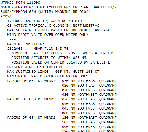
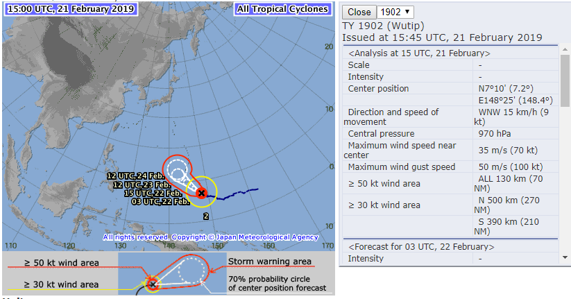
The Regional Specialized Meteorological Center (RSMC) Tokyo Typhoon monitoring page had winds slightly less than the estimates from the JTWC, though it should be noted that these are all satellite estimates, since there are no aircraft observations.
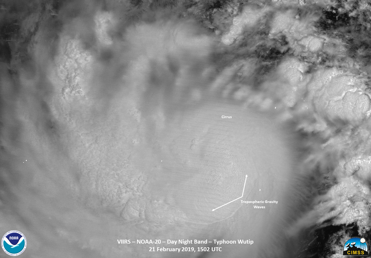
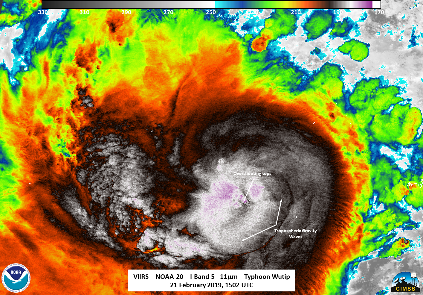
Typhoon Wutip was observed by the train of three satellites shortly around the 1500Z observations. First was an edge of scan pass from NOAA-20. The IR showed a broad area of convection, with tropospheric gravity waves and overshooting tops easily visible. The waning gibbous (95% illumination) also provided enough moonlight to illuminate the storm quite nicely, also showing the tropospheric gravity waves and overshooting tops. Both of these are indications of intense convection.
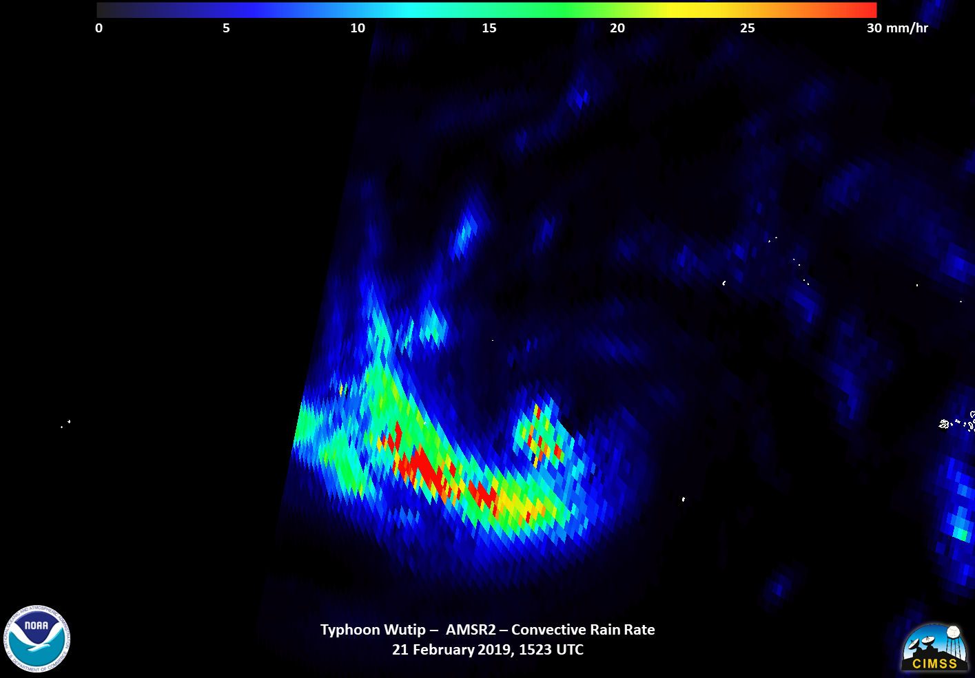
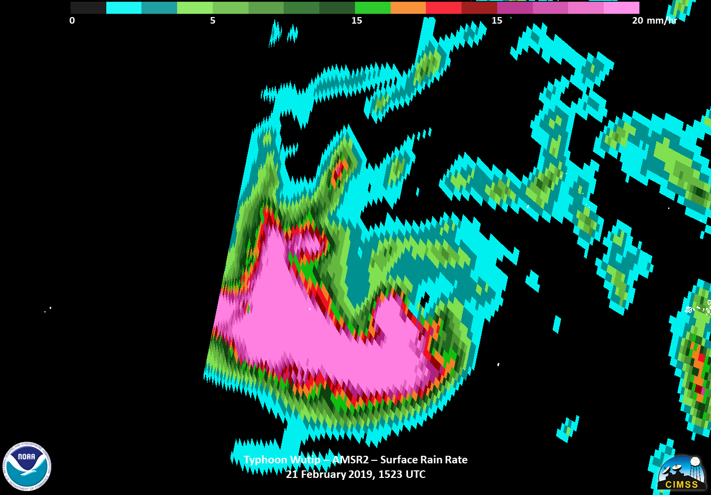
The next satellite was GCOM-W1, with AMSR2 instrument, about 20 minutes later. Both products showed the storm quite well, with the convective precipitation product appearing to show the convection beginning to wrap around the circulation.
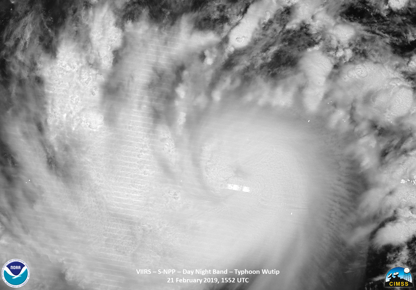
Finally, S-NPP flew over Wutipat ~1552UTC, with a near nadir overpass. While similar features to NOAA-20 were observed in both the IR and DNB imagery, the DNB imagery also spotted a lone lightning streak near the center of circulation.

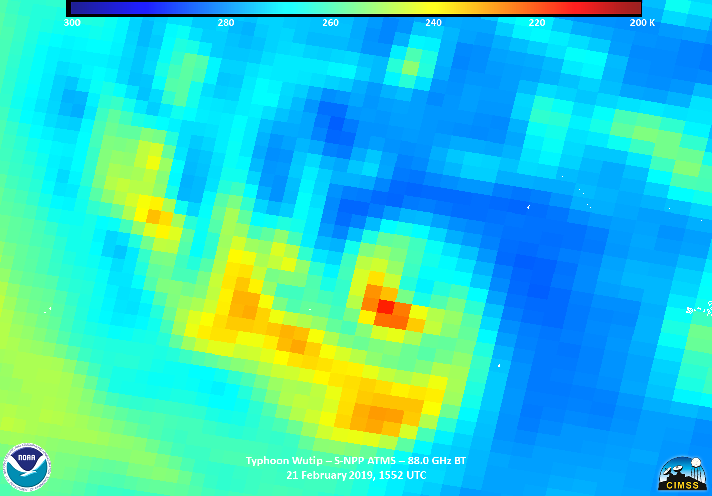
Both S-NPP and NOAA-20 have the ATMS instrument, which provides a look inside of the storm. The 88.0 GhZ BT from S-NPP showed an intense cold region in the exact location of the overshooting top observed both in the IR and DNB, which just happens to be where the lightning streak was observed in the DNB imagery. In addition, it seemed to indicate some wrapping of the the colder cloud regions around the inner circulation.
This storm is current forecast to have impacts to Guam and the Northern Mariana Islands in the next couple of days as it continues to intensify over the warm waters of the Pacific.

