« Back to "Typhoon Vongfong (Ambo) - 13-15 May 2020"
Severe Tropical Storm Vongfong – 15 May 2020
Posted: May 15, 2020
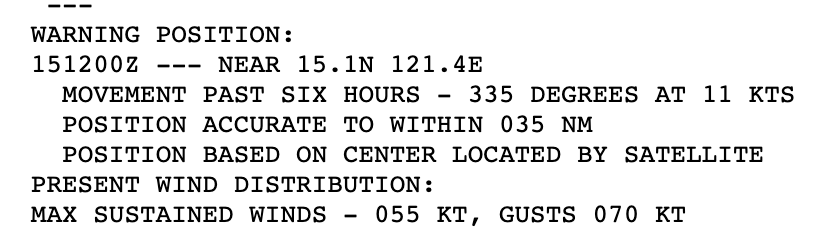
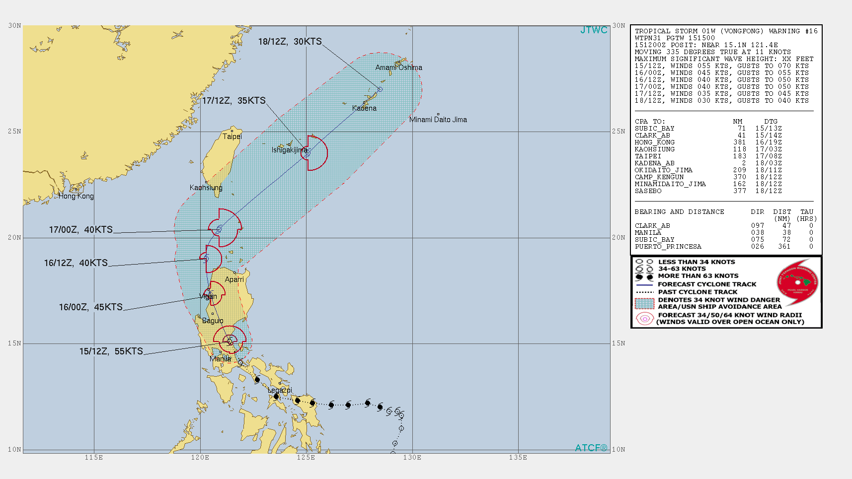
Severe Tropical Storm Vongfong has continued to weaken over the last 24 hours, with the Joint Typhoon Warning Center (JTWC) 1500 UTC discussion stating that Severe Tropical Storm Vongfong winds of 55knts, or ~63mph. This would make it a strong tropical storm in the Atlantic basin.
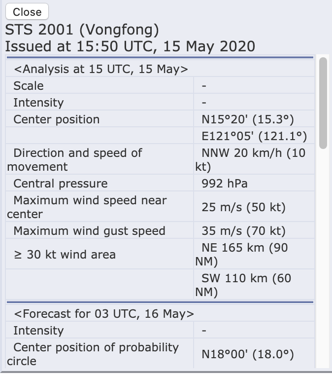
The Regional Specialized Meteorological Center (RSMC) Tokyo stated that the maximum winds at the center continued to be 50knts or ~57mph. While slightly different than the speed the JTWC showed, this difference is due to differing methods of determining the winds and due to the fact that JTWC adopts a 1 min mean wind speed, but RSMC Tokyo adopts 10 mins mean wind speed. As with the JTWC discussion, it would also make Vongfong a strong tropical storm in the Atlantic basin.
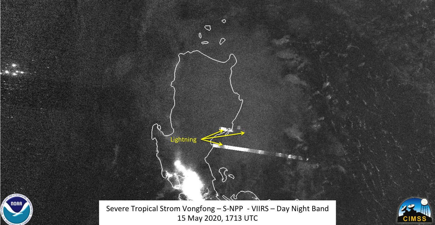
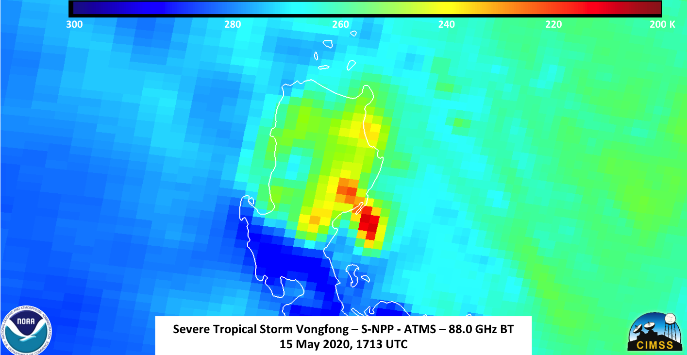
S-NPP first observed Severe Tropical Storm Vongfong at ~1713Z close to nadir, providing the best viewing geometry of the storm. The I05 (11μm) imagery clearly showed that the western side of the storm was sheared, with the remnant convection remaining offshore. In addition, the imagery showed a lone overshooting top with some tropospheric gravity waves emanating to the west
The Waning Crescent (41% illumination) was below the horizon, meaning the storm was only observable with light being reflected by airglow and the city lights. While there were no major mesospheric signatures, there were several lightning streaks near the convective core
The ATMS imagery from S-NPP showed just the areas of strongest convection, with no evidence of it encompassing the circulation center.
This is supported by the GCOM-W1 pass at ~1744Z, roughly 30 minutes after S-NPP observed Severe Tropical Storm Vongfong
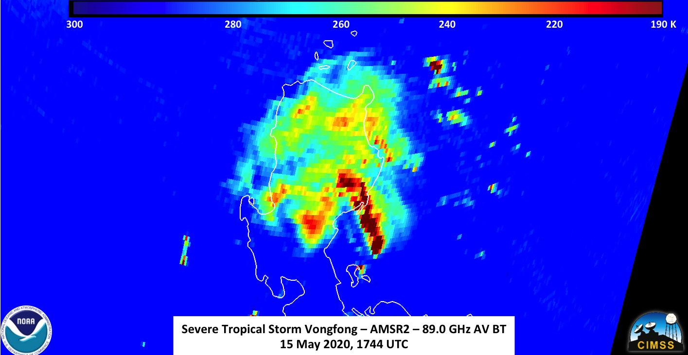
While the 1500Z JTWC Prognostic reasoning used an SSMI/S microwave image at 1036Z, the AMSR2 and ATMS do support their statement of a decaying eye.
THE INITIAL POSITION IS BASED WITH GOOD CONFIDENCE ON A DECAYING MICROWAVE EYE SEEN IN A 151036Z SSMIS 91GHZ PASS
NOAA-20 observed Severe Tropical Storm Vongfong at ~1803Z on the eastern edge of the scan. While the imagery was on the edge of the scan, one can see that the convection remained offshore with little change between the SNPP and NOAA-20 passes in the I05 (11μm) imagery, with similar features seen in both
While the moon illumination didn’t change between the two passes, the lunar geometery did, given that the NOAA-20 pass observed Severe Tropical Storm Vongfong on the eastern edge of the pass. This, along with the extended granule that NOAA-20 affords to the DNB, means that features were illuminated by the faint moonlight, including the tropospheric gravity waves coming from the convection off the island of Luzon
The forecast from JTWC has Severe Tropical Storm Vongfong continuing to weaken as it tracks into the East China Sea.

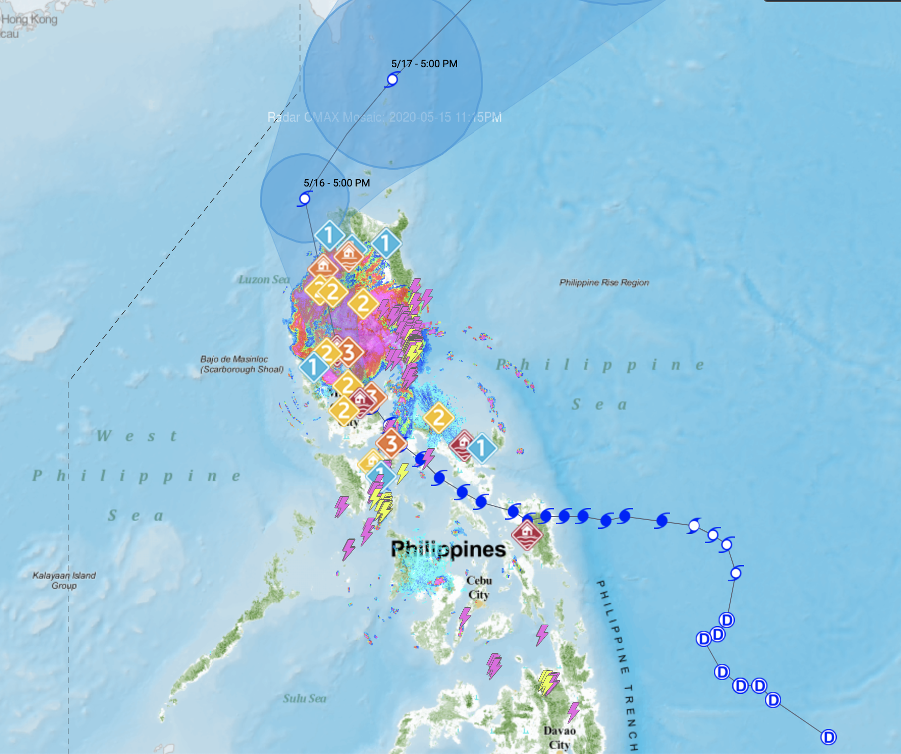
Because of the impacts to the Philippines, the Philippine Atmospheric, Geophysical and Astronomical Services Administration (PAGASA) are also tracking Tropical Storm Vongfong, which is called Ambo by PAGASA, to assess the impacts on the various islands in the path of the storm. Their track is also very similar to JTWC and JMA
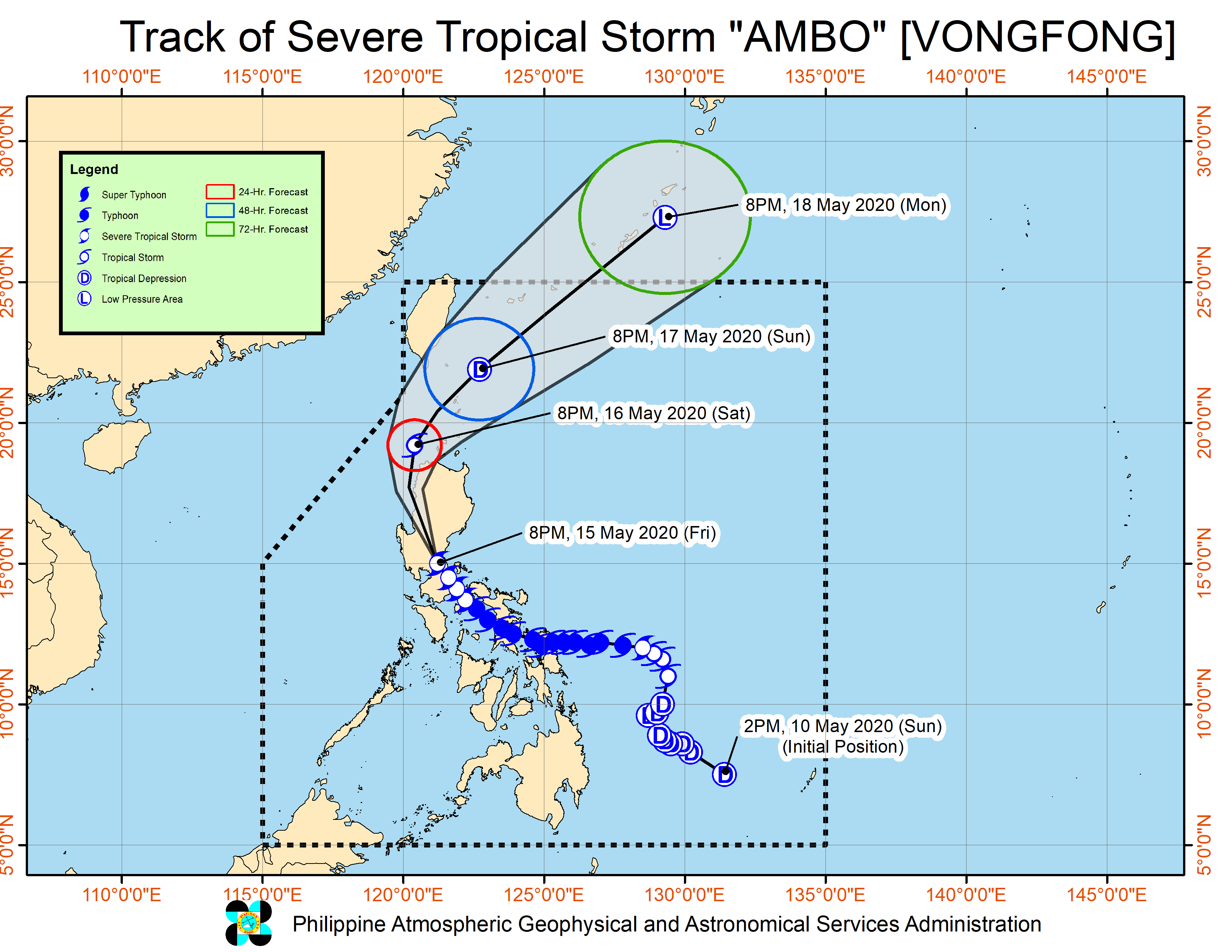
In anticipation of the storm, PAGASA has continued to issue flood alerts to various locations. This is especially important due to the fact most of the population is along the coast and in low-lying areas. Evacuations have been challenging given the ongoing CoVID-19 pandemic.