« Back to "Typhoon Kammuri - November 28 - December 2 2019"
Typhoon Kammuri on 2 December 2019
Posted: December 2, 2019
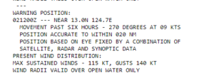
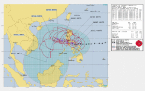
Typhoon Kammuri has rapidly intensified over the last 24 hours, with winds as of the 1500Z Joint Typhoon Warning Center (JTWC) discussion, of 115knts, or ~132mph. This would make it just barely a Category 4 storm in the Atlantic basin.
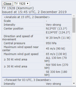
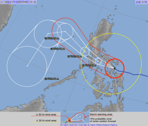
The Regional Specialized Meteorological Center (RSMC) Tokyo stated that the maximum winds at the center were 90knts or ~103mph at 1550UTC. While slightly different than the speed the JTWC showed, this difference is due to differing methods of determining the winds and due to the fact that JTWC adopts a 1 min mean wind speed, but RSMC Tokyo adopts 10 mins mean wind speed. If one used the JMA wind speed for your tropical system classification, Kammuri would be considered the equivalent of a Category 2 storm in the Atlantic basin.
As previously mentioned, while this doesn’t affect forecasts for this storm, this sort of difference in measurement could mean the difference between a tropical storm warning or a hurricane warning depending on the location you are using for your forecast and warnings.
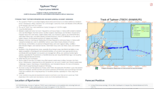
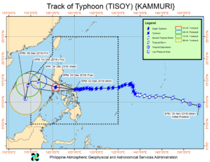
Per the 1500UTC bulletin from Philippine Atmospheric, Geophysical and Astronomical Services Administration (PAGASA), at 11pm local time (1500UTC), Kammuri (Tisoy) made landfall near Gubat, Sorsogon (12.9 °N, 124.3 °E ).
Image from PAGASA website on 2 December 2019 at 1532Z
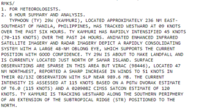
The Joint Typhoon Warning Center (JTWC) prognostic reasoning at 15UTC, though they were unable to utilize any microwave imagery due to the storm being farther to the west as well as orbital overpasses. However, given the proximity to land, ground-based radar is the preferred method due to its rapid temporal refresh. As it approached landfall, the storm rapidly consolidated with an oblong eye.
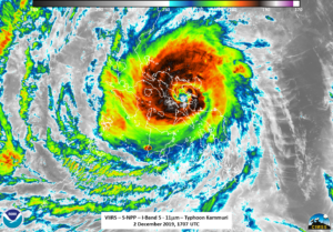
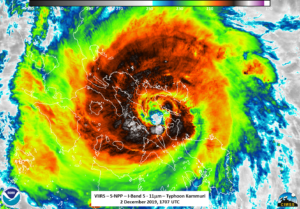
S-NPP, NOAA-20, and GCOM-W1 all observed the storm after it had made landfall and transitioned the southern part of the island of Luzon. S-NPP saw Typhoon Kammuri at ~1707UTC with a near nadir overpass. The first thing that could be seen in the I05 (11μm) imagery is that Kammuri presented itself as a classic major hurricane with a well defined, though somewhat oblong, eye as well as feeder bands, intense convection, and tropospheric gravity waves.
Zooming into the eye, one can see some mesovorticies within the eye itself
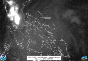
While there was interference from some city lights, the signal from the airglow (the moon was a waxing crescent with 33% illumination) revealed mesospheric gravity waves on the northern side of the storm.
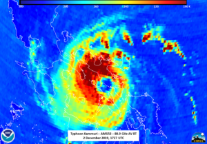
The ATMS instrument was able to observe in the 88.2GHz, showing that the circulation within the storm was slightly shifted as compared to the I05 (11μm) brightness temperature. In addition, the circulation was not completely surrounded by convection, which is likely due to the interaction with the land
NOAA-20 observed Kammuri at approximately 1757UTC on the eastern side of the pass, which lead to some parallax effects in the I05 (11μm) imagery as compared to S-NPP, though similar tropospheric features could be observed in both, with some rotation being observed between passes. The most obvious thing that could be seen due to parallax is the fact that the eye shifted back to the east as well as becoming noticeably smaller.
AMSR2 was also able to observe Kammuri with a near nadir pass over the Philippines at approximately 1727UTC. The structure of the inner part of the storm can be observed by looking at the 36.5 and 88.9 GHz brightness temperatures. As can be seen, the circulation between the two channels was nearly on top of each other, a sign of a well-organized storm.
A comparison with the NPP ATMS 88.2GHz imagery reveals how much more detail the AMSR2 sensor can provide regarding the structure of the storm.
This includes a “tongue” of cloud into the circulation center, as seen in the zoomed-in imagery
It is interesting to note that the Joint Typhoon Warning Center (JTWC) prognostic reasoning at 21UTC, did not mention the timely AMSR2 pass. This is likely due to the availability of multiple ground-based radars, which is the preferred method near land due to its rapid temporal refresh.
The forecasts from JTWC and (RSMC) Tokyo has Kammuri weakening as it interacts with the mountains of the Philippines, eventually making landfall by early on 3 December 2019.
PAGASA continues to track Kammuri as it passes over the Philippines order to assess the impacts on the various islands in the path of the storm, with their track being similar to that of the JTWC and (RSMC) Tokyo.
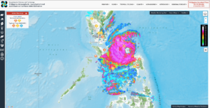
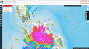
In anticipation of the storm, PAGASA has continued to issue flood alerts to various locations. The image below shows the radar at the time of the S-NPP pass.
Image from PAGASA website on 2 December 2019 at 1710Z
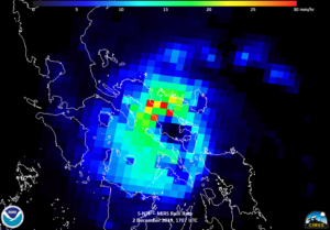
An interesting comparison is with the Microwave Integrated Retrieval System (MiRS) rainfall rate product which indicates that the deepest convection and precipitation is indeed in the same region the radar indicates the heaviest precipitation as well.
At the time of the NOAA-20 pass, one can see that the radar in the northern part of the storm was no longer present, potentially due to localized power outages. However, one can still get an idea to the scale, from the ground, of the magnitude of Kammuri as it tracked across the Philippines.
Image from PAGASA website on 2 December 2019 at 1756Z
One thing to note is the location of where the eye is located in the radar, VIIRS and AMSR2 imagery. It appears to track to the north of Sorsogon Bay. This means as it goes to the west, the wind will push the water on to the western side of Sorsogon, the southern part of the island of Luzon. This could lead to major flooding due to the storm surge and intense rainfall.

