« Back to "Super Typhoon Hagibis - October 6-13 2019"
Super Typhoon Hagibis on 7 October 2019
Posted: October 7, 2019
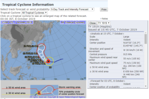
At ~1509, Super Typhoon Hagibis passed just to the south of the island of Anatahan. Per the JTWC discussion at 1500Z , it had winds of ~140kts (~161mph), which would make it a Super Typhoon or the equivalent of a Category 5 storm
RSMC JMA stated that Hagibis was a “Violent” Typhoon with maximum wind gusts near 150kts
Unfortunately GCOM-W1 was just out of position for the storm, but NOAA-20 first observed the storm on the edge of scan at 1525Z, with the setting waxing gibbous moon (68% illumination) lighting up some of the clouds.
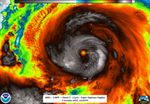
The high resolution I05 (11μm) imagery showed a very small eye along with copious amounts of tropospheric gravity waves. Note that the eye is shifted due to parallax, being on the edge of scan
S-NPP was the next satellite to observe Hagibis, though this closer to nadir. Unfortunately the imagery from the DNB, while not moonlit, did not show any real features (i.e no real mesospheric features, even away from the storm) and is not shown in this discussion. However, more of the structure of the storm could be seen in the I05 (11μm) imagery, along with numerous tropospheric gravity waves.
Of note in both the NOAA-20 and S-NPP I05 (11μm) imagery is the small pinhole eye, which can be seen even closer when it was close to Anatahan.
It is worth noting that the ATMS Band 16 (88.2GHz) imagery from showed a broad area of circulation, not just the small eye seen in the I05 (11μm) imagery, indicating a broad area of circulation.
As with the post yesterday, the rotation of the storm, including the shifts due to parallax, can be seen from the two I05 (11μm) images
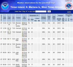
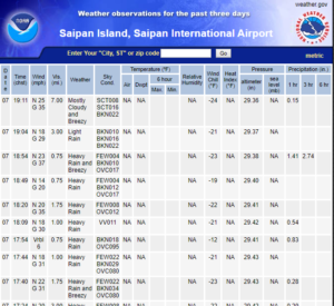
It is worth noting that the ASOS stations at Tinian and Saipan have not reported any weather since as of 9:28am CHST on 8 October 2019 (23:28 UTC on 7 October 2019). The last recorded observation from Tinian Island was 1:32pm CHST on 7 October 2019 (0323UTC) and the last observation on at the Saipan International Airport was at 7:11pm CHST on 7 October 2019 (0911UTC)
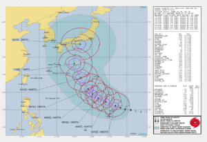
Hagibis is expected to remain a strong tropical storm over the next day, eventually weakening as it turns to the north and likely impacting Japan by the weekend, per the Joint Typhoon Warning Center forecast at 15Z, shown below, which agrees with the forecast from JMA as well (not shown).


