« Back to "Typhoon Bualoi - 21-24 October 2019"
Typhoon Bualoi on 24 October 2019
Posted: October 24, 2019
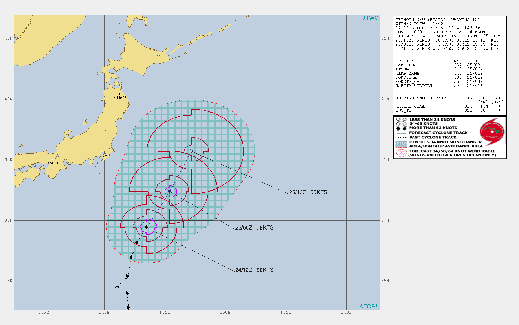
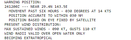
At 1500Z on 22 October, the Joint Typhoon Warning Center (JTWC) stated that Typhoon Bualoi had sustained winds of 90knts or ~103mph, making it equivalent to a Category 2 storm in the Atlantic basin. In addition, they note the storm is becoming extratropical.
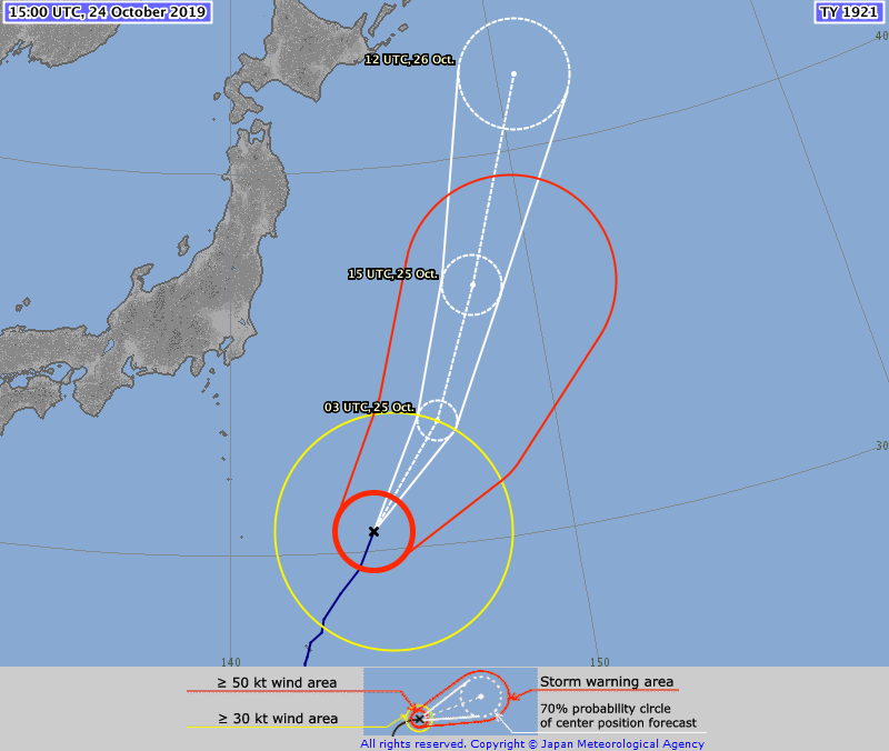
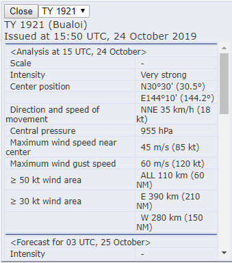
The Regional Specialized Meteorological Center (RSMC) Tokyo stated that the maximum winds at the center were 85knts (~97mph). The difference is due to differing methods of determining the winds and due to the fact that JTWC adopts a 1 min mean wind speed, but RSMC Tokyo adopts 10 mins mean wind speed.
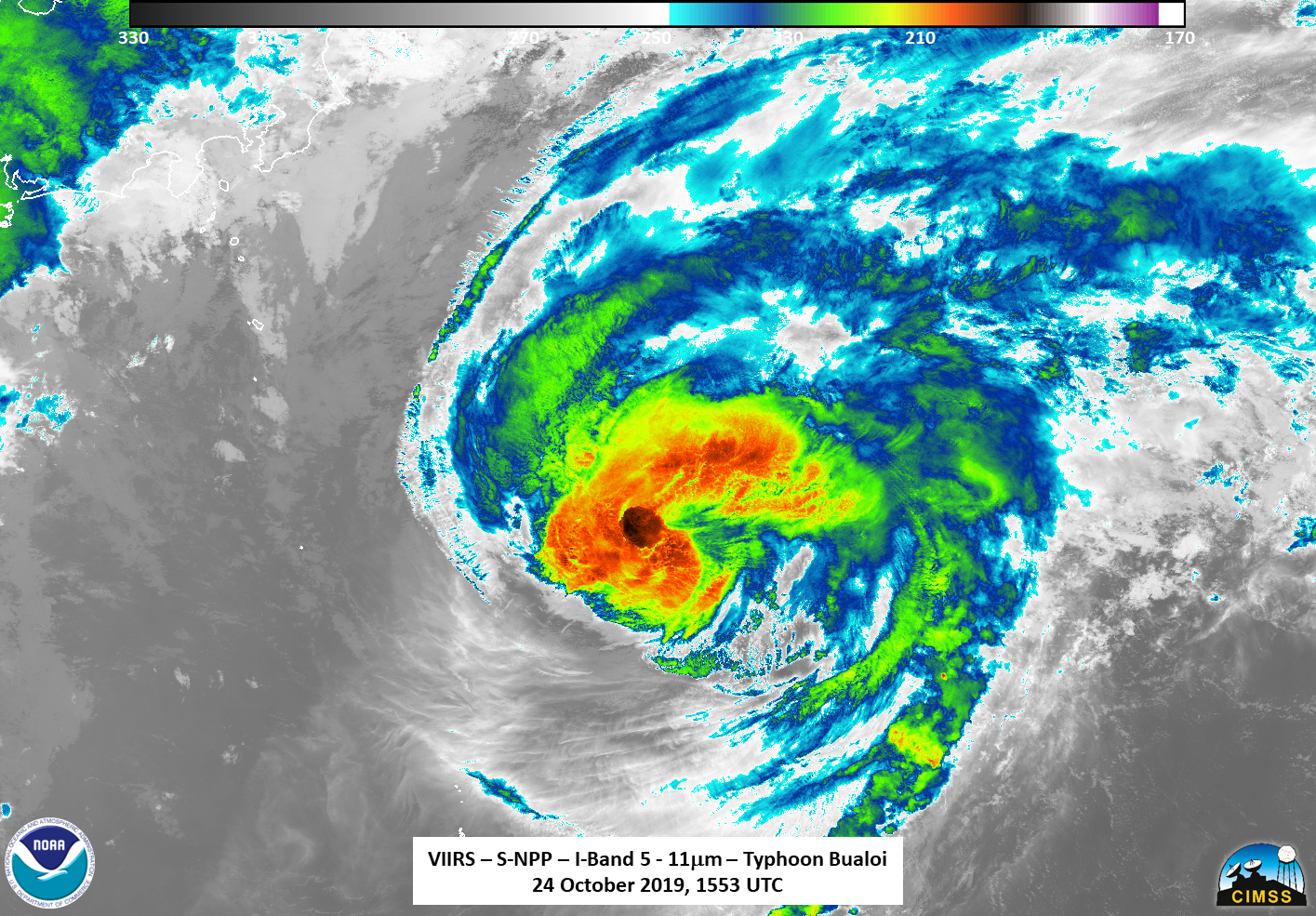
Unlike 23 October 2019, only 2 satellites (S-NPP and NOAA-20) observed Bualoi as it transitioned to an extratropical system.
Suomi-NPP (S-NPP) was the first polar-orbiting satellite to see Typhoon Bualoi at ~1553Z, with a close to nadir overpass. The I05 (11μm) brightness temperature again showed dry air entraining on into the storm as it becomes extratropical, losing the distinctive circulation one sees with tropical systems.
The waning crescent (28% illumination) and lunar geometry meant that the storm itself was illuminated primarily by airglow in the Day Night Band. Using a scaling in radiance space typically used for dark scenes (i.e. going to 1E-9 in radiance space) nothing much could be seen, as shown below
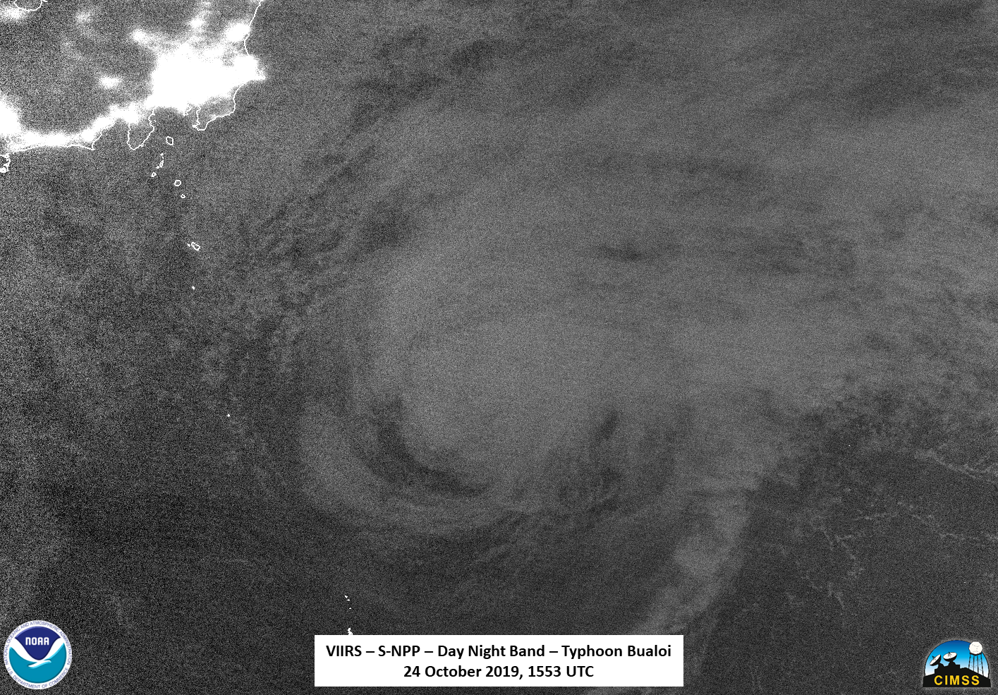
However, if one enhances the data even further, one can pick up on some faint mesospheric gravity waves, perhaps excited by the lone bit of intense convection near the circulation center.
The coldest air that was seen by the ATMS instrument was associated with the convection seen in the I05 (11μm) imagery. In addition, warmer air could easily be seen entraining into the circulation at the level of the ATMS observation.
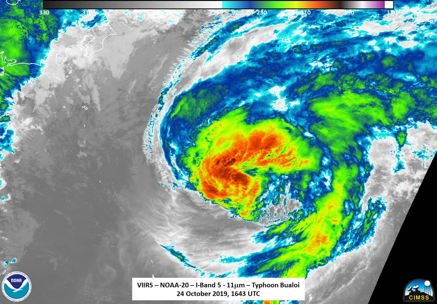
The second and final polar-orbiting satellite to see Bualoi was NOAA-20 at ~1743Z on the eastern side of the pass. While the I05 (11μm) brightness temperature did observe the storm, it was on the edge of the scan, meaning that features were offset due to parallax.
However, making use of the extended granule on NOAA-20 in the Day Night Band (DNB) meant that, one could easily see the mesospheric gravity waves excited by the remaining bit of convection as Bualoi as it dissipates into an extratropical system.
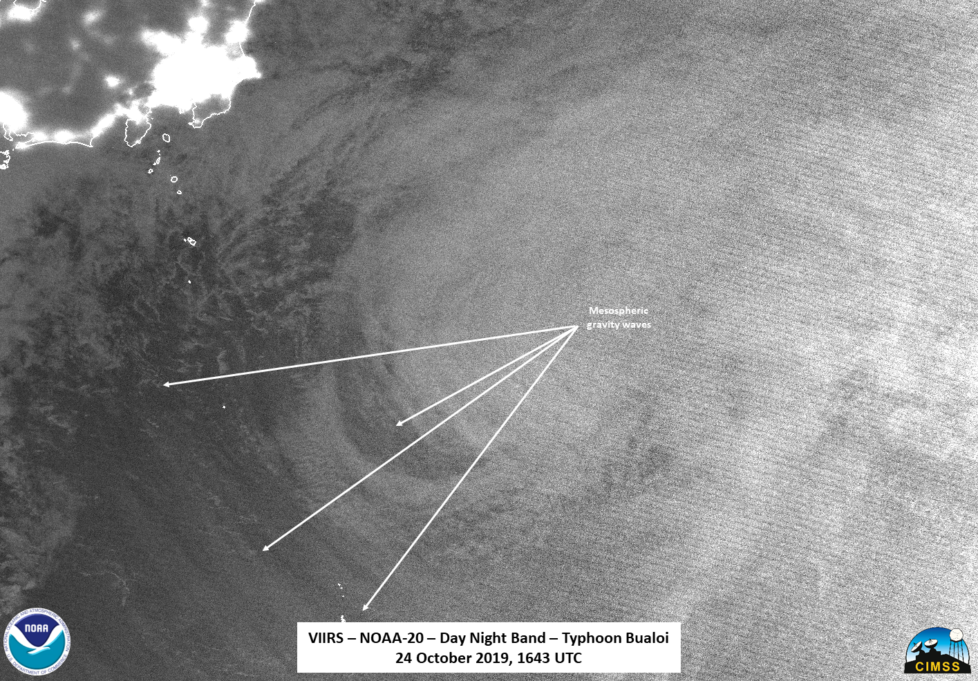
It is also worth seeing how these mesospheric gravity waves changed shape between the passes. However, it is extremely important to note that because these waves are high up in the atmosphere and the NOAA-20 imagery was on the edge of the pass, they will be affeced by parallax.
Bualoi is expected to become extratropical as it continues north and northeast, well away from the main islands of Japan per the Joint Typhoon Warning Center forecast and JMA. Both of these forecasts continue to be in fairly good agreement on the rough timing and direction of the storm. Because has become extratropical, this will be the last post on Bualoi.