« Back to "Hurricane Storm Dorian Aug 28 - Sep 6 2019"
Sentinel and Day Night Band analysis over Bahamas on 5 Sept
Posted: September 5, 2019
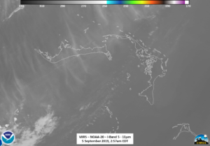
As mentioned in the previous post regarding Dorian on 5 September 2019, the region around Grand Bahama and Abaco Island were basically clear on the morning of 5 September 2019, with the execption of a few thin cirrus clouds from Hurricane Dorian, as shown below. This can be seen in the 11μm imagery image below.
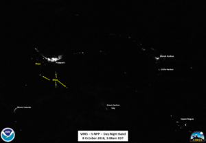
A comparison image was taken from 6 October 2018 at 3:08am EDT due to lunar lighting and clear sky conditions. Reference conditions are shown in the slider below
A labeled reference image is shown below as well, noting where the ships are in the reference imagery
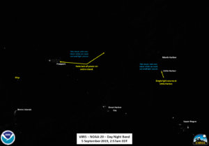
Comparing the two sets of DNB images, we can get an idea of the extent of the outages on Grand Bahama and Abaco Island, shown in the slider below
In addition to seeing virtually no ships =in the region, one can clearly see that in the case of Grand Bahama Island, Freeport has a drastic reduction in amount of light along with virtually every other light along the coast, even accounting for the thin clouds overhead. Abaco Island has an even greater reduction in light, with only a single point of light near Little Harbor. A labeled image is shown below
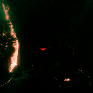
There are other methods of doing this analysis. For example, you can combine the before and after imagery
Imagery provided by Steve Miller, CIRA/CSU
into a RGB image, where red are lights that are out, green are new lights and yellow are constant. Note that the small green and red dots over water are just ship lights moving around, and the blotchy green over Florida is moonlit clouds which show up as “new” lights in some areas.
Imagery provided by Steve Miller, CIRA/CSU
While this is a good representation of where outages are located, it does not necessarily tell you the areas that are “out” because of clouds (example, Florida) and does require a bit of interpretation. In addition, it does have the disadvantage that those with red-green color vision deficiency (which is about 8% in males in the US) will have a harder time picking out the differences in the imagery.
However, it is important to note that both types of outage products (labled and RGB) both have there advantages and deficiencies. Thus, such products can be used in conjunction with one another to help cover the needs of different users.
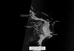
Roughly 4 hours later, at roughly 7:02am EDT, Sentinel-1A provided an edge of scan image over part of Abaco Island. Using yesterdays imagery, taken roughly 24 hours prior, the reduction in the amount of flooding, as well as the reappearance of several of the smaller cays can be seen.
Sentinel-1A/B acquired by ESA/Copernicus, provided by Christopher Jackson, NOAA/STAR/SOCD
Contains modified Copernicus Sentinel data 2019
While VIIRS and ABI imagery provide good visible imagery, the 5 meter Synthetic-aperture radar (SAR) resolution provides the ability to see finer features of flooded regions. It can potentially provide information on vegetation damage as a result of massive flooding.

