« Back to "Hurricane Storm Dorian Aug 28 - Sep 6 2019"
A look at flooding on Grand Bahama Island from Sentinel-1
Posted: September 4, 2019
As mentioned in this post, the Bahama Islands continue to be under clouds, preventing traditional visual observations of flood mapping. As such, stakeholders must rely on Synthetic-aperture radar (SAR) imagery from Sentinel-1A/B as well as other satellites. Such data is routinely collected at NOAA for use to observe sea surface roughness, but can be quickly exploited for usage on flood detection. Copernicus continued to provide non-routinely gathered Sentinel-1 data over the area affected by Hurricane Dorian, especially over the Bahamas, where Dorian sat over for nearly 40 hours, battering both Grand Bahama Island and the Abaco Islands. To emphasize how much storm surge took place on Grand Bahama Island, this video, reportedly sent by a member of the Bahamian showed the storm surge at Freeport International Airport, located on the western side of the island.
Hurricane Update: Iram Lewis,
Member of Parliament,
Central Grand Bahama sent me this video of Freeport International Airport: FPO pic.twitter.com/oDPIJXBnP9— Kionne “Commish” McGhee (@kionnemcghee) September 2, 2019
Sentinel-1A/B passed over Abaco Island on 2 September 2019 and passed over Grand Bahama Island on 4 September 2019 at ~1109UTC (7:09am). While not a routine collection, this was provided by Copernicus as part of the response to Hurricane Dorian. As it turns out, this pass also contained imagery from Abaco Island. As can be seen in the slider below, there has been some improvement, as some of the smaller islands have begun to reappear.
Sentinel-1A/B acquired by ESA/Copernicus, provided by Christopher Jackson, NOAA/STAR/SOCD
Contains modified Copernicus Sentinel data 2019
Moving on to the Grand Bahama Island, as compared to reference imagery was taken on 29 August 2019, one can clearly see differences over large parts of the island. There are areas where rivers are clearly swollen and there is vegetation damage.
Sentinel-1A/B acquired by ESA/Copernicus, provided by Christopher Jackson, NOAA/STAR/SOCD
Contains modified Copernicus Sentinel data 2019
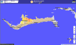
If one compares to the hourly clear composites of the ABI Flood Product, one gets very good agreement between ABI and Sentinel-1A SAR imagery
If you look at the region around Freeport, it appears that there is still flooding at Grand Bahama International Airport as well as damage along the coast.
Sentinel-1A/B acquired by ESA/Copernicus, provided by Christopher Jackson, NOAA/STAR/SOCD
Contains modified Copernicus Sentinel data 2019
As the storm progresses, SAR data will continue to provide a critical role in mapping the impacts of the floods, especially given how cloudy the region will be.


