« Back to "Hurricane Storm Dorian Aug 28 - Sep 6 2019"
Category 3 Hurricane Dorian from morning of 3 Sept 2019
Posted: September 3, 2019
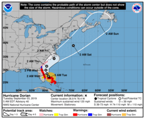
As of the 0900UTC (5am EDT) Public advisory, Dorian continues to be stationary but is now a Category 3 storm with winds of 120mph. The winds for Dorian have steadily decreased over the last several hours, though they have remained constant at 120mph since the 0600UTC and 0700UTC public advisories.
NPP, GCOM-W1, and NOAA-20 all passed over Dorian in that order, starting about 43 minutes after the 0600Z advisory, each observing unique (and surprising) features. As with previous discussions, it will step through the VIIRS imagery first and then move on to the microwave instruments (ATMS and AMSR2).
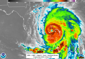
At ~0643 UTC (2:43 am EDT), SNPP caught Dorian with a slightly off-nadir pass, meaning it got a good look at the ragged features of the storm. Unlike about 24 hours prior, the eye is now much smaller and much less defined, something that can be seen in the high-resolution I05 imagery.
In addition, the heavy convection is not completely surrounding the circulation as well as what looks like a possible dryslot trying to make its way in on the southern side of the storm.
Interestingly, some faint mesospheric gravity waves appear to still be coming from the storm, seen in the DNB imagery lit by airglow (due to the moon phase being a waxing crescent moon with 14% illumination).
Also of note are the lights from Nassau can be seen. Freeport and the cities of Grand Bahama and Abaco Islands could not be seen. While power outages have been reported on those islands, they continue to be cloud covered at the time of both the S-NPP and NOAA-20 overpasses
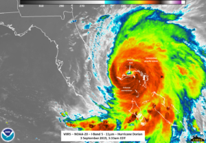
Roughly 50 minutes later at ~0733UTC (3:33 am EDT), NOAA-20 flew over, with Dorian being on the eastern edge of the scan. While this does mean that there was parallax in the features, certain things, such as what appears to be the dry slot on the southern edge wrapping in as well as the convection not being completely wrapped around the circulation, could continue to be seen.
The DNB also revealed what appeared to be mesospheric gravity waves on the far south feeder band (south of the Florida Keys) as well as into the Gulf of Mexico. Also, a single lighting streak could also be seen.
In cases where the circulation of the storm is not as defined in the IR imagery, one needs to rely on other instruments and satellites. The 88.2 GHz BT on the ATMS instrument and MiRS rainrate product derived from ATMS from S-NPP easily shows that the convection does not completely surround the wide circulation. In fact, it is favored to the northeastern side of the storm.
The GCOM-W1 pass roughly 20 minutes after S-NPP went over also shows the fact that convection remains heavily on the northeastern side of the circulation.
This is something the is mentioned in the 1200UTC forecast discussion and a dramatic change from the 0300UTC forecast discussion, which mentioned that the convection completely surrounded the circulation. This is a strong indication of the hurricane weakening.
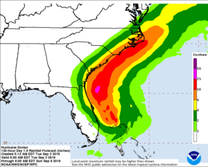
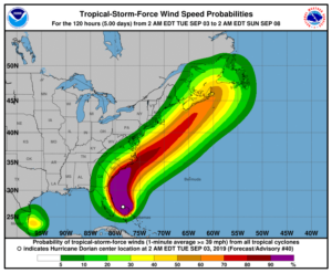
As of the 5am EDT Public Advisory from NHC, Dorian will begin to move dangerously close to the Florida east coast over the next two days and then up the coast to Georgia and the Carolina’s later this week

