« Back to "Hurricane Storm Dorian Aug 28 - Sep 6 2019"
Category 2 Hurricane Dorian from morning of 4 September
Posted: September 4, 2019
Hurricane Dorian continues to weaken after battering the Bahamas. As many people have seen, the Sentinel-1 SAR imagery from 2 September showed most of Abaco Island decimated with significant flooding being seen.
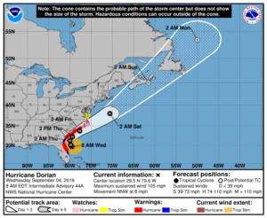
As of the 10am EDT (1400UTC), Dorian was moving parallel to the coast of Florida as a Category 2 storm with winds of 105mph. This is down from 110mph at the 0600Z public advisory which weakened to 105mph at the 0700Z advisory.
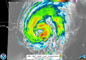
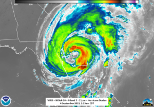
NPP, GCOM-W1, and NOAA-20 all passed over Dorian all within the span of an hour, each observing unique features as it was paralleled Florida’s coast. This discussion will step through the VIIRS imagery first and then move on to the microwave instruments (ATMS and AMSR2).
At ~0522 UTC (2:22am EDT), NPP caught Dorian on the western part of the pass. The wide circulation (i.e. wind field) was easily seen in the IR imagery. Also of note is the fact that circulation center was not completely surrounded by convection. In fact, the southwestern portion of the eye was almost completely exposed, with drier air getting wrapped into the storm. in addition, the convection around Dorian is notably less than previous days.
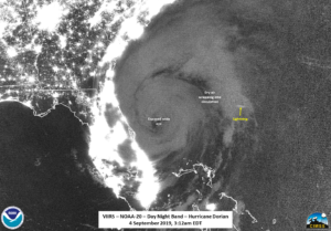
Because of the fact that Dorian was on the edge of the pass, the DNB imagery was extremely noisy with only a small amount of structure being able to be seen.
About 50 minutes later at ~0612, NOAA-20 caught Dorian, this time just east of nadir. As can be seen in the IR imagery, the circulation is was completely exposed, with dry air wrapping into the storm.
The (cleaner) DNB imagery, illuminated by airglow over the ocean (waxing crescent moon, 23% illumination) also easily saw the exposed eye and dry air wrapping into the storm, along with a lone lightning streak on the far edge of one of the feeder bands.
One other note is that, while there were some thin clouds over Grand Bahama and Abaco Islands, they were extremely dark in the DNB as compared to imagery from before Dorian.
The exposed circulation was also easily identifiable in the ATMS brightness temperature from NOAA-20 and AMSR2 imagery taken ~20 minutes after the NOAA-20 pass.
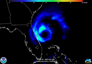
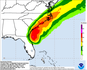
The other concern with this storm is the rain. While the IR imagery can give an idea of where rain is occurring, the NOAA-20 MiRS rain rate product also indicates that most of the rain at the time was offshore.
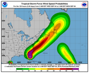
Unless the hurricane stalls, most of the issues with hurricanes come from the wind and storm surge. The observations from the satellites and instruments above support the NHC forecast discussion at 1200Z where they noted that Dorian’s circulation is becoming broader and less well-defined.
Dorian is expected to continue to skirt the US coast, possibly making landfall briefly in the Carolinas, before departing into the Atlantic by this weekend.

