« Back to "Severe Tropical Cyclone Harold and Vanuatu - 5 - 8 April 2020"
Cyclone Harold on 5 April 2020
Posted: April 6, 2020
On 4 April, Harold became a Category 5 severe tropical cyclone, the highest rating on the Australian scale. As of 0600Z on 6 April 2020, Cyclone Harold had estimated winds of 135kt (155mph) with gusts of 165kts, according to the Joint Typhoon Warning Center.
This is equivalent to a Category 4 storm on the Saffir-Simpson scale. At approximately 1359Z on 5 April 2020, NOAA-20 captured a near-nadir image of Cyclone Harold as it passed by the island of Espiritu Santo, which is the largest island of Vanuatu (population of approximately 40,000).
In the high resolution I05 (11μm) imagery, you can see that Harold is that it is a well defined storm with both tropospheric gravity waves as well as mesovorticies within the cloud covered eye.
The Waxing Gibbous moon (90% illumination) provided enough moonlight to show the visible features of the storm as it passed on the southwestern side of the island.
These same features are more easily in the zoomed in imagery, as shown below.
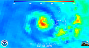
While the AMSR2 sensor on GCOM-W1 was out of position today for observations of Harold, the ATMS sensor on NOAA-20 did reveal that the colder temperatures were almost completely around the center of circulation.
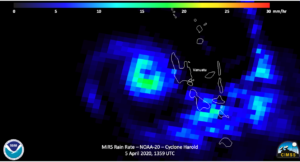
In addition, the MiRS rainrate product showed impressive rainrates also nearly surrounding the circulation center, a sign of a healthy tropical cyclone.
Another interesting thing to show is the use of SAR data for other purposes. At ~0714 UT on 6 April 2020, the European Space Agency’s (ESA)/Copernicus Sentinel-1A satellite, which has synthetic-aperture radar (SAR), passed over Cyclone Harold. Utilizing this methods described in Monaldo, Jackson, and Li (2017) and other publications, NOAA’s Satellite Oceanography and Climatology Division, specifically the Sea Surface Roughness Group at NOAA/STAR, can derived winds from this imagery, as shown below.
Sentinel-1A/B acquired by ESA/Copernicus, provided by Christopher Jackson, NOAA/STAR/SOCD
Contains modified Copernicus Sentinel data 2020
Products for this and other storms can be found at the can be viewed at the SAROPS Tropical Storm Winds Demonstrator here.
The low-lying islands of Vanuatu are very susceptible to tropical systems, especially with such an intense storm. It is highly likely that there has been significant flash flooding as the system continues to impact the islands. As can be seen in the 09Z forecast from the JTWC, Harold is expect to impact Vanuatu for the rest of the day before moving off towards Viti Levu, which is main island of Fiji tomorrow.
While the International Charter has been activated to help assess damage to the islands due to the likely flash flooding that is occurring. Unfortunately, humanitarian assistance will be hampered due to the ongoing CoVID-19 pandemic. On March 18, Vanuatu announced that travel to and from countries with more than 100 COVID-19 cases is prohibited. Interesting to note, as of today, according the WHO, there are 0 confirmed cases of COVID-19 in Vanuatu and 12 cases in Fiji.


