« Back to "Extremely Severe Cyclonic Storm Fani - April/May 2019"
Extremely Severe Cyclonic Storm Fani – 3 May 2019
Posted: May 3, 2019
Extremely Severe Cyclonic Storm Fani made landfall this morning between 0230 TO 0430 UTC on 3 May with winds of around 185kph (115mph). That is equivalent to a Category 4 hurricane hitting a low lying, densely populated region.
There were three VIIRS (ATMS) overpasses and one AMSR2 overpass of Extremely Severe Cyclonic Storm Fani prior to landfall on 2 May. As such information from the discussions on 2 May are shown. The 21Z discussion on 2 May, the Joint Typhoon Warning Center stated Fani had sustained winds of 135kts (155.355) at 1800Z on 2 May, which was prior to the polar satellite overpasses
RSMC New Dehli estimated maximum sustained winds at 21Z of 115 knts (132mph) and a central pressure of 937hPa.
Both of these would make Fani a strong Category 4 storm, on the Saffir-Simpson scale at the time.
This discussion is broken into two parts: VIIRS and microwave imagery
VIIRS
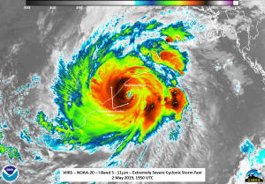
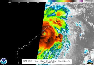
SNPP observed Fani first at ~1900Z on the edge of the scan, followed by near nadir pass from NOAA-20 at ~1950 and then again by SNPP, again on the edge of scan, at ~2040. In each case, the IR imagery presented a symmetric storm, with well defined tropospheric gravity waves and some overshooting tops. The near nadir pass from NOAA-20 showed a very well defined, open eye, and an almost circular shape in some places.
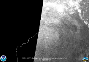
Features in the 1900Z (shown below) and 2040Z (not included) passes were offset or missing due to the fact that Fani was on the edge of the S-NPP pass.
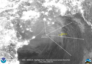
The moon phase was a Waning Crescent moon with ~6% illumination, meaning that (again) the only illumination are from either man-made lights, lightning or airglow from the mesosphere. Fani did not disappoint with mesospheric gravity waves easily seen in both the 1900Z NPP and 1950Z NOAA-20 DNB imagery. These waves were quite expansive and extended all the way to the opposite side of the Bay of Bengal.
Microwave
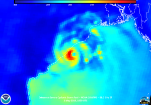
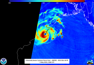
As the subject line suggests, there were 4 microwave sensors (3x bt ATMS and 1x AMSR2) that could see in to the storm, though in the case of the ~1900Z S-NPP pass, the sensor viewing angle cut off before the main part of Fani could see the storm (thus it is not shown). However, the near-nadir ATMS imagery from NOAA-20 ~1950Z, showed cold temperatures surrounding the well defined circulation.
The features from ATMS on NOAA-20 clearly lined up with features in the VIIRS imagery. About 10 minutes prior to the NOAA-20 pass, the AMSR2 instrument, while on the edge of the scan, revealed what might possibly by a double eyewall, suggesting that Fani was possibly in an eyewall replacement cycle at that time.
After Fani made landfall, it has weakened considerably, with the guidance from RSMC New Delhi just after landfall stating it was a Very Severe Cyclonic Storm Fani and would very likely move into Gangetic West Bengal as a Severe Cyclonic Storm with wind speed of 90-100 Kmph gusting to 115 Kmph by early on 4 May and then move into Bangladesh. Depending on the exact track, it could emerge briefly over water and make a second landfall.
This means that there will be significant flooding impacts in low-lying and highly populated areas, which is partially why the International Charter has been activated to assist the Indian government in their response to the storm (https://disasterscharter.org/web/guest/activations/-/article/cyclone-in-india-activation-608-).


