« Back to "Tropical Storm Barry 11-15 July 2019"
Tropical Storm Barry – 14 July 2019
Posted: July 14, 2019
Barry continues to be weakening as it makes it’s way northward. At 7am CDT (12UTC), Tropical Storm Barry had maximum sustained winds of 45 mph and a central pressure of 1005mbar according to the National Hurricane Center. This was very similar to Barry in the 9UTC and 6UTC National Hurricane Center public advisories .
At approximately 2:38am CDT (0726Z), NPP flew over Tropical Storm Barry slightly off nadir, allowing VIIRS at ATMS to observe the storm fully. As can be seen in all of the instruments, the main convection remains offshore, with occasional bands coming on shore. The circulation is not apparent in either the IR (I05, 11μm) or ATMS microwave imagery, shown below.
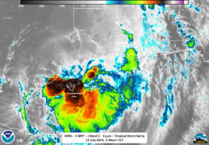
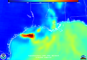
though there are several notable overshooting tops and tropospheric gravity waves that can be see in the 11μm brightness temperature. The circulation easily shows up in the visible imagery from the DNB, with the waxing gibbous moon (94% illumination), along with the moonlit overshooting tops and a few lightning streaks as well, which can be seen in the slider below.
The MiRS rain rate product, derived from the ATMS instrument on S-NPP also indicates that the bulk of the rain was occurring offshore in the same region as the most intense convection.
The AMSR2 imagery, both 89.0 Ghz BT and the convective rain product from ~20 minutes after S-NPP flew over, also collaborates the SNPP observations regarding where the bulk of the convection was occurring at the time.
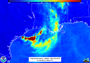
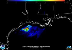
At ~3:28am CDT, NOAA-20 provided the final set of imagery, with an off nadir observation of Barry showing very little movement of the convection offshore. It should be noted that there is some distortion due to parallax effects due to the fact it was on the edge of scan.
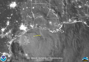
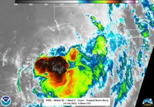
These observations of the convection offshore are consistent with the 0900Z NHC Forecast discussion.
On the response side of the storm, there are power outages in Louisiana, particularly in southern Louisiana along the coast. However, as can be seen in the VIIRS imagery, those regions are currently cloud covered. The story of this storm will continue to be the possibility of heavy rain and flooding as can be seen in the forecast rain amounts from the Weather Prediction Center
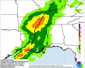
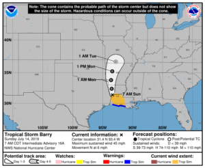
Warning cone and QPE rainfall forecast taken from NHC Graphics page for Tropical Storm Barry on 14 July 2019 at 7am CDT


