« Back to "4 April 2019 South Korea Wildfires"
4 April 2019 wildfires in South Korea
Posted: April 5, 2019
On 4 April, an apparent transformer spark near a resort in the mountainous region along the north east coast of the Republic of Korea (대한민국 大韓民國), along with strong winds (20m/s or ~45mph, according to KMA), caused a wind driven fire to engulf the border town of Sokcho (속초시), In addition, there is a major fire further south along the coast near Donghae (동해시), which is also in the Gangwon (강원도) province, which resulted in the shutdown of the highways and train services in that region. Roughly 4000 people have fled the various fires going on, which have been impacting various cities in South Korea. By the morning of 5 April 2019, the fires in Sokcho (속초시) had been contained (per media reports) and South Korean President Moon Jae-in visited the region and called for all available resources to be deployed. No Olympic facilities have been reported damaged by the fire.
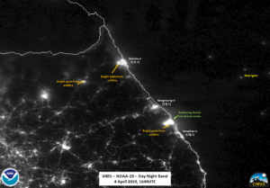
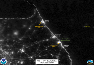
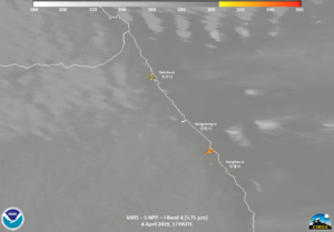
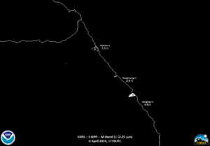
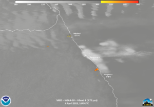
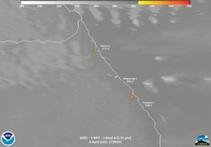
The focus of this discussion is on what can be seen from polar orbiters. Both fires could easily be seen in the VIIRS instrument from yesterday (4 April) in both NOAA-20 (~1649 UTC) and 50 minutes later from S-NPP (~1739UTC). As can often be seen, each of the fire channels as well as the DNB. In the case of the DNB, one can see the scattering of the light to the east of the fires, likely caused by the smoke as well as clouds (in the case of the NOAA-20 pass) off the coast.
Unlike the New Jersey fire earlier this week, though, there was no warming of the clouds (or even smoke) seen in the NIR or SWIR imagery, despite the intensity and strong winds.
Also, if you switch between passes, you may also notice there is another fire further inland, which gets masked out by clouds (though you can still see it in IR and DNB imagery) by the time NPP flew over 50 minutes later, despite being a near nadir pass.
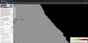
It is also worth noting that the VIIRS Active Fire I-Band product picked up both fires
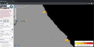
(https://www.star.nesdis.noaa.gov/jpss/mapper/#date=20190404/zoom=10/lat=37.9056/lon=128.75839233398438/tc=false/sat=N20/l2=true/sens=VIIRSN/prod=frpi_d/ave=daily/gran=false)
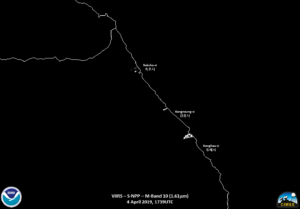
while the M-Band product did not pick up the northern fire near Sokcho (속초시).
This is something that can also be seen in the M13 imagery, where that fire is not as prominent in the lower resolution imagery. This goes to show that resolution of not just the imagery but resolution of the products is extremely important. In addition, by utlizing both imagery and products, one can get a better sense of the fire and it’s intensity.

