« Back to "2019 California Wildfiles"
Kincade Fire on 25 October 2019
Posted: October 25, 2019
A dangerously fast-moving fire near Geyserville in Sonoma County, California began at roughly 9:20 p.m. PDT on 24 October 2019. This was easily observed from the 1 minute Mesoscale Domain Sector GOES-17 (GOES-West) over California. The first thermal anomaly was evident in Shortwave Infrared and Near-Infrared imagery at 0421 UTC, which was 9:21 PM PDT on 23 October. This can be seen in the imagery from the CIMSS Satellite Blog.

Image courtesy of Scott Bachmeier and the CIMSS Satellite Blog
The cause of the fire is currently under investigation. The blaze was swept by winds of up to 60 miles per hour, causing the fire to move at a dangerous rate. At around midnight, mandatory evacuation orders were issued in the area around Geyserville, per the California Department of Forestry and Fire Protection (CalFire).
#KincadeFire #calfirelnu Mandatory evacuation orders for the areas of Geysers Road, Cloverdale Geysers Road, Red Winery Road, Alexander Mountain Road, Pine Flat Road and all roads east of Hwy 128 to Geyserville. #CALFIRE updates to follow.
— CAL FIRE LNU (@CALFIRELNU) October 24, 2019
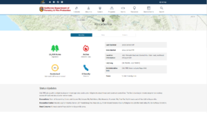
As of 9:30am PDT on 25 October, CalFire reported that the fire was approximately 21,900 acres in size and 5% contained. There are also over 2000 evacuations including the entire town of Geyserville, CA. According to media reports, as of Friday morning, there were at least 50 structures destroyed but no reports of any fatalities.
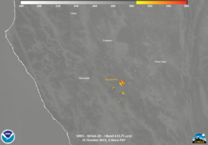
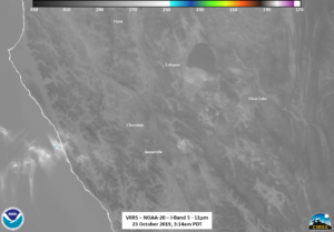
Several hours earlier, both NOAA-20 and S-NPP overflew the region observing the Kincade Fire. NOAA-20 was first at ~2:36am PDT (0926 UTC). While not intense enough for the I05 (11μm) to really see the fire, the high-resolution I04 (3.75μm) channel could easily pick out the thermal signature of the fire
The I04 band is one of two “traditional” channels to observe the fires. There is a lower resolution (750m) channel, M13 (4.05μm), that can detect a has a wider range of temperatures than the I04 channel. The VIIRS M13 channel dynamically-assigns low/high gain settings depending on the radiance level. This means the saturation temperature on VIIRS M13 channel is approximately 659 K, compared to just compared to 367K for the I04 and M12 bands. To put it another way, it can measure the temperature of hotter fires than the I04 band. However, it is important to note that the I04 band is better to give a higher spatial idea of the fire perimeter, shown below
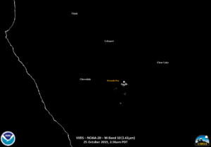
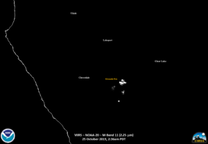
In addition to the IR channels, one can also use the 750m shortwave IR channels, M10 (1.6μm) and M12 (2.25μm), during the night time to get a view of the thermal signature of the fires without any affects of warm land. While not an issue in the case of the Kincade Fire, this can be an issue in areas of (thermally) bright deserts. These are shown below with the I04 band as reference.
All of these channels can be combined into a single product, call the VIIRS Active Fire (VAF) Product, which can show not only the location of the fire at high resolution (375m) but also the radiative power of the fire. This is shown below in addition to the I04 channel to show that the VAF detections match up
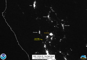
While produced operationally, this product can also be produced at direct broadcast sites utilizing the Community Satellite Processing Package (CSPP). By doing this, the VAF product can be disseminated quickly after the satellite has passed overhead. A final tool that can be used is the Day Night Band, as it sees the emitted and thermal heat from the fire as well as the emitted lights from the surrounding cities. If the moon were lit and out, one might also be able to see features such as smoke very easily. However with the moon being a waning crescent (18% illumination), seeing these features is extremely hard to do. However, along with the VAF product, one can clearly see that the Kincade Fire is extremely close to Geyserville, CA, both visibly in the DNB and via the VAF product.
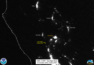
The NOAA-20 pass was followed by S-NPP roughly 50 minutes later at ~3:26am PDT (~1026UTC). While much of the same features can be seen in both sets of imagery, the following sliders show the temporal change in the I04 (3.75μm), M11 (2.25μm), Day Night Band and finally the VIIRS Active Fire Product.
Something that may have been noticed when you looked at the DNB is that the area around Geyserville looks a bit dark. If one looks at the nearest non-fire clear scene, say from 23 October 2019
One can compare the imagery from both scenes and see if there are any outages. If you do that, as seen below, you clearly see that the lights around Geyserville, CA were not present.
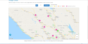
This could be because of smoke. However, if one compares to the Pacific Gas and Electric outage website taken at approximately 9:30am this morning, you see that
The outages are primarily due to PG&E turning off power in the affected areas to minimize wildfire threats, but also because of the ongoing fire in the area.
As of the fire incident update at 7am PDT, CalFire working to mitigate threats to structures as well as construct a control line. However, this is difficult because the fire is burning in remote steep terrain making access to the fire difficult and slow due to limited access to the fire. Approximately 1300 personnel are assigned as of the 10am update with 12 helicopters working fire suppression.

