« Back to "2019 California Wildfiles"
Kincade Fire and California power outages on 27 October 2019
Posted: October 27, 2019
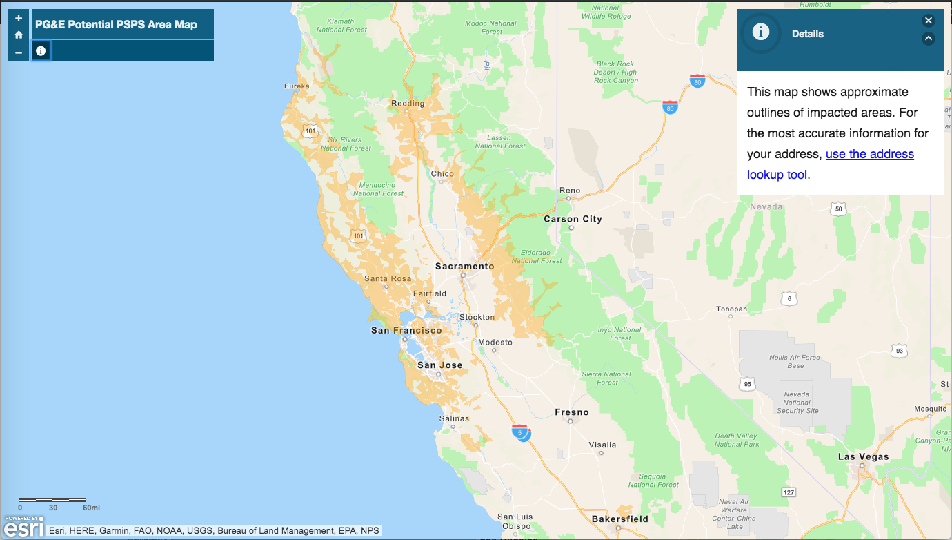
The fast-moving Kincade fire near Geyserville in Sonoma County continues to burn and expand in size over the course of the night. In addition, as mentioned yesterday, Pacific Gas and Electric (PG&E) planned to cut off power to 940,000 customers due to winds reaching in excess of 80 mph. The screenshot below shows the area where PG&E planned to cut off power to try and prevent new wildfires from starting.
Winds for the region were predicted to be extremely high, as shown in this info-graphic from the NWS Forecast Office in Sacramento, CA.
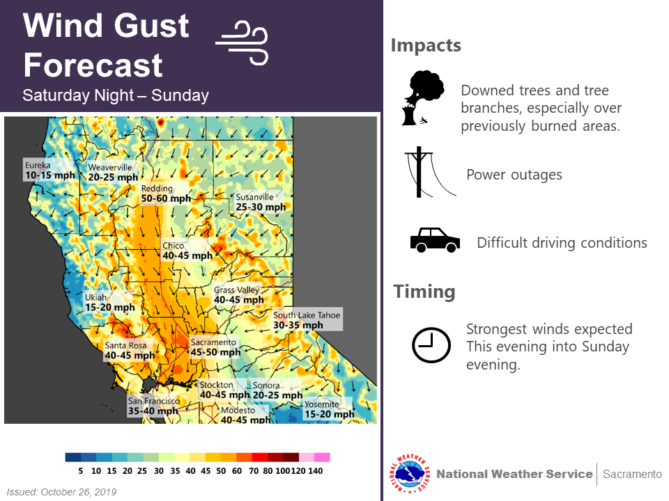
Image from NWS Forecast Office Sacramento, CA website on 27 October 2019 at ~3:30am PDT
As seen by the National Weather Service’s Weather & Hazards Data Viewer website, winds were very high
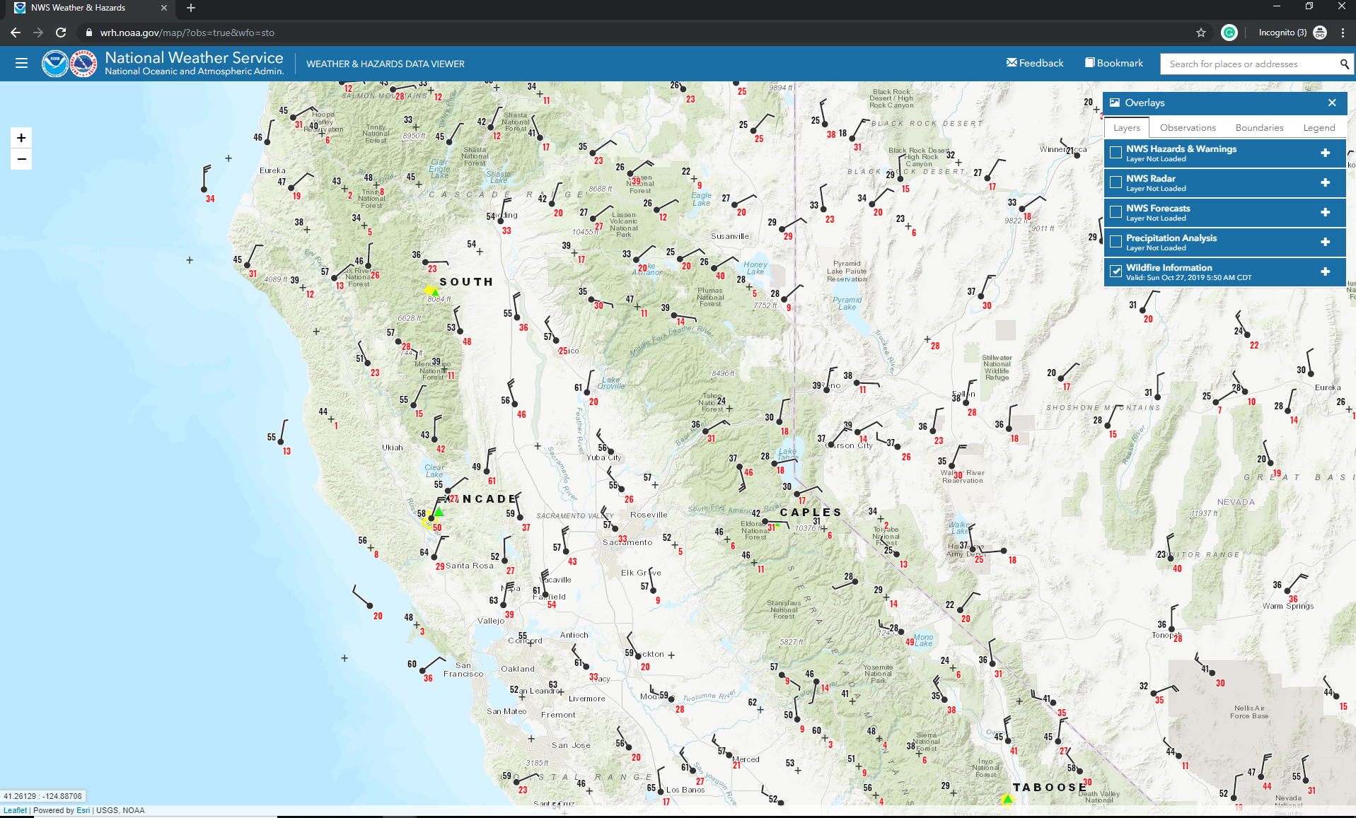
Screenshot from National Weather Service’s Weather & Hazards Data Viewer website on 27 October 2019 at ~3:30am PDT
In fact at one of the RAWS stations near the Kincade fire, there were wind gusts of around 50 miles per hour
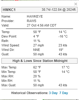
Screenshot from National Weather Service’s Weather & Hazards Data Viewer website on 27 October 2019 at ~2:56 PDT (4:56am CDT)
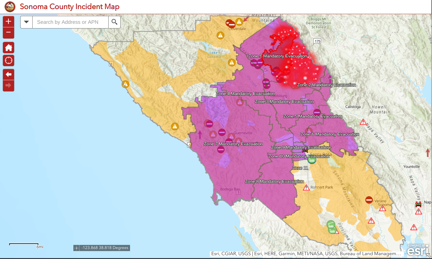
As of the 7:46am PDT on 27 October, CalFire reported that the fire was approximately 30,000 acres in size and 10% contained. At least 79 structures destroyed but no reports of any fatalities. These high winds caused an explosive growth of the fire have caused the evacuation zone to expand all the way to the Pacific Ocean. This can be seen in the screenshot below
In addition, the areas of evacuations have been ordered in Sonoma county. These can be seen in a screenshot from the Sonoma County Incident Map shown below.
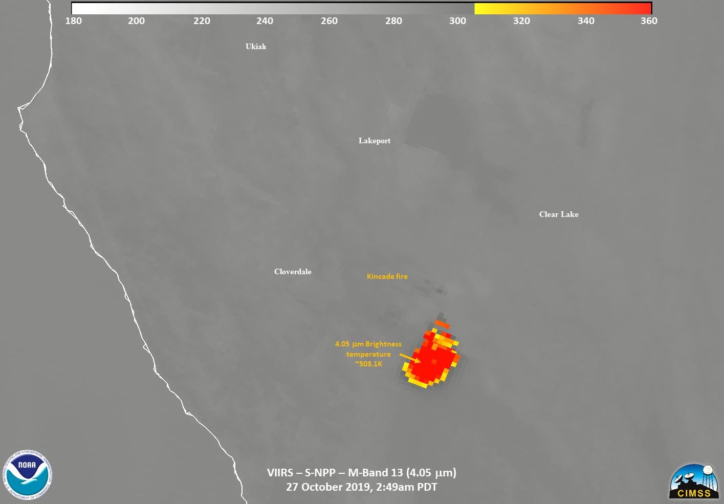
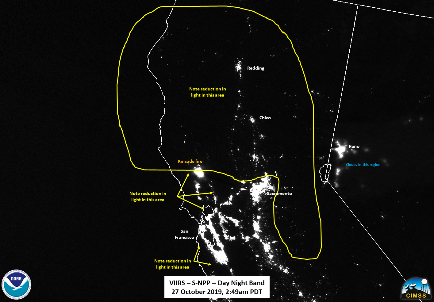
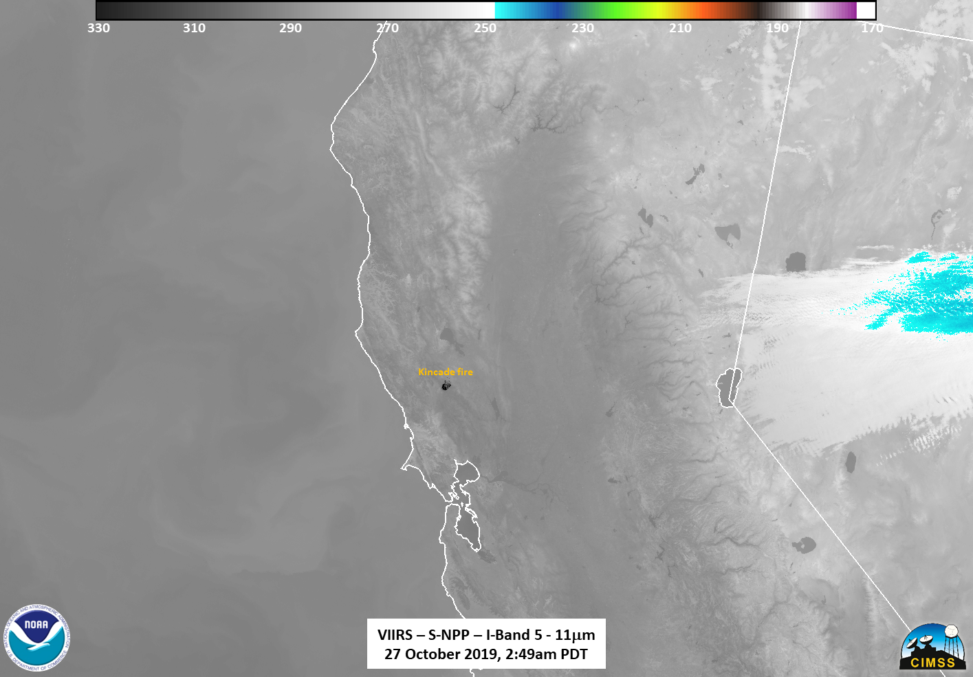
The Kincade Fire was observed by once by Suomi-NPP (S-NPP) and NOAA-20. The first observation from Suomi-NPP, which occurred at approximately 2:49am PDT (0949 UTC) just off of nadir. The most obvious thing when one looks at the I04 (3.75μm) channel is that it appears that the most intense part of the fire is “cool”. This is due to a wrap around effect when the detectors reach saturation. As mentioned in the previous post the I04 (3.75μm) brightness temperature is over 367K, which means that this was an extremely intense fire.
This is where the lower resolution (750m) dual-channel, M13 (4.05μm) comes into play, since it’s saturation temperature is approximately 659K. If one measures the temperatures in that region, you will find brightness temperatures of approximately 501.3K, or 445.91°F. This is hotter than one should cook meat in the oven at.
The fact that the fire is so intense means that the signal in the I05 (11μm) channel is much more pronounced. Recall that this channel is traditionally used in deriving land surface temperatures from satellites. The temperature in the hottest part of the fire was close to 300K, again showing the intensity of the fire.
The intensity of the fire meant that near-infrared M10 (1.6μm) and M12 (2.25μm) channels, as well as the Day Night Band, exhibited a “blooming” effect, which is caused by intense heat sources, as shown below.
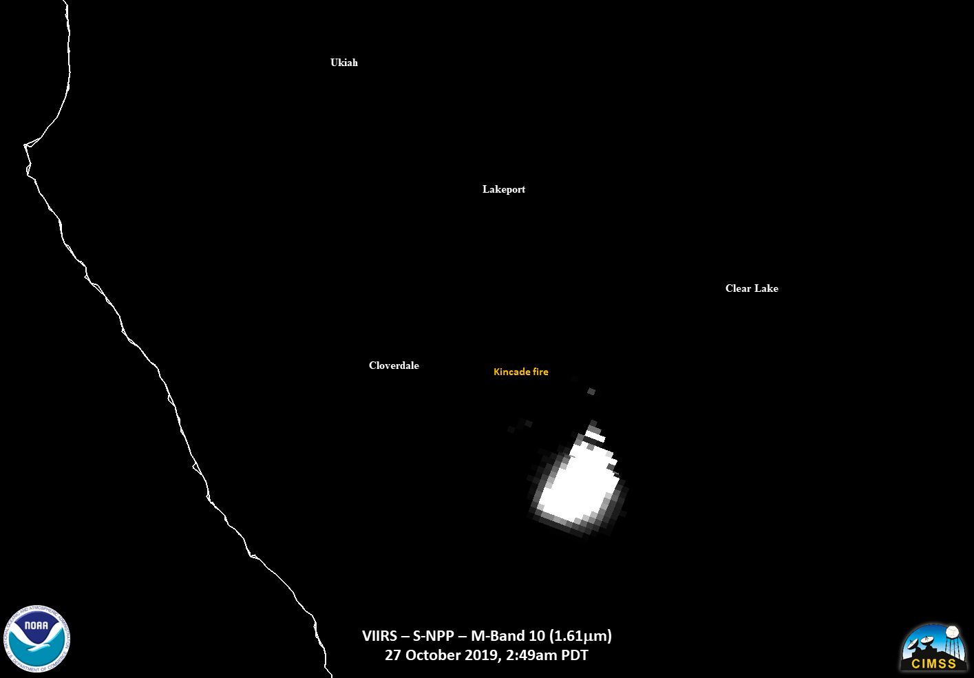
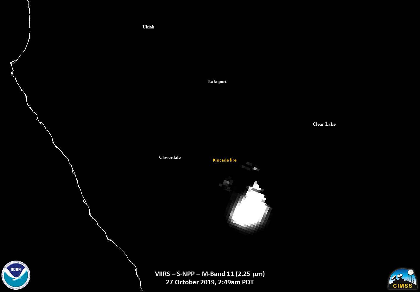
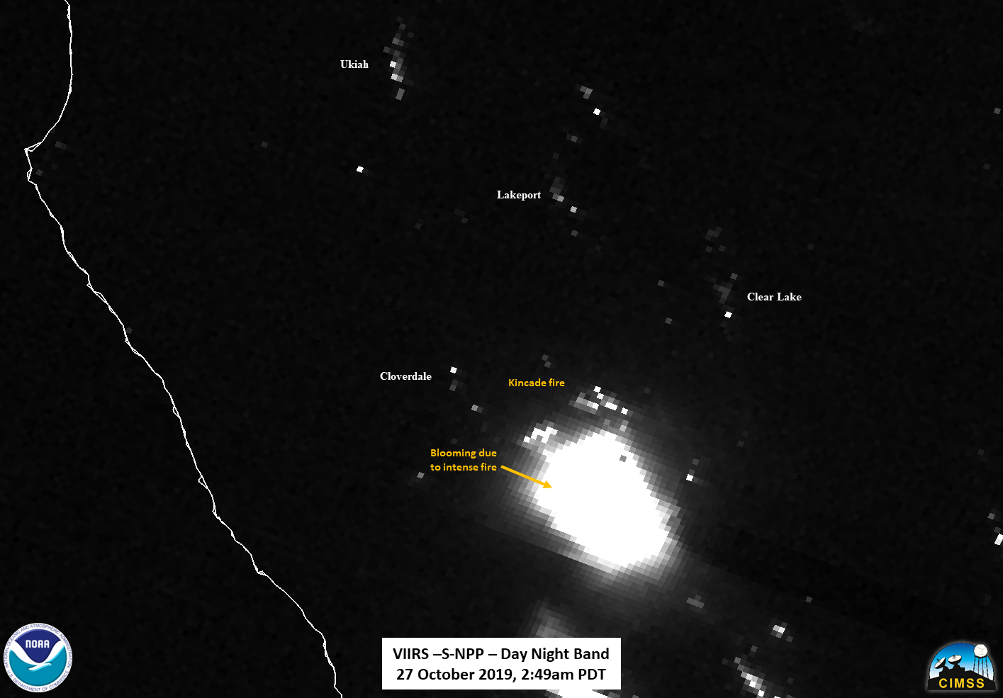
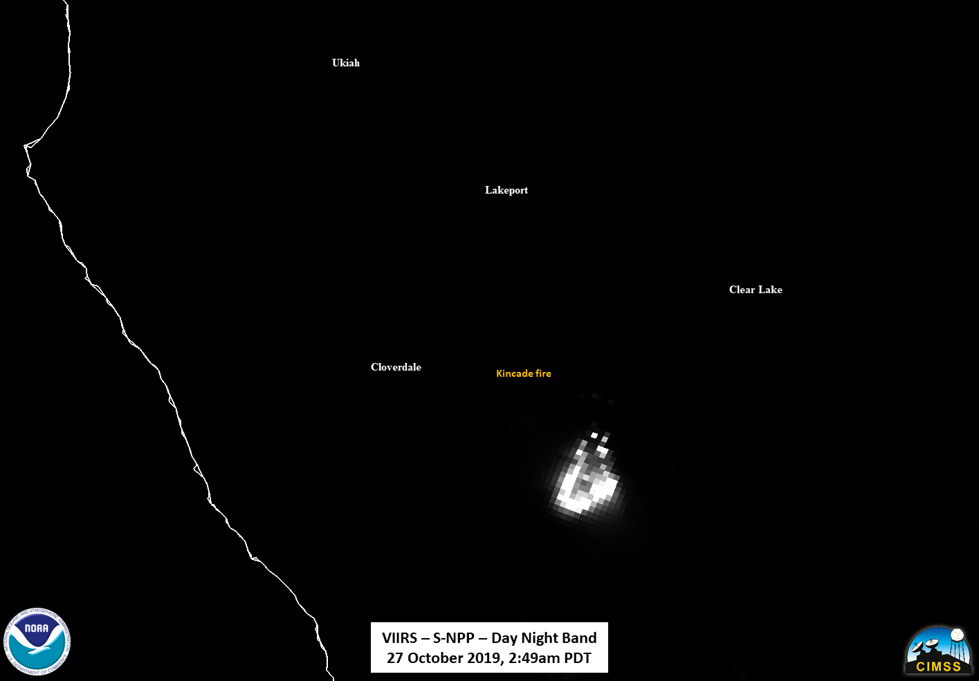
One cannot clearly see the smoke in the DNB due to the moon illumination being only 4% (Waning Crescent) illuminated, given that it is relatively optically thin in the IR channels. However, some of the lights from some of the city lights were being scattered by the smoke from the fire. One can cut out some of the blooming effects by scaling the DNB radiances to only show the hottest pixels. However, this only shows where the most intense fire is occurring and not necessarily anything about the overall perimeter
The hottest area also where the majority of the detection’s in the VIIRS Active Fire (VAF) Product, as processed by CSPP, occurred.
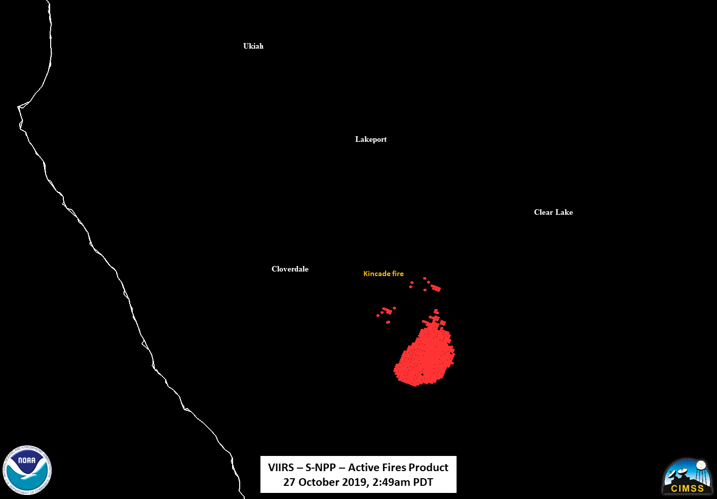
Note that there are hot spots on the northern side of the fire. The fact that the fires is most intense to the south is unsurprising given the winds were coming from the NNE, fanning the flames.
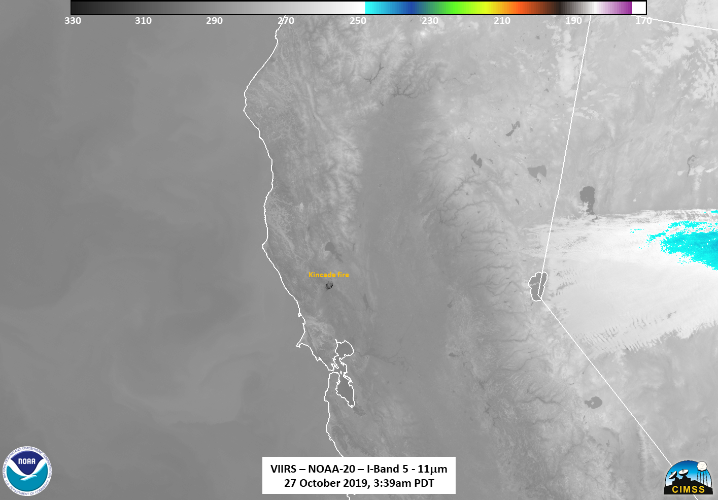
The NOAA-20 pass ~50 minutes later at ~3:39am PDT (1039 UTC), observed the Kincade fire on the eastern side of the pass. Because the fire was on the eastern side of the pass, some of the more intense pixels were lost. The following sliders show the temporal change in the I04 (3.75μm), M13 (4.05μm), M11 (2.25μm), Day Night Band and finally the VIIRS Active Fire Product between the two successive passes.
As can be seen, the shape and relative intensity of the fire remained the same through the two passes, though some changes can be seen. These changes could be due to either scan edge effects as well as the movement of the fire.
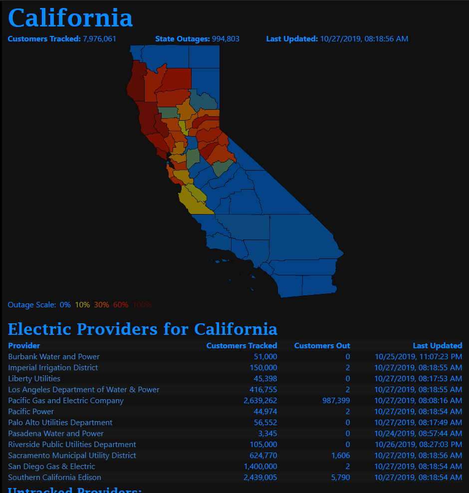
Power outages
As mentioned above, The plan was to cut off power to 940,000 customers. At ~3:38PDT, which was the time of the NOAA-20 overpass, roughly 978,730 customers were without power, primarily in northern California, as seen in the screenshot from poweroutage.us
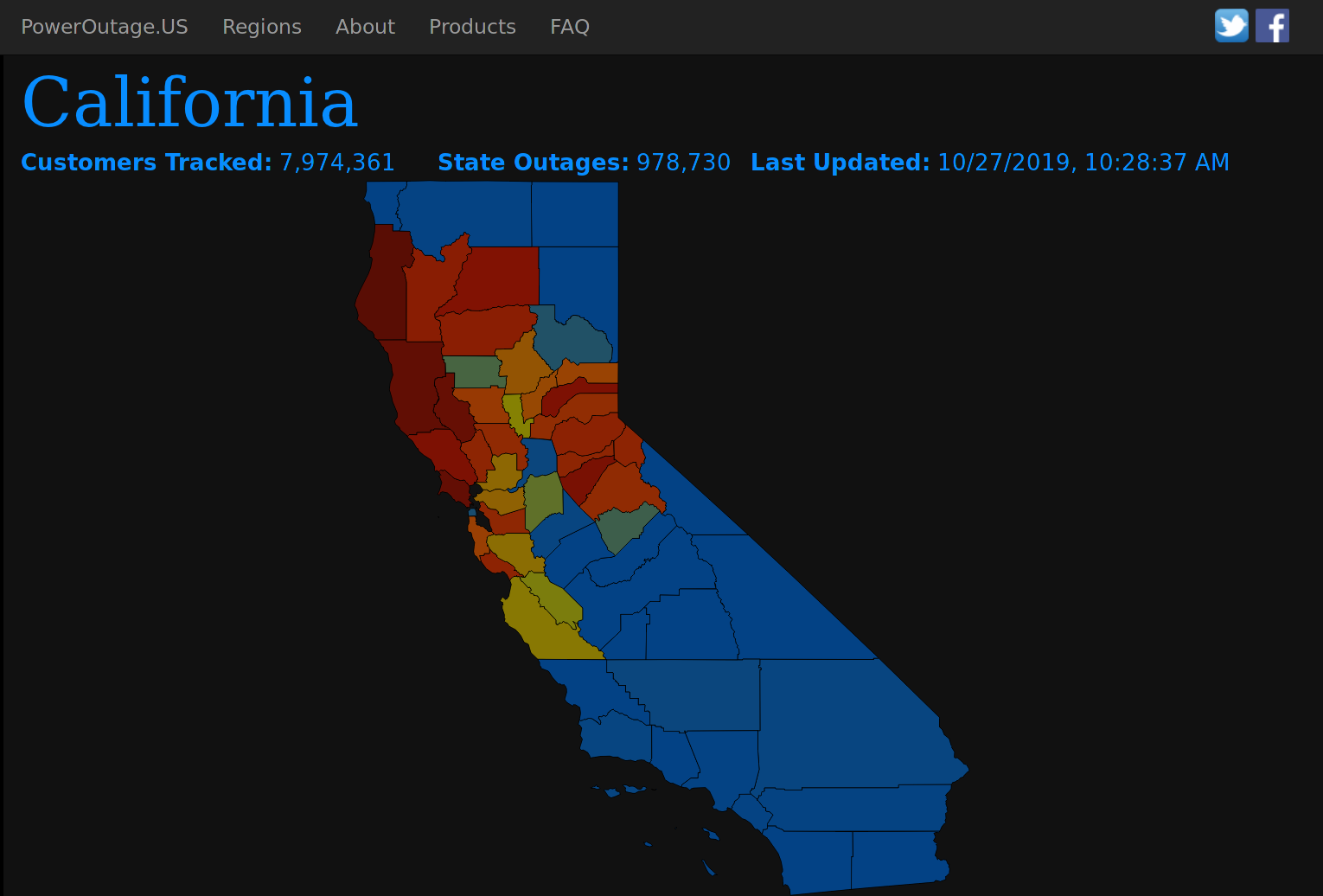
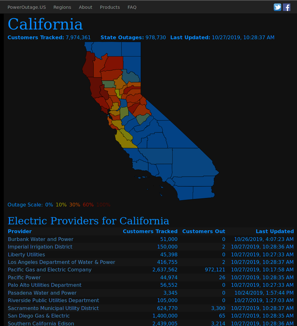
Screenshots from poweroutages.us on 27 October 2019 at ~4:38am PDT
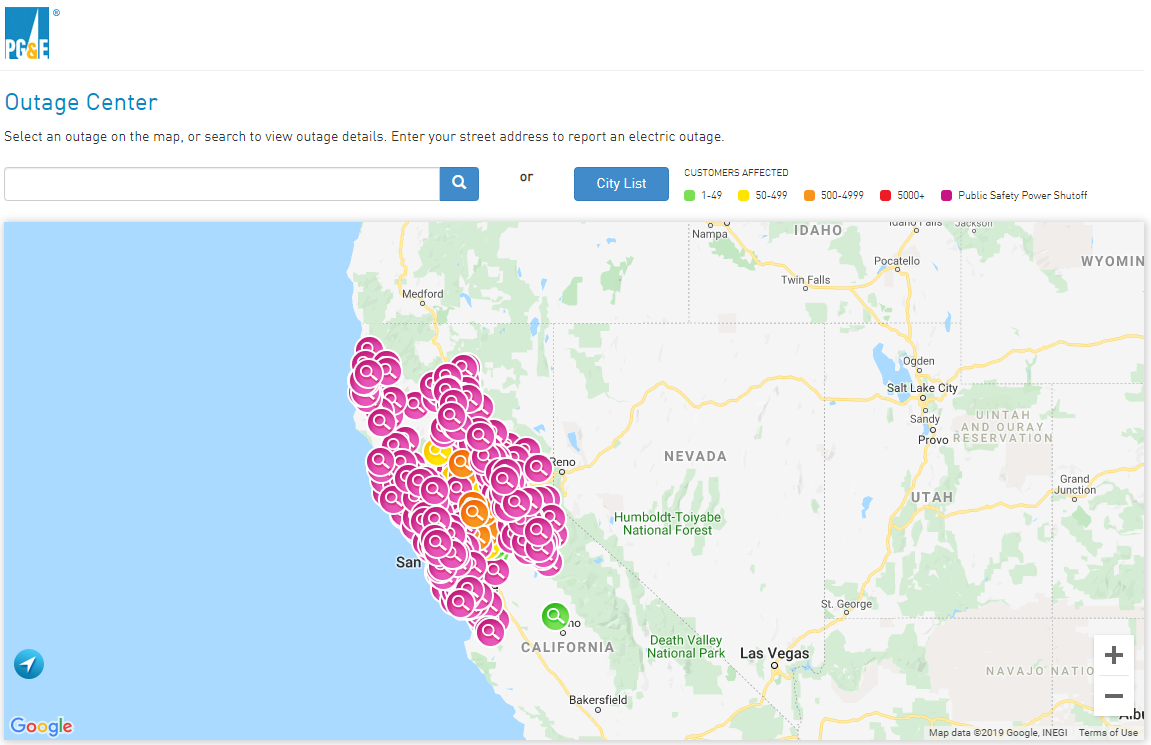
Outages from the Pacific Gas and Electric outage website taken at approximately 4:30am PDT this morning also showed a similar distribution of outages.
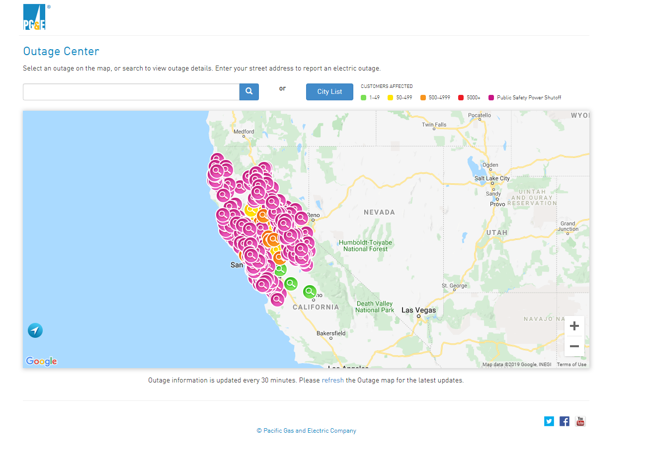
Screenshots from PG&E’s Outages tracker website on 27 October 2019 at ~4:38am PDT
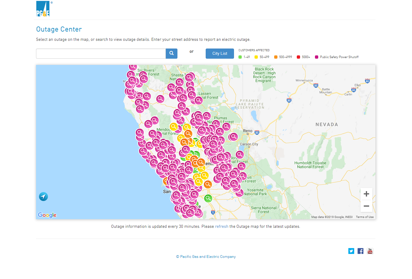
A zoomed out view of northern California, as compared to 23 October 2019, clearly shows that the outages in the same areas as the power trackers.
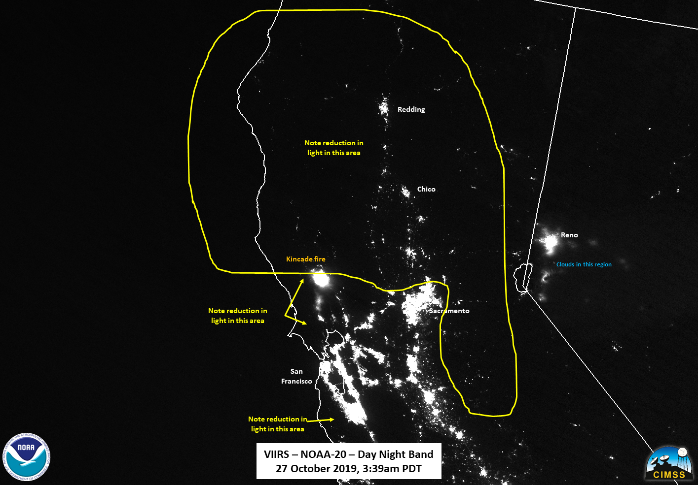
Not that the reason the area near Reno, NV is different than the reference imagery is due to clouds over that region, as seen in the I05 (11μm) channel.
As of 6:24amPDT, the number of outages had risen to 994,803 customers without power, all of them occurring in the same areas
As of the fire incident update at 7am PDT, the evacuation orders have been expanded, and residents are reminded to maintain good situational awareness and heed the direction of officials. High winds and low humidity are predicted to continue, creating critical fire weather conditions. Steep, remote, terrain is hampering efforts on the north side of the fire is burning while the southern portions of the fire have started to move into the Southern Alexander Valley. CalFire continues to mitigate structure threats and find opportunities to construct control lines. Approximately 3,081 personnel are assigned as of the 7am update with 10 helicopters working fire suppression.

