« Back to "2019 Australian wildfires"
Fires near Mallacoota over 31 December to 1 January
Posted: December 31, 2019
As the new year was rung in through the world, the devastating fires in Australia continue to burn ferociously. In the resort town of Mallacoota, Australia, wildfires surrounded the southeastern seaside town. Over 4000 people were forced to seek refuge on the beach and even boats in the water yesterday as deadly blazes closed in. The scene has been described as apocalyptic, with the sky literally turning dark orange and blood red. In addition, there have been at least 2 confirmed fatalities as a result of this wildfire.
https://twitter.com/BradleyWDeacon/status/1211785772379959297
Both geostationary and polar orbiting satellites have provided imagery of the continuing situation in Australia. The focus of this post is on the events of 31 December 2019 to the morning of 1 January 2020 in Australia.
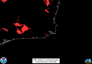
At approximately 1:24am Australian Eastern Daylight Savings Time (AEDT, UTC+11) on 31 December 2019, or 1424UTC on 30 December, NOAA-20 observed the fires in the Australian state of Victoria. The I04 (3.75μm) and M13 (4.05μm) channels easily picked up on the massive wildfires along the southern coast of Australia, as shown below.
This large region of “hot” pixels could be a massive firestorm or be a result of the fires heating up the smoke being produced. All of these hot pixels are also picked up in the VIIRS Active Fire Product
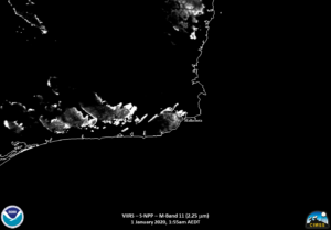
The M10 (1.6μm) and M12 (2.25μm) bands clearly shows some blooming affect, leading to the likelihood that the hot pixels are a result of the air being heated by the fires.
A comparison of the the I04 (3.75μm) and I05 (11μm) brightness temperatures also suggests that at least some of the “hot” regions are indeed heated smoke or air, but a lot are actual fires
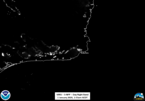
This blooming affect also affects the Day Night Band depending on the scaling and enhancement used.
However, scaling to a smaller range also means that one loses the light from the fire near Mallacoota, despite it actually being there. Another notable feature in the the IR imagery is the presence of pyrocumulonimbus (pyroCb) clouds. This is most striking in the I05 (11μm) imagery
Roughly 50 minutes later, at 2:14am AEDT, Suomi-NPP (S-NPP) got a near nadir over pass of the fires. One of the most striking features is the comparison between the lower resolution (750m) M13 (4.05μm), and the high resolution (375m) I04 (3.75μm) channels. One can clearly see the wider range of temperatures that the two channels can detect.
As has been mentioned in previous posts the M13 (4.05μm) channel on VIIRS can detect a wider range of temperatures than the I04 channel. This is because the M13 channel dynamically-assigns low/high gain settings depending on the radiance level, meaning it will saturate at a temperature of approximately 659 K, compared to just compared to 367K for the I04 and M12 bands. This is why one sees the “wrap-around” effect (i.e. “cold” temperatures) in the most intense parts of the fire in I04 image, while the M13 image shows features through out the fire. This includes measured temperatures of over 548K (274.85°C, 526.73°F).
It is important to note that this is the radiating temperature that the satellite sees and not the measured temperature within the fire itself. Given the half orbit between S-NPP and NOAA-20, it is also interesting to see the evolution of the fire perimeters, as seen in the VIIRS Active Fire Product, M10 (1.6μm), M12 (2.25μm) and Day Night Band. Note that the Day Night Band has been scaled such that the fire perimeters can easily be seen.
Another feature that can be observered at higher resolution than the geostationary satellites (though at significantly less temporal resolution) is the evolution of the large pyrocumulonimbus (pyroCb) clouds
To see the temporal resolution, one needs to use a geostationary satellite, such as Himawari-8, which had the 2.5min target sector over the southern part of Australia. As seen in the animation, courtesy of the CIMSS satellite blog, one can observe several pulses of pyrocumulonimbus (pyroCb) clouds coming from the brush fires.
Image courtesy of the CIMSS Satellite Blog
Fires continued to rage during the day and edged closer to Mallacoota, causing the scenes seen in numerous social media images with the sky turning red. The reason for the sky turning red is the way smoke particles scatter sunlight. Smoke particles are fairly large and are better at scattering the longer (red) wavelengths of light, known as Mie scattering. If there a sufficient amount of smoke, Mie scattering will dominate over Rayleigh scattering, which is how light is primarily scattered in the atmosphere. This causes the red and orange colored sky.
In the early afternoon, S-NPP flew over the region at near nadir at approximately 2:35pm AEDT on 31 December 2019. As mentioned in a previous post, while one can see smoke in the visible (0.64μm) channel, the 0.47μm channel is extremely useful for aerosol and smoke detection. If one compares the M04 (0.488μm) and I01 (0.64μm) imagery, one can easily distinguish the smoke from clouds, though it is easier to see in the M04 channel due to the sensitivity to that part of the spectrum
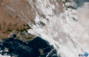
Along with the 0.51μm, the 0.64μm (red) and 0.47μm (blue) channels can be combined to make a true color image. When you correct for Rayleigh scattering and apply this combination to imagery from a geostationary satellite, such as Himawari-8, one can get a sense of how the smoke is moving over time, as shown in the animated image produced by the CIRA Slider website from approximately the time of the S-NPP overpass
One can see not only the smoke blowing over Mallacoota, but also several pyrocumulonimbus (pyroCb) continuing to build. In addition to the imagery, one can look at the Vertical Column CO from the Sentinel-5 Precursor satellite’s TROPOMI Vertical Column CO at 2:38pm AEDT, only a few short minutes after the S-NPP overpass, one sees an extremely large amount of carbon monoxide over Mallacoota, which is an indication of large amounts of smoke
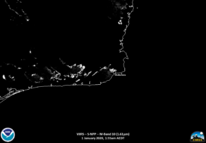
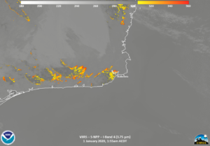
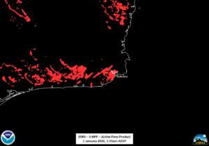
Finally, at approximately 1:55am AEDT on 1 January 2020, just a couple hours after the new year began, S-NPP again got a near nadir look at the area on the southern coast of Australia. While the region was fairly cloud free, one could see that the fire had progressed passed Mallacoota in the various VIIRS products, with impacts being likely in the town. In fact, the Australian Defense Force dispatched a frigate, the HMAS Choules, to evacuate the stranded residents in Mallacoota.

