« Back to "Typhoon Vongfong (Ambo) - 13-15 May 2020"
Typhoon Vongfong – 13 May 2020
Posted: May 13, 2020
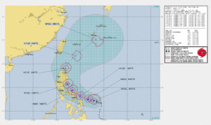
On 13 May 2020 November 2019, Typhoon Vongfong became the first typhoon of the 2020 West Pacific season. The 1500Z, the Joint Typhoon Warning Center (JTWC) stated that Typhoon Vongfong had strengthened, having winds of 90knts, or ~103mph. This would make it a Category 2 storm in the Atlantic basin.
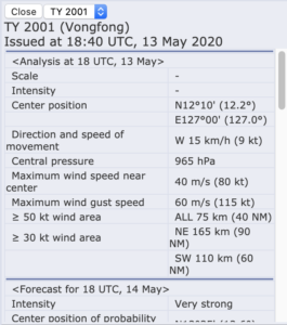
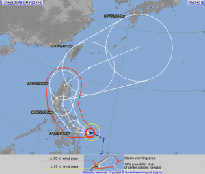
The Regional Specialized Meteorological Center (RSMC) Tokyo stated that the maximum winds at the center were 70knts or ~92mph. While slightly different than the speed the JTWC showed, this difference is due to differing methods of determining the winds and due to the fact that JTWC adopts a 1 min mean wind speed, but RSMC Tokyo adopts 10 mins mean wind speed. As with the JTWC discussion, it would make Vongfong a Category 1 storm in the Atlantic basin.
As has been discussed previously, this doesn’t affect forecasts for this storm, this sort of difference in measurement could mean the difference between a tropical storm warning or a high wind warning
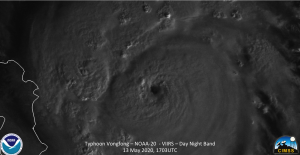
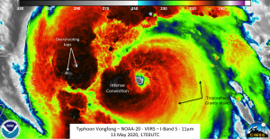
NOAA-20 saw Typhoon Vongfong at ~1703Z, at near nadir. The I05 (11μm) imagery showed features that one would expect from an intensifying storm, including overshooting tops and tropospheric gravity waves. In addition, a clear eye could be seen
The waning gibbous (61% illumination) provided enough moonlight to illuminate similar features in the Day Night Band.
Zooming in shows each of these features in a much more clear manner
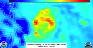
Unfortunately, GCOM-W1 was not in an ideal position to observe Vongfong. However, the ATMS instrument, which is on both NOAA-20 and S-NPP, can look into the inner part of the storm. While not as high of resolution as AMSR2, the 88.2GHz imagery from ATMS shows that the colder temperatures (where the convection is located) surrounds the circulation center
The forecast from JTWC has Typhoon Vongfong intensifying to ~115knts by 14 May 2020, which would be the equivalent to a Category 4 storm in the Atlantic. Both JTWC and JMA have it impacting the Philippines by 14 May 2020.
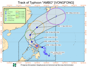
Because of the impacts to the Philippines, the Philippine Atmospheric, Geophysical and Astronomical Services Administration (PAGASA) are also tracking Typhoon Vongfong, which is called Ambo by PAGASA, to assess the impacts on the various islands in the path of the storm. Their track is also very similar to JTWC and JMA
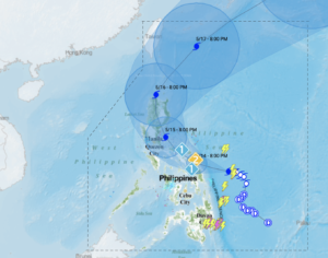
In anticipation of the storm, PAGASA has begun to issue flood alerts to various locations. This is especially important due to the fact most of the population is along the coast and in low-lying areas.


