« Back to "Severe Tropical Cyclone Harold and Vanuatu - 5 - 8 April 2020"
Cyclone Harold on 9 April 2020
Posted: April 9, 2020
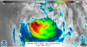
Cyclone Harold continues to be a very intense storm. At 1200Z on 8 April 2020, Cyclone Harold had estimated winds of 80knt winds (~70mph) with gusts of 100kts, according to the Joint Typhoon Warning Center (JTWC).
This is equivalent to a Category 1 storm on the Saffir-Simpson scale, and according to the JTWC, is becoming extratropical. At approximately 1155UTC Suomi-NPP observed Cyclone Harold, again at near nadir. As can be seen in the high resolution I05 (11μm) imagery, it is much more ragged than previous several days and exhibits a significant amount of shearing.
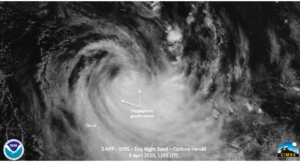
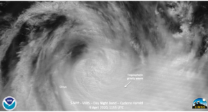
The waning gibbous (97% illumination) provided enough ample moonlight to show the visible features of the storm. Again, similar features in the I05 (11μm) imagery could be seen in the DNB visible imagery.
Some of the features are more prevalent in the zoomed in imagery, as seen below
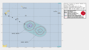
Unfortunately, the AMSR2 instrument was again out of position. The ATMS instrument on S-NPP showed that the storm was rapidly losing its tropical characteristics as it moves well to the southeast, as seen by the JTWC 15Z forecast, rapidly weakening over the next several hours.
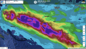
Also of note is the CMORPH2 7-day accumulated precipitation product which caught the track of Harold over the last several days


