« Back to "Typhoon Kammuri - November 28 - December 2 2019"
Typhoon Kammuri on 3 December 2019
Posted: December 3, 2019
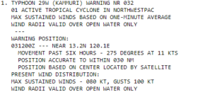
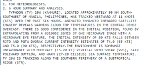
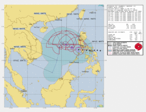
Typhoon Kammuri has decreased in intensification significantly over the last 24 hours, with winds as of the 1500Z Joint Typhoon Warning Center (JTWC) discussion, of 80knts, or ~92mph. This would make it a strong Category 1 storm in the Atlantic basin.
The Joint Typhoon Warning Center (JTWC) prognostic reasoning at 15UTC showed that the cloud top temperatures were warming and they needed to utilize the microwave imagery from SSMIS in order to find the eye feature
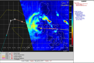
The 85GHz image from SSMIS is shown below, courtesy of the CIMSS Tropical Cyclone website, which reveals that the eye was not completely surrounded by convection .
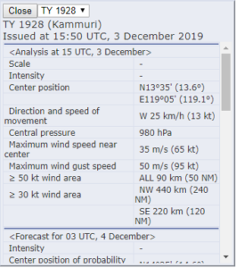
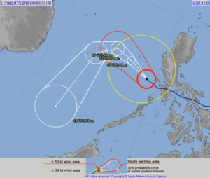
The Regional Specialized Meteorological Center (RSMC) Tokyo stated that the maximum winds at the center were 65knts or ~103mph at 1550UTC. While slightly different than the speed the JTWC showed, this difference is due to differing methods of determining the winds and due to the fact that JTWC adopts a 1 min mean wind speed, but RSMC Tokyo adopts 10 mins mean wind speed. If one used the JMA wind speed for your tropical system classification, Kammuri would be considered the equivalent to just barely a Category 1 storm in the Atlantic basin.
As previously mentioned, while this doesn’t affect forecasts for this storm, this sort of difference in measurement could mean the difference between a tropical storm warning or a hurricane warning depending on the location you are using for your forecast and warnings.
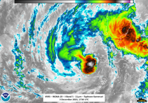
NOAA-20 saw Typhoon Kammuri at ~1737UTC with a near nadir overpass. The first thing that could be seen in the I05 (11μm) imagery is that Kammuri has lost it’s classic hurricane characteristics. In fact, Kammuri has reverted back to appear to only have a central dense overcast rather than having a well-defined eye.
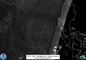
This is likely due to the fact that it was sheared apart by the mountains on the Philippine islands. Even though the moon was a waxing crescent moon (43% illumination), there weren’t many obvious observable features other than the structure of the clouds from Kammuri as well as a lone lightning streak, well away from the main part of the system. The other notable thing to observe was the large number of fishing boats that were observable to the west of Kammuri. This is either due to the possible upwelling of fish due to the waves or due to the fact they had not left the region.
S-NPP observed Kammuri at approximately 1828UTC on the extreme eastern side of the pass, which led to large parallax effects in the I05 (11μm) imagery as compared to the NOAA-20 imagery. This includes the elongation of the central dense overcast, as seen in the slider below.
In addition, it meant that the DNB imagery was mostly lost to noise, as seen below
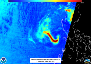
There were several interesting observations in the microwave, starting with the AMSR2 pass Kammuri on the eastern side of the scan at 1811UTC. As seen below, the 88.9GHz brightness temperature shows a curved type pattern.
There does appear to be some indication of convection in the imagery where the circulation center is notionally located. The 36.5GHz imagery, which is at a slightly higher level, shows a more distinct circulation
One could think that this is just an artifact of it being near the edge of the scan. However, this same feature occurs in the AMSR2 imagery from NOAA20 taken roughly 40 minutes prior at 1737UTC
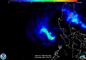
The fact that it is in both AMSR2 and ATMS means that it is a physical feature within the storm. It is also quite noticeable in the MiRS Rain Rate product from NOAA-20
though there one can see the circulation within the storm. Notice, however, how the feature mimics exactly where the convection lies in the (11μm) imagery
So the colder temperatures in the microwave are showing exactly where the convection lies. The low level circulation in the AMSR 36.5GHz, also seen in the MiRS rain rate product, shows that the low level circulation is directly under the central dense overcast. The presentation, however, is of a storm that is sheared, primarily due to interaction with land and is being weakened.
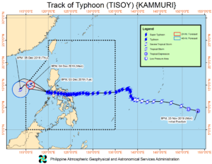
The forecasts from JTWC and (RSMC) Tokyo has Kammuri continuing to weaken as it tracks to the west before making a southward turn on 5 December.
PAGASA continues to track Kammuri as it exists in the PAGASA area of responsibility, with their track being similar to that of the JTWC and (RSMC) Tokyo.
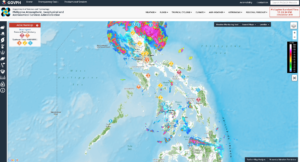
As the Kammuri has passed, PAGASA continued to issue flood alerts to various locations due to the large amounts of precipitation that were dropped by Kammuri

