« Back to "Extremely Severe Cyclonic Storm Fani - April/May 2019"
Flooding after Fani – 4 May 2019
Posted: May 4, 2019
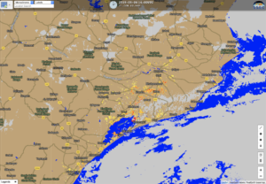
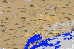
The skies over Puri were clear on 4 May as the remnants of Fani (pronounced as ‘Foni’) transitioned over the country of Bangladesh. Flooding in the region could easily be seen by the VIIRS Flood Mapping product, which is routinely generated for the entire globe and posted at SSEC’s RealEarth website. The Flood Map product is a daytime product and can be determined when there is only clear sky. A pair screenshot from 4 May are shown below, with a zoomed in
This is the same region that was hit by the 1999 Odisha cyclone, which reportedly had over 10,000 fatalities (http://www.rsmcnewdelhi.imd.gov.in/images/pdf/archive/rsmc/1999.pdf). However, this time, authorities were able to evacuate over 1 million people before the storm hit this low-lying and densely populated region (https://www.nytimes.com/2019/05/03/world/asia/cyclone-fani-india-evacuations.html).
Flooding is likely to continue over the next several days in this region, including Bangladesh. The latest global maps can be found at http://realearth.ssec.wisc.edu/?products=cspp-viirs-flood-globally


