« Back to "Super Typhoon Hagibis - October 6-13 2019"
Typhoon Hagibis on 11 October 2019
Posted: October 11, 2019
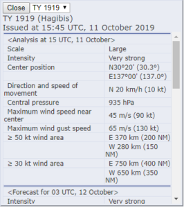
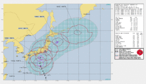
At 1500Z on 11 October, the Joint Typhoon Warning Center (JTWC) stated that Typhoon Habigis had sustained winds of 115knts or ~150mph. This is the equivalent of a weak Category 4 storm in the Atlantic basin.
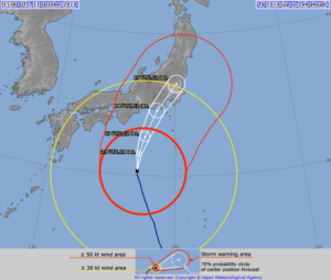
The Regional Specialized Meteorological Center (RSMC) Tokyo stated that the maximum winds at the center were 90knts (~104mph). The difference is due to differing methods of determining the winds and due to the fact that JTWC adopts a 1 min mean wind speed, but RSMC Tokyo adopts 10 mins mean wind speed.
As previously mentioned, while this doesn’t affect forecasts for this storm, this sort of difference in measurement could mean the difference between a tropical storm warning or a high wind warning.
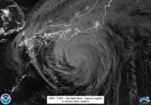
S-NPP first saw Typhoon Habigis at ~1638, just off of nadir on the western side of the scene. The waxing gibbous moon (95% illumination) providing enough illumination to show the expanse of the storm, with moisture being pulled far to the north of the northern island of Japan.
Focusing a bit more on what is going on with the storm, one could see in the DNB and the I05 (11μm) imagery the interaction with the islands of Japan, with the mountains reducing the moisture available to the storm, producing a notable dry slot in western side of the storm, weakening it as it approaches the island of Honshū (本州) .
In addition, the DNB shows that the very small eye is almost completely cloud covered, while the I05 (11μm) brightness temperature showed some opening in the eye, as seen in the zoomed in imagery over the circulation center.
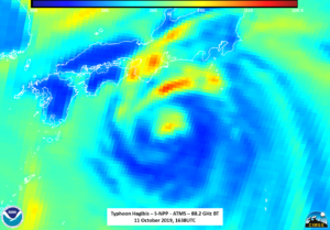
Unfortunately, GCOM-W1 continues to be out of position for Habigis, leaving only the S-NPP ATMS instrument to be able to observe the inner part of the storm. In doing so it reveals that the circulation is not completely surrounded. Rather, the circulation, which is very small, as indicated by the colder temperatures, is surrounded by warmer temperatures. This again could be a sign of weakening.
By the NOAA-20 pass ~50 minutes later at ~1728, in both the DNB and I05 (11μm) imagery they eye was completely closed. This could be because of the parallax effects being on the extreme eastern edge obscuring the extremely small eye.
It is also worth pointing out that the extended granule in the NOAA-20 DNB also continued to show the convection funneling into the coast of Japan.
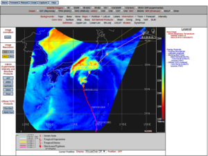
While GCOM-W1 was out of position, there are other microwave sensors, such as the SSMIS-18 satellite. The image below, which is a screenshot from the CIMSS Tropical Cyclone website, shows the 85 GHz brightness temperature from 2032Z on 11 October.
This asymmetry is also seen in the AHI 10.3um channel as well (imagery from the CIMSS Satellite Blog)

Image courtesy of the CIMSS Satellite Blog
All of the imagery from these various LEO and GEO satellites point to the fact that Hagibis is shearing as it interacts with the mountains and land of Japan.
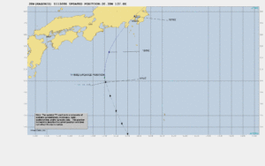
The forecast from JTWC and JMA continue to have it impacting Japan on 12 October 2019. Habigis continues to be a concern to the main island of Japan through the weekend.
The 18Z forecast from the Joint Typhoon Warning Center (JTWC) has it being over Tōkyō (東京) at around 1200UTC on 12 October 2019, about 4 hours before the SNPP and GCOM-W1 passes and about 5 hours before the NOAA-20 pass.
As with all tropical systems, there is the potential for heavy rains and flash flooding. There is enough of a concern that International Disasters Charter was activated by JAXA due to the potential of flooding in urban areas. Flights and trains have already been cancelled in advance of the storm as well as affecting major sporting events being held across Japan at the weekend, such as the Rugby World Cup.


