« Back to "Super Typhoon Wutip - February 21-26, 2019"
Typhoon Wutip on 26 February 2019
Posted: February 26, 2019
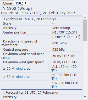
It’s been a busy couple days. On 25 February, Wutip rapidly reintensified to 160mph, making it the strongest typhoon in February. By 26 February at 1500Z, Typhoon Wutip had winds of 120mph, according to NWS Guam. This makes it equivalent to a Category 3 storm.

The Joint Typhoon Warning Center (http://www.metoc.navy.mil/jtwc/products/wp0219web.txt) also mentioned that winds were 105kts (120mph).

The Regional Specialized Meteorological Center (RSMC) Tokyo Typhoon monitoring page (https://www.jma.go.jp/en/typh/index.html) observations of Wutip were also fairly close to those of the JTWC.
Since Typhoon Wutip was almost stationary, both NPP and N20 were able to observe the storm 50 minutes apart. GCOM-W1 was again out of position for observing Wutip today. The The last quarter (50% illumination) still provided enough moonlight to illuminate parts the storm.
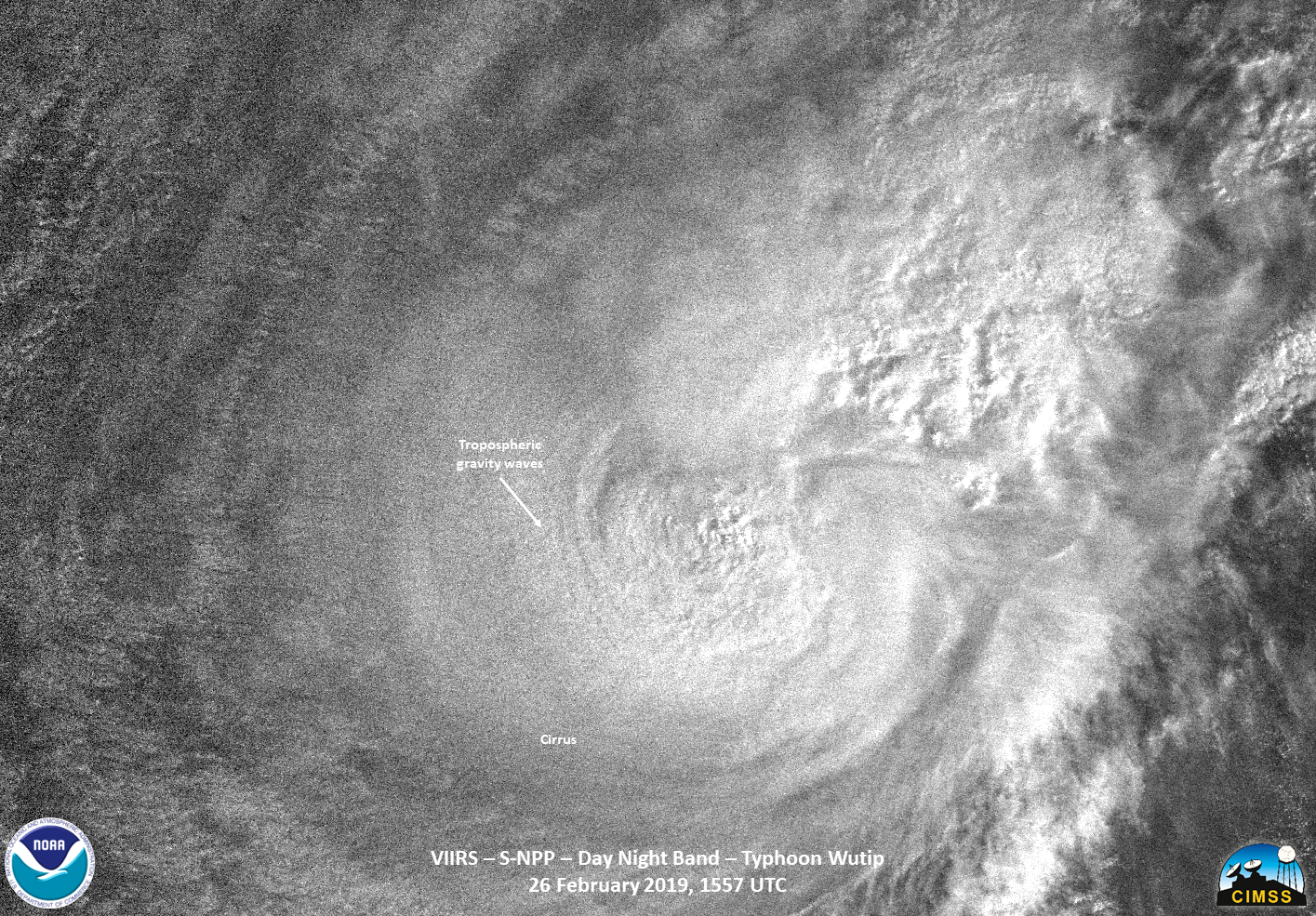

Both the IR and DNB observed the tropospheric gravity waves and overshooting tops from the weakening storm. As can be seen in the imagery, there is quite a bit of sheering as compared to the last time Wutip was a Category 3 storm.
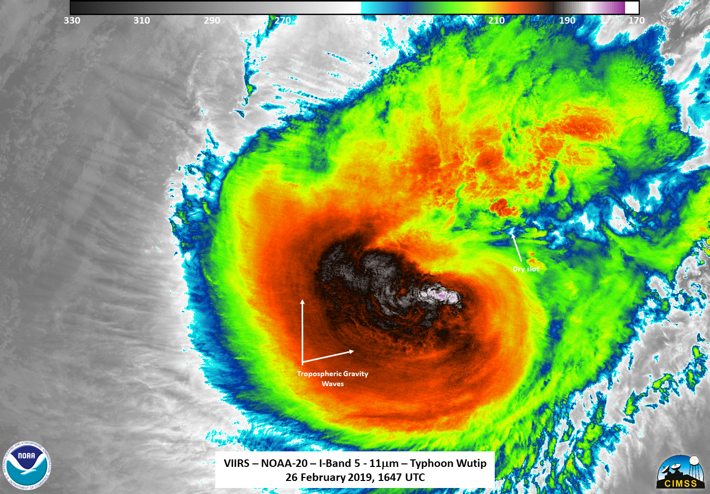
In fact, on the northern flank there even appears to be some warmer air being pulled into the circulation.
Both ATMS instruments also measured the internal part of the storm, this time showing warm air also intruding in the storm. In addition, unlike last time, the cold air is no longer completely surrounding the circulation.

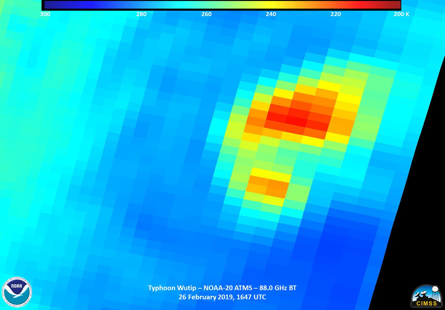
So perhaps this time Wutip is truly in the weakening stage, especially as it goes over cooler waters. Also, like a few days ago, note the orientation of the IR and ATMS brightness temperatures (see above). So it appears that Wutip has maintained it’s ~50 min rotation.

