« Back to "Super Typhoon Hagibis - October 6-13 2019"
Super Typhoon Hagibis on 9 October 2019
Posted: October 9, 2019
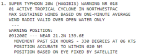
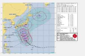
At 1500 on 9 October, the Joint Typhoon Warning Center stated that Super Typhoon Habigis had sustained winds of 140knts or 161.1092 mph. This is the equivalent of a Category 5 storm in the Atlantic basin.
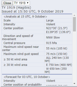
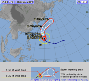
The Regional Specialized Meteorological Center (RSMC) Tokyo stated that the maximum winds at the center were 105knts (~120mph). The difference is due to differing methods of determining the winds and due to the fact that JTWC adopts a 1 min mean wind speed, but RSMC Tokyo adopts 10 mins mean wind speed.
While this doesn’t affect forecasts for this storm, this sort of difference in measurement could mean the difference between a tropical storm warning or a high wind warning, as has been seen in some previous instances as storms transition from the Central Pacific to the RMSC Tokyo or other areas of responsibility.
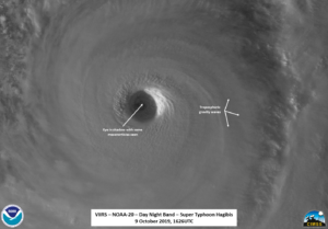
S-NPP first saw Super Typhoon Habigis at 1536Z on the western part of the pass, leading to an oblong effect of the eye, which the waxing moon (83% illumination) cast into shadow. This meant that any features that were in the eye itself could not really be seen .In addition, there was a lone lightning strike that could be seen in the S-NPP imagery.
However both the moonlit imagery from the DNB and the I05 (11μm) imagery showed what you’d expect of an intense tropical cyclone: a well defined eye along with copious amounts of tropospheric gravity waves as well as some intense convection in the feeder bands.
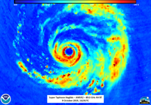
Just under an hour later, GCOM-W1 passed with a near nadir overpass of Habigis, allowing the AMSR2 instrument to looking to the storm. The 88.9GHz imagery showed a wide circulation, similar to the IR imagery and ATMS imagery from NOAA-20 about 3 minutes later.
However, the 23.8Ghz showed the center of circulation was not exactly at the center of the IR or 88.9GHz circulation.
Also note the double eye in the 88.9Ghz AMSR2 data, possibly indicating an eyewall replacement either being underway or having taken place.
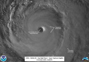
The I05 (11μm) imagery from NOAA-20 again showed similar features to the NPP imagery 50 minutes prior, though with the almost-nadir overpass, features were a bit less affected by parallax.
One other feature of the NOAA-20 pass is that the eye was not completely in shadow, with some mesovorticies within the eye, again a feature of an intense system. This can easily be seen in the zoomed in imagery of the eye.
The forecast from JTWC and JMA continue to have it impacting Japan on 12 October. This is enough of a concern that the Rugby World Cup has cancelled the (important) match between Japan and Scotland on that day due to weather concerns from Habigis, meaning the match is a draw, with Japan advancing to the quarter-finals.

