« Back to "Super Typhoon Hagibis - October 6-13 2019"
Super Typhoon Hagibis on 8 October 2019
Posted: October 8, 2019
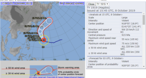
At 1500 on 8 October, the Joint Typhoon Warning Center stated that Super Typhoon Habigis had sustained winds of 135knts or 155mph. This is the equivalent of a Category 4 storm in the Atlantic basin.
The Regional Specialized Meteorological Center (RSMC) Tokyo stated that the maximum winds at the center were 105knts (~120mph). The difference is possibly due to differing methods of determining the winds and due to the fact that JTWC adopts a 1 min mean wind speed, but RSMC Tokyo adopts 10 mins mean wind speed.
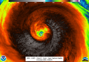
The orbits were such that GCOM-W1 again just missed Habigis. S-NPP was able to catch Habigis at near-nadir first at ~1556 UTC. As can be seen, the high resolution IR imagery showed a very small eye along with copious amounts of tropospheric gravity waves as well as some overshooting tops in some of the outer bands.
This is even more obvious when you zoom in on the eye itself
The waxing gibbous (76% illumination) was just setting providing ample lighting to see the small (though not as small as yesterday) cloud filled eye along with lightning streaks and some tropospheric gravity waves, with the gravity waves being in roughly the same areas as seen in the I05 (11μm) imagery.
The ATMS instrument picked up on a more broader circulation that was slightly offset from what could be seen in the IR and visible-at-night imagery.
The NOAA-20 pass ~50 minutes later, was on the edge of the scan. While the IR imagery showed similar features, though offset and affected by parallax as compared to S-NPP, as seen in the slider comparison of the I05 (11μm) imagery shown below
This is even more obvious when looking at the zoomed in imagery of the eye
In the case of NOAA-20, the moon was below the horizon in the region where Habigis was located, meaning that airglow illuminate the storm. This meant that one could see some mesospheric gravity waves in the DNB imagery
Given the fact that we now have two VIIRS instruments that are 50 minutes apart means that being able to see tropospheric and mesospheric features from the same area is likely to be much more common. It is also worth noting that in both the NOAA-20 and S-NPP imagery, while cloudy over the region, one could also see some scattered light coming from both Guam and Saipan.
While VIIRS and ATMS provide both high resolution imagery as well as information within the storm in a pseudo-temporal way, one cannot discount the the use of geostationary imagery, which provides high temporal information of the storm development. As seen below, in this image from the CIMSS Satellite Blog, one can see the evolution and changes of Habigis as the intensity changes over time
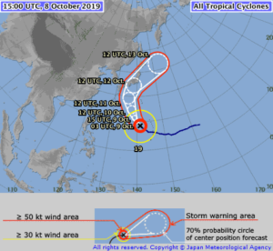
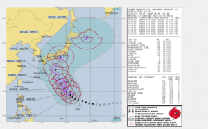
Hagibis is expected to remain a strong tropical cyclone over the next day, eventually weakening as it turns to the north and likely impacting Japan by the weekend, per the Joint Typhoon Warning Center and JMA. Interestingly, the tracks and intensity from JTWC and JMA do vary, but the timing is very similar.


