
report produced with glance, version 0.2.6.25
comparison generated Wed Apr 13 22:28:20 2011 by user hongz on craackly.ssec.wisc.edu
file A:
path: /data/hongz/cloud_V5_11082010/cloud_team_version5_release_delta_11082010/geocat/glance_comp/geocatL2.GOES-R.2005155.220000.hdf
md5sum for file A: 6a0acd82c855bd11ea7eb85759af2089
last modified: Tue Apr 5 19:41:34 2011
file B:
path: /data/hongz/cloud_V5_11082010/cloud_team_version5_release_delta_11082010/geocat/glance_comp/ncsa_fcm_rem_2km_conus_wrf_2005_0604_2200utc_notime_rev.nc
md5sum for file B: 67fa7fdc768661302983d2a436311263
last modified: Mon Apr 11 18:17:38 2011
A configuration file was used to control the production report.
Please see this copy of the configuration file
for details.
latitude in A: pixel_latitude
latitude in B: lat
longitude in A: pixel_longitude
longitude in B: lon
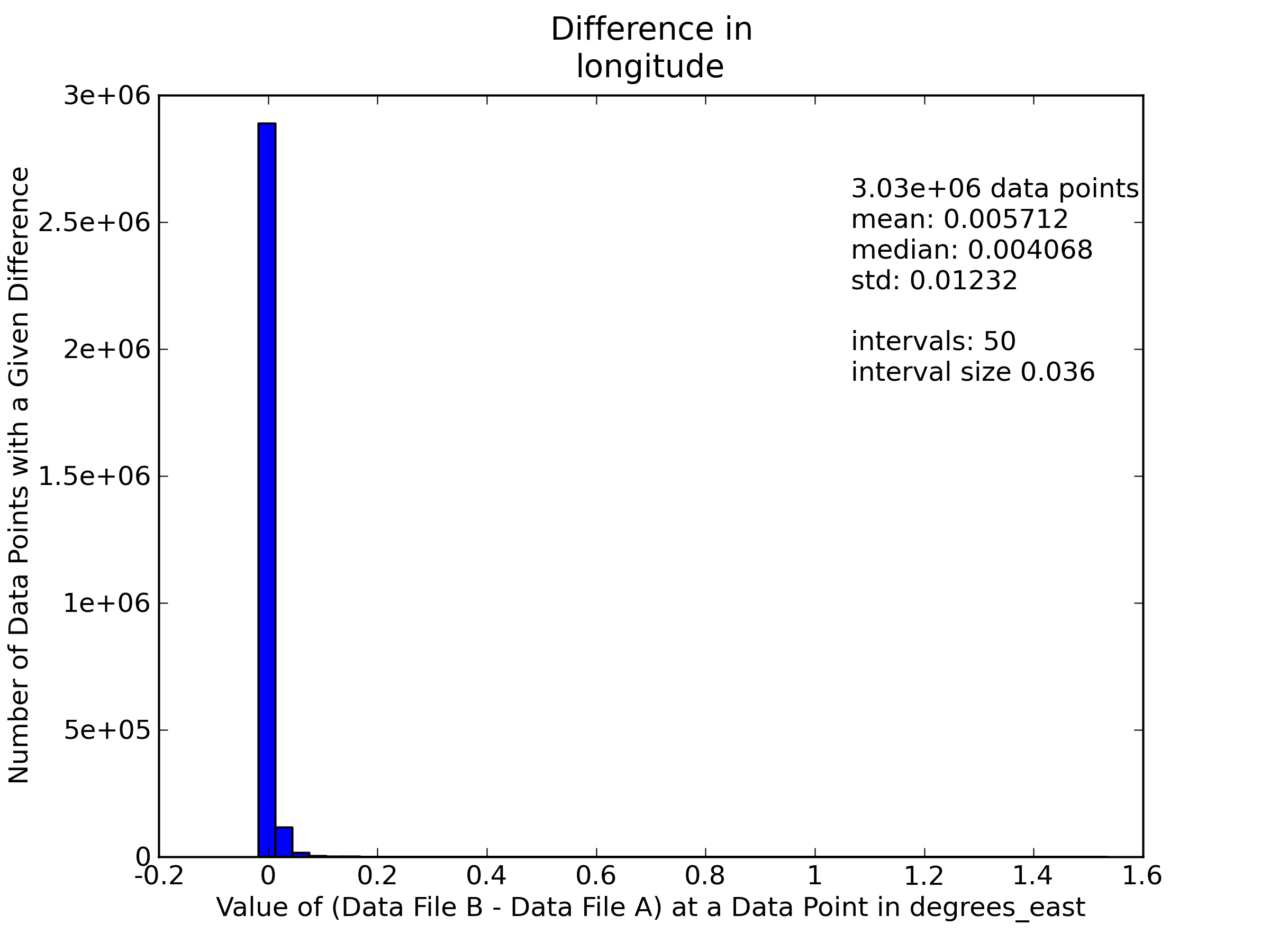
longitude/latitude comparison epsilon: 0.01
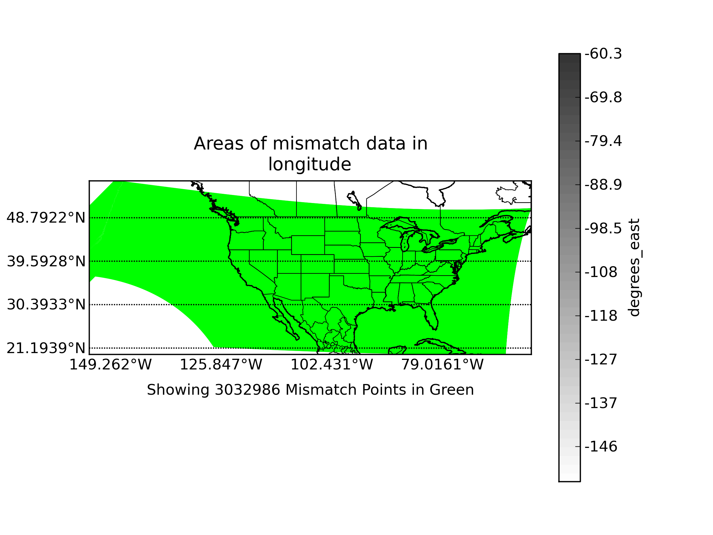
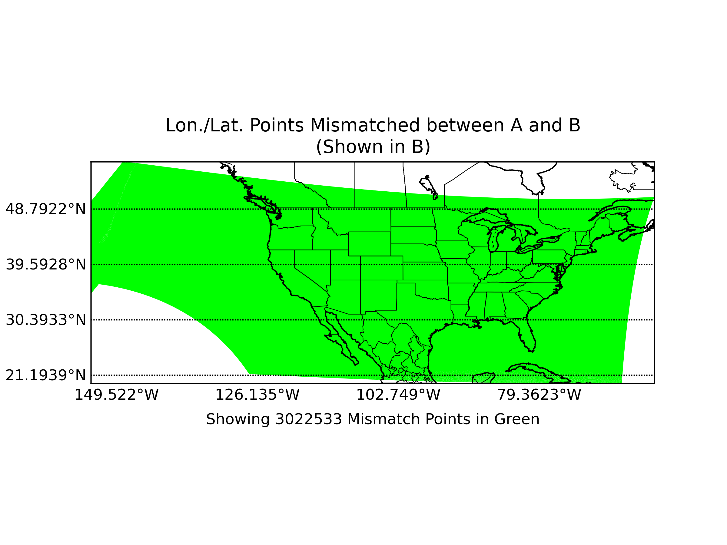
WARNING: 3022533 data points
(93.2% of all data)
show possible mismatch in values stored in file a
and file b longitude and latitude values. Depending on the degree of mismatch, some data value comparisons
in this report may be distorted or spatially nonsensical. Please consider re-running this report and including an
examination of your longitude and latitude variables with appropriate epsilons in order to analyze the significance
of the difference.
View mismatching points in A's lon/lat system
View mismatching points in B's lon/lat system
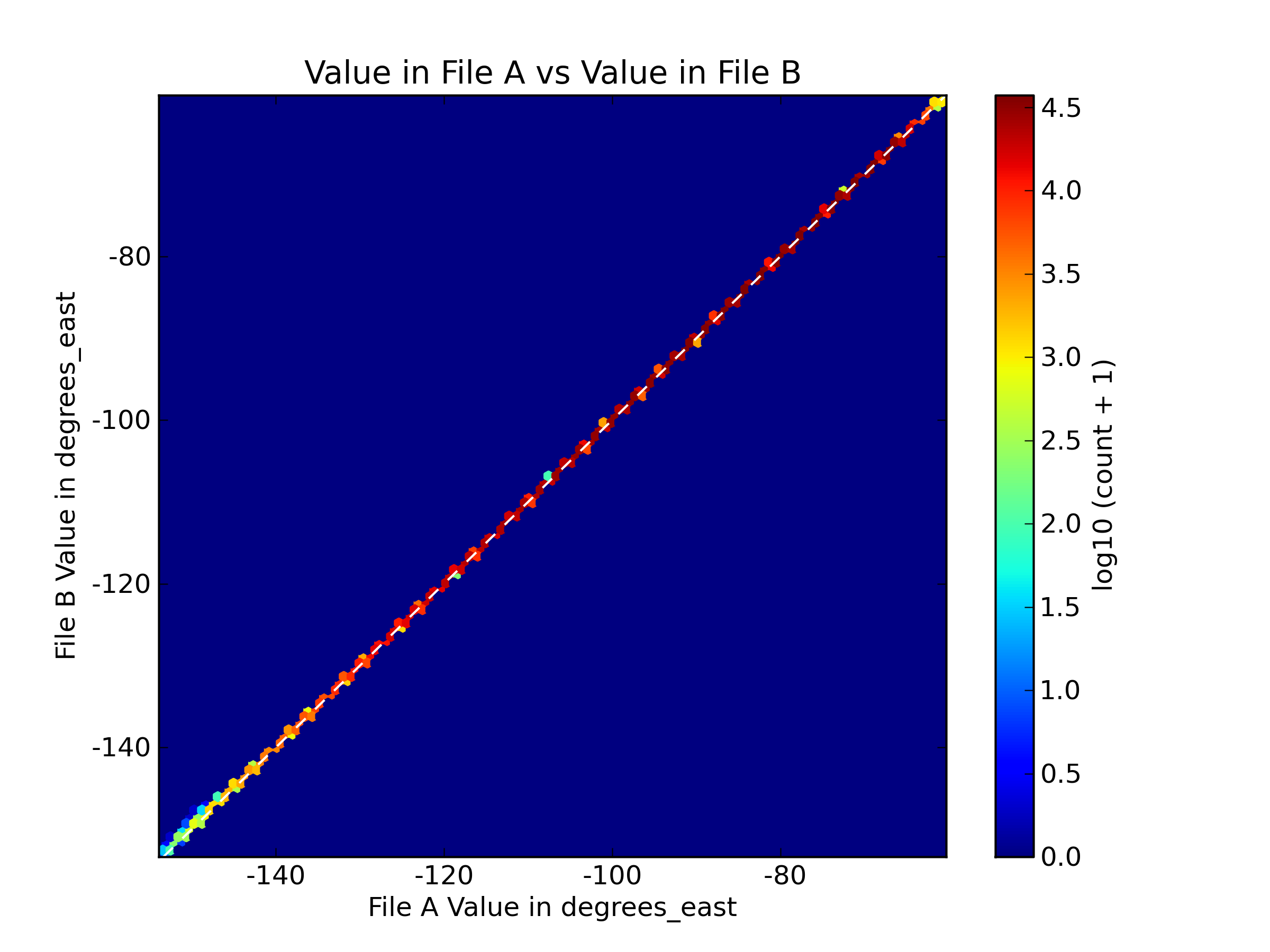
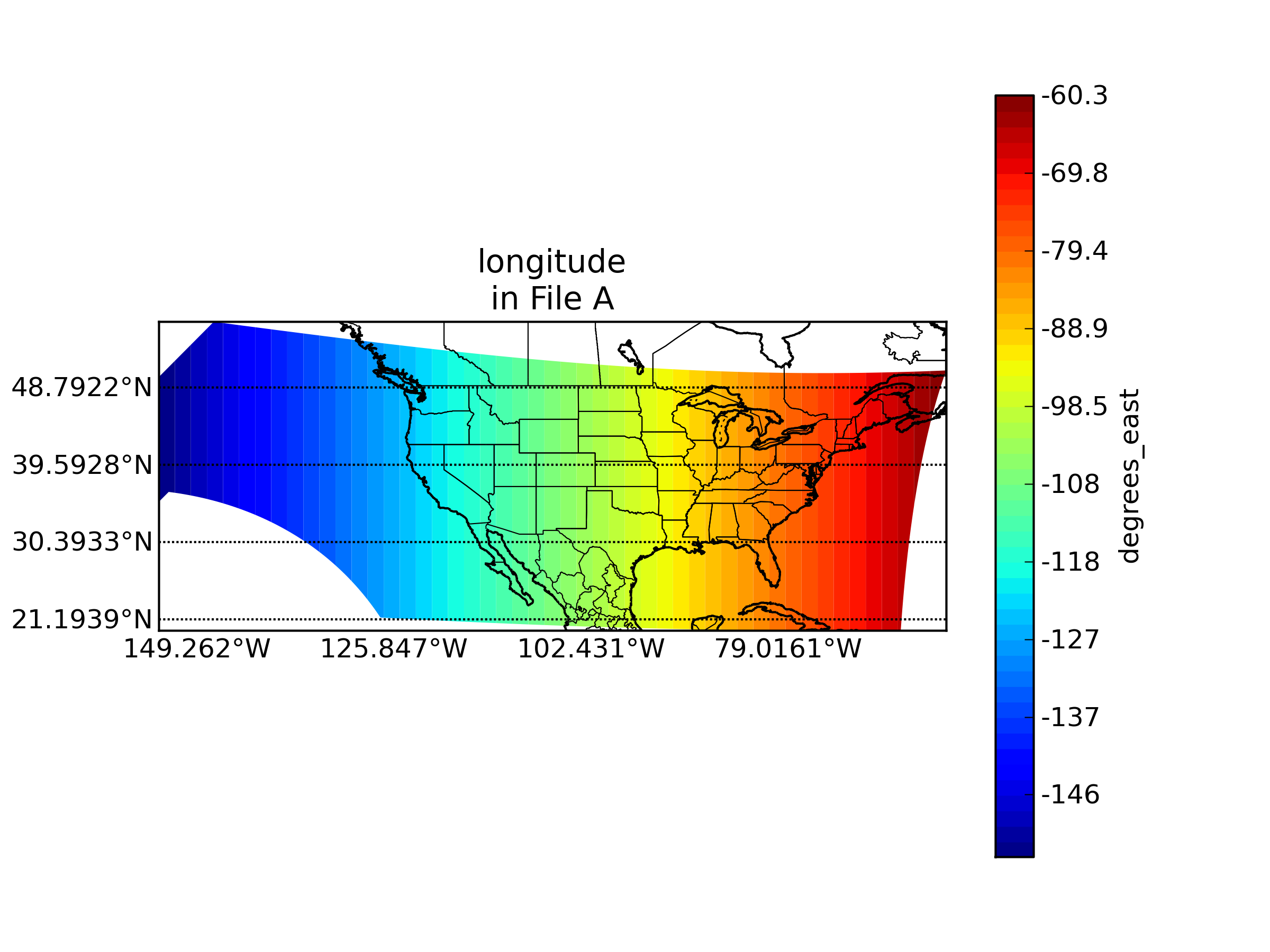
variable name in A: pixel_longitude
variable name in B: lon
epsilon value: 0.0
"missing" data value in A: -32768
"missing" data value in B: -999
units in A: degrees_east
units in B: degrees_east